
Zusamaltheim
| coat of arms | Germany map | |
|---|---|---|

|
Coordinates: 48 ° 32 ' N , 10 ° 38' E |
|
| Basic data | ||
| State : | Bavaria | |
| Administrative region : | Swabia | |
| County : | Dillingen on the Danube | |
| Management Community : | Wertingen | |
| Height : | 444 m above sea level NHN | |
| Area : | 17.92 km 2 | |
| Residents: | 1212 (Dec. 31, 2019) | |
| Population density : | 68 inhabitants per km 2 | |
| Postal code : | 86637 | |
| Area code : | 08272 | |
| License plate : | DLG, WHO | |
| Community key : | 09 7 73 188 | |
| Community structure: | 4 parts of the community | |
| Association administration address: | Schulstr. 12 86637 Wertingen, Germany |
|
| Website : | ||
| Mayor : | Stephan Lutz (Free Electoral List, Citizens' Block) | |
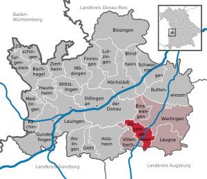
| Location of the community of Zusamaltheim in the district of Dillingen on the Danube | ||
  |
||

Zusamaltheim is a municipality in the Swabian district of Dillingen on the Danube and a member of the Wertingen administrative community .
geography
Zusamaltheim is in the Augsburg region.
The municipality has four officially named municipal parts (the type of settlement is given in brackets ):
- Gauried ( wasteland )
- Marzelstetten ( hamlet )
- Sontheim ( Kirchdorf )
- Zusamaltheim ( parish village )
The districts of Sontheim and Zusamaltheim exist in the municipality .
history
Until the church is planted
Zusamaltheim belonged to the Bocksberg rule , which in 1504 came into the possession of the Augsburg Cathedral Monastery . Sontheim also belonged to the Augsburg Cathedral Monastery. Since the Reichsdeputationshauptschluss of 1803 the place belongs to Bavaria.
Incorporation and reclassification
With effect from July 1, 1964, the Marzelstetten part of the community was reclassified from the Hettlingen community to the Zusamaltheim community. On May 1, 1978, the previously independent community of Sontheim was incorporated.
Population development
- 1961: 893 inhabitants
- 1970: 913 inhabitants
- 1987: 912 inhabitants
- 1991: 1074 inhabitants
- 1995: 1181 inhabitants
- 2000: 1275 inhabitants
- 2005: 1303 inhabitants
- 2010: 1278 inhabitants
- 2015: 1208 inhabitants
Between 1988 and 2018 the municipality grew from 927 to 1209 by 282 inhabitants or by 30.4%.
politics
mayor
Stephan Lutz (Free Voters List Sontheim, Bürgerblock Zusamaltheim), who was elected from two applicants with 79.0%, has been there since May 1, 2020. His predecessor was Wolfgang Grob (BBZ) from May 2002 to April 2020. Wolfgang Schuberth (BBZ / FWS) was the mayor until 2002.
Municipal council
The community council of Zusamaltheim (BBZ) has 8, the Free Voters' Group Sontheim (FWS) 3 seats and Bündnis 90 / Die Grünen one seat in the twelve-member municipal council (status: local elections 2020).
coat of arms
The description of the coat of arms reads: Under a black shield head , inside three golden re- crosses , split by red and silver, on the dividing line a gold-crowned black melusine (female fish) with golden tails.
Attractions

- Catholic parish church of St. Martin
- Catholic branch church St. Stefan in Sontheim
Economy and Infrastructure
Economy including agriculture and forestry
In 1998, according to official statistics, there were no employees at the place of work in the manufacturing industry 88 or in the trade and transport sector. In other economic sectors, twelve people were employed at the place of work subject to social security contributions. There were a total of 425 employees at the place of residence subject to social security contributions. There were none in the manufacturing sector and four in the construction sector. In addition, in 1999 there were 40 farms with an agricultural area of 1252 ha, of which 1024 ha were arable land.
education
The following institutions exist (as of: 1999):
- Kindergarten: 48 kindergarten places with 55 children
- Primary school: with 13 teachers and 244 students
sons and daughters of the town
- Ignaz Agricola (1661–1729), historian
- Johann Deisenhofer (* 1943), German biophysicist and 1988 Nobel Prize winner for chemistry
- Leo Bunk (* 1962), former German soccer player
Web links
- Entry on the coat of arms of Zusamaltheim in the database of the House of Bavarian History
Individual evidence
- ↑ "Data 2" sheet, Statistical Report A1200C 202041 Population of the municipalities, districts and administrative districts 1st quarter 2020 (population based on the 2011 census) ( help ).
- ^ Community of Zusamaltheim in the local database of the Bavarian State Library Online . Bayerische Staatsbibliothek, accessed on August 30, 2019.
- ↑ a b c Federal Statistical Office (ed.): Historical municipality directory for the Federal Republic of Germany. Name, border and key number changes in municipalities, counties and administrative districts from May 27, 1970 to December 31, 1982 . W. Kohlhammer, Stuttgart / Mainz 1983, ISBN 3-17-003263-1 , p. 770 .
- ↑ Result of the local elections in Zusamaltheim (March 2020)

Aislingen | Bachhagel | Bächingen an der Brenz | Binswangen | Bissingen | Blind home | Buttenwiesen | Dillingen on the Danube | Finningen | Glött | Gundelfingen an der Donau | Haunsheim | Höchstädt on the Danube | Holzheim | Laugna | Lauingen | Lutzingen | Medlingen | Mödingen | Schwenningen | Syrgenstein | Villenbach | Wertingen | Wittislingen | Ziertheim | Zöschingen | Zusamaltheim