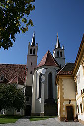
Göss (municipality of Leoben)
|
Göss ( district ) locality Göß cadastral community Göß |
||
|---|---|---|
|
|
||
| Basic data | ||
| Pole. District , state | Leoben (LE), Styria | |
| Judicial district | Leoben | |
| Pole. local community | Leoben | |
| Coordinates | 47 ° 21 '47 " N , 15 ° 5' 45" E | |
| height | 551 m above sea level A. | |
| Residents of the village | 3801 (January 1, 2020) | |
| Building status | 839 (2001) | |
| Area d. KG | 8.21 km² | |
| Post Code | 8700 Leoben | |
| Statistical identification | ||
| Locality code | 15673 | |
| Cadastral parish number | 60308 | |
| Counting district / district | Maßenberg u. Mühltal-W , Göß-Ost; Steigtal-Ost, -West ; Goess-West; Windischberg - Gößgraben , Prettach - Schladnitz (61108 040.045; 050.051; 060; 100.101) | |
| Cadastral communities of Leoben: (7) Göß (village with 6, 9, 10) |
||

|
||
| Former municipality until 1938 Source: STAT : Place directory ; BEV : GEONAM ; GIS-Stmk ; City of Leoben |
||
Göss (also Göß ) is the southernmost district and a village and cadastral municipality of the municipality of Leoben in Upper Styria , in the Leoben district of Styria .
The place is particularly known for the Benedictine monastery Göss and the Gösser beer, which was originally brewed as a monastery beer .
geography
Göss is located about 2½ kilometers south of the Leoben town center, to the right of the Mur on the meanders of the Leoben basin , at an altitude of 550 m above sea level. A. The S6 Semmering expressway passes the town.
The village comprises over 800 buildings with around 4,000 inhabitants, of which around 1 ⁄ 3 are in the center and 1 ⁄ 2 in the Steigtal residential area to the south.
The cadastral community of Göß , with about 820 hectares , also includes the locality Sankt Erhard south of the Mur upstream, the Rotte Windischberg east above, and the houses in Steigtal and Kaltenbrunn in Gößgraben .
The cadastral communities Prettach Muraufwärts (with industrial park Leoben-West , Schladnitzdorf and Winkl ), Schladnitzgraben there to the south, as well as Gößgraben-Göß ( Groß- and Klein-Gößgraben ) in the rear part of the Gößgraben are counted as part of the locality area, with which the village has all areas on the right the Mur in the south of Leoben and more than half of the municipal area.
- Neighboring catastral communities and towns
- Neighboring places
| Leitendorf (O. and KG) |
Leoben (O.)
Waasen (KG) |
Mühltal (KG) |
|
Hinterberg (O.) Prettach (KG) |

|
|
|
Sankt Michael ok (mixed) ∗∗
|
Schladnitzgraben (KG) |
Gößgraben-Göß (KG) |
- ∗∗∗∗behind the Ortsch. Laufnitzgraben , Gamsgraben and Gams (all Gem. Frohnleiten , Bez. Graz-Umg. )
history
In Göss was around 1004 pin Göss first monastery of Styria from the future Archbishop Aribo of Mainz , founded by the Abbey Nonnberg settled in Salzburg and by Emperor in 1020 Henry II. As Reichsabtei placed under his protection. In 1782 it was dissolved by Emperor Joseph II . With the creation of the tax communities around 1800, Göß was set up independently. Around 1840 were here two iron hammers (a Zerrenn - and a lighter hammer ), three forging ( scythes - hacking - and Nagelschmied ), a Hafner pestle , a nut press , a sawmill and two mills located.
In 1938, when large communities were formed all over Austria after the Anschluss , Göss, then a separate community, was incorporated into Leoben.
Economy and Infrastructure
Two large companies determine the economic performance of the Leoben district:
- The Göss brewery was first mentioned in a document in 1459 and is known throughout Austria. That is why there is also a brewery museum in the Göss district.
- The Mayr-Melnhof Holz Holding operates one of the most powerful hogging saw systems in Austria in Göss . The holding company is also located here.
The main traffic axis is Josef-Heissl-Straße , which is designated as the L101 state road and leads from the center of Leoben to the Leoben-West junction of the S6 .
literature
- Susanne Leitner-Böchzelt: Leoben . “The” series of archive images. Sutton Verlag GmbH, 2002, ISBN 978-3-89702-408-3 , Chapter 6. Göß - Not just a brand name for beer , pp. 119–126 - numerous historical photos.
proof
- 61108 - Leoben. Community data, Statistics Austria .
- ↑ Stadtgemeinde Leoben (Ed.): Statistisches Jahrbuch 2011 . Chapter 2. Population and culture ( pdf ( page no longer available , search in web archives ) Info: The link was automatically marked as defective. Please check the link according to the instructions and then remove this notice. , Leoben.at)
- ^ Göss in the Austrian map and Geonam Austria ; Göß in the directory 2001 for the village; Cadastral municipality also Goess
- ↑ Georg Goeth : The Duchy of Styria: geographically-statistically-topographically represented and provided with historical explanations . tape 2 . Verlag JG Heubner, Vienna 1841, 20. District Göſs 10. Tax municipality Göſs , p. 359–365 ( Google eBook, full view ).


