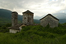
Dropull parish
|
Dropull Dropulli |
||

|
||
|
Coordinates: 39 ° 56 ' N , 20 ° 16' E |
||
| Basic data | ||
|---|---|---|
| Qark : | Gjirokastra | |
| Municipality : | Dropull | |
| Area : | 448.25 km² | |
| Bashkia residents : | 3503 (2011) | |
| Population density (Bashkia): | 8 inhabitants / km² | |
| Telephone code : | (+355) 0884 | |
| Politics and administration (as of 2019 ) | ||
| Mayor : | Dhimitraq Toli ( PS ) | |
| Website : | ||
 Territory of the municipality within Albania |
||
The municipality of Dropull ( Albanian Bashkia e Dropullit ; Greek Δήμος Δρόπολης ) is one of the 61 municipalities in Albania . The community in the far south of the country belongs to the Gjirokastra Qark . It is right on the border with Greece; the majority of the 3500 residents belong to the Greek minority . The main town of the municipality is Jorgucat .
The municipality was created in 2015 by merging the three municipalities Dropull i poshtëm (2100 inhabitants), Dropull i sipërm (971 inhabitants) and Pogon (432 inhabitants). In terms of population, it is the second smallest municipality in the country .
The municipality includes the Dropull region , the Drino valley between Gjirokastra and the Greek border, as well as areas in the neighborhood that are inhabited by the Greek minority. In the more densely populated and well-developed Lower Dropull , the villages of Dervican , Goranxi , Vanistër , Haskova , Dhuvjan , Sofratika , Terihat , Gorica , Frashtan , Lugar , Grapsh , Peshkëpi e sipërme , Peshkëpi e poshtme , Glina , Vrahogoran and are located . The villages of Jorgucat , Zervat , Bularat , Bodrishta , Kakavija , Vodhina , Vrisera , Drita , Kërra , Pepel , Klishar , Selo , Likomil , Llovina , Krioner , Sotira , Llongo and Koshovica belong to the Upper Dropull , which adjoins the southwest . They are no longer in the Drinos Valley, but in the side valley of the Kselos River . The first eight places mentioned are down in the valley on the edge of or not far from the Dropull plain and the SH 4 national road and are therefore still easily accessible. The Pogon region includes the villages of Poliçan , Skoreja , Sopik , Çatistra , Mavrojer , Hllomo and Selcka . These are very isolated and difficult to access east of the Dropull in a high valley between the Burreto mountain ( 1763 m above sea level ) in the west and the Nemërçka ( 2485 m above sea level ). The only unpaved access roads lead through the area of the neighboring municipality of Libohova or via a border crossing at Sopik .
Individual evidence
- ↑ Ligj no. 180/2014 "Për një ndryshim në ligjin nr. 115/2014 'Për ndarjen administrativo-territoriale të njësive të qeverisjen vendore në Republikën e Shqipërisë' ". (PDF file) (No longer available online.) Albanian Parliament, December 18, 2014, formerly in the original ; Retrieved November 6, 2015 (Albanian). ( Page no longer available , search in web archives ) Info: The link was automatically marked as defective. Please check the link according to the instructions and then remove this notice.


