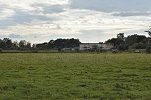
Grabnik Mały
| Grabnik Mały | ||
|---|---|---|

|
|
|
| Basic data | ||
| State : | Poland | |
| Voivodeship : | Warmia-Masuria | |
| Powiat : | Mrągowo | |
| Gmina : | Mikołajki | |
| Geographic location : | 53 ° 50 ' N , 21 ° 39' E | |
| Residents : | ||
| Postal code : | 11-730 | |
| Telephone code : | (+48) 87 | |
| License plate : | NMR | |
| Economy and Transport | ||
| Street : | Woźnice / DK 16 → Grabnik Mały | |
| Rail route : | no rail connection | |
| Next international airport : | Danzig | |
Grabnik Mały ( German Klein Grabnick ) is a village in the Polish Warmian-Masurian Voivodeship . It belongs to the urban and rural community Mikołajki ( German Nikolaiken ) in the Powiat Mrągowski ( Sensburg district ).
Geographical location
Grabnik Mały is located in the eastern center of the Warmian-Masurian Voivodeship , 24 kilometers east of the district town of Mrągowo (Sensburg) .
history
The Gutsort Klein Grabnick was founded in 1694 and mentioned in 1785 as a Köllmisches Gut with two fireplaces. In 1874 the village was incorporated into the newly established Wosnitzen District ( Woźnice in Polish ), which - renamed "Julienhöfen District" in 1938 - existed until 1945 and belonged to the Sensburg district in the Gumbinnen district (from 1905: Allenstein district ) in the Prussian province of East Prussia . In 1910 the Klein Grabnick manor district had 20 residents.
On September 30, 1928 Small grave Nick lost its independence and became, along with July Thal ( Polish Lelek ) in the rural community Wosnitzen (1938-1945 July courtyards , Polish: Woźnice ) incorporated.
When the whole of southern East Prussia was transferred to Poland in 1945 as a result of the war , Klein Grabnick was also affected and from now on received the Polish name form “Grabnik Mały”. The village is now a locality within the urban and rural municipality Mikołajki (Nikolaiken) in powiat Mrągowski ( Sensburg district ), until 1998 the Suwałki Voivodeship , since then assigned to the Warmian-Masurian Voivodeship . In 1945 a large state farm was established here ( Państwowe gospodarstwo rolne - PGR).
church
Until 1945, Klein Grabnick was parish in the Protestant Church of Schimonken (1938 to 1945 Schmidtsdorf , Polish: Szymonka ) in the church province of East Prussia of the Church of the Old Prussian Union and also in the Catholic Church of St. Adalbert in Sensburg (Polish: Mrągowo) in the Diocese of Warmia .
Today Grabnik Mały belongs to the Evangelical Church Mikołajki in the Diocese of Masuria of the Evangelical-Augsburg Church in Poland and to the Catholic parish Woźnice in the Diocese of Ełk in the Polish Catholic Church .
traffic
Grabnik Mały is not far from the Polish national road 16 (former German Reichsstraße 127 ) and can be reached directly from Woźnice (Wosnitzen , Julienhöfen from 1938 to 1945 ) . Woźnice was also the next train station from 1911 to 2009 and was on the Czerwonka – Ełk ( German Rothfließ – Lyk ) line, which is no longer used.


