
Ports in Bremerhaven


The ports in Bremerhaven reflect the industrial change and the complicated city history of Bremerhaven . Only the old and new harbors are owned by the city of Bremerhaven; both have more of a museum significance. The city of Bremen seaport and the fishing port, which belongs to the state of Bremen , bring jobs and money . At the same time, many citizens of Bremerhaven work in the Bremen ports .
Geestemünde

Founded in 1847 by the Kingdom of Hanover (half-heartedly) to compete with the successful Bremerhaven, Geestemünde gained a certain importance as an import port for wood and petroleum . In 1862 the Geestemünde train station was built, and immediately next to it the first main customs office in Geestemünde . Geestemünde remained insignificant for freight traffic . However, an extremely lively fish trade developed.
Geeste
Since the fishing steamer had no real port, they moored on the south bank of the Geeste . German deep-sea fishing began here on February 7, 1885 , as is remembered by the Busse memorial . When there was no longer enough space and Bremerhaven turned the old port into a fishing port, Prussia built the tide-independent fishing port (Bremerhaven) in the province of Hanover . Only when it was put into operation in 1896 did the fish landings move from the Geeste bank to today's fishing port I. The buildings on the southern bank of the Geeste were very complex. Warehouses were the remains of the fishing industry. Bars and small businesses were housed there. Kennedy Bridge and storm surge barrier separate the bank into two sections. When the Morgenstern Museum was built in the eastern part of the Alte Geestebrücke , the first buildings were demolished. In the western part of Weserfähre towards landed barges and barges gravel from the Mittelweser on. When the long-established Rathjen construction business went bankrupt in the early 1980s, gravel handling was stopped. The pier became a berth for sailing yachts. Today there is a house built around 1992. A yacht outfitter is still working in the old halls just below the Kennedy Bridge. The Elbe-Weser shipping route is of little economic importance .
As a result of climate change with ever-increasing storm surges can be expected, the Geeste should at the mouth of the Weser a new, higher barrage be built, which for floods to 6.7 m above mean sea level is sufficient and replace the existing barrage on the Kennedy Bridge should. Almost 31 million euros are earmarked for this, half of which will be taken over by the states of Bremen and Lower Saxony. The building is scheduled to be completed by the mid-2020s.
Commercial port
One advantage of the commercial port was that it was directly at the customs border with the railway facilities of the Geestemünder station and goods only had to be reloaded once (not twice as in Bremerhaven). The immediately adjacent main customs office in Geestemünde was also responsible for Bremerhaven and the access to the New Harbor was no longer sufficient. That is why more and more shipowners sent their ships to Geestemünde. As early as 1866, 462 sailing ships from 15 shipping companies came to the trading port. Until Easter 1930 it was connected to the Geestevorhafen by a chamber lock. With the connecting canal to the fishing port it had become superfluous. The gate to the Geestervorhafen was filled in. The chamber and the inland gate were preserved so that the former lock can still be used as a dry dock today. The Seebeck shipyard was located in the commercial port . According to plans by Theodor Hoebel , Germany's largest petroleum port was built in 1875 at the southern end of the commercial port. To the east of the swing bridge over the Geestemünder Hauptkanal is the yacht harbor of the Weser Yacht Club Bremerhaven. The transverse canal behind it to the north was filled in in 1962.
Holzhafen
Also according to plans by Theodor Hoebel, the wooden port for rafting was built in 1877 at the eastern end of the port canal . A siding led to the north side, which branched off from the branch line to Bremerhaven behind the Holzhafen Canal . The shallow basin was used for intermediate storage and processing of wood. In 1937/1938 it was separated from the branch canal and rebuilt. The Holzhafen is one of the most beautiful places in Geestemünde and has always been very popular with ship model builders. Handelshafen, Elbinger Platz and Holzhafen have been opened up and merged in terms of urban development in recent years.
Offshore industry
Industry for the construction, operation and supply of offshore wind farms has settled in Labradorhafen (at the southern end of Fischereihafen II ) and on Luneplate . The Bremerhaven Offshore Terminal (OTB) is to be built in the so-called Blexer Bogen of the Weser .

Rice and petroleum clippers in the commercial port

Gravel for Rathjen on the Geeste

Fishing port

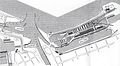
Geestemünde ports

Holzhafen

Main channel, marina


Middle (Bremerhaven)

The silting up of the Weser and the growing ships forced Bremen to build an upstream port. On January 11, 1827, Johann Smidt bought 122 hectares of land on the north side of the Geeste estuary from the Kingdom of Hanover . Jacobus Johannes van Ronzelen directed the construction of the old port between 1827 and 1830. Ronzelen's famous lock to the Geeste was the first port lock on the European continent. Instead of normal ebb gates, the inner head had so-called fan gates. When the tide was low , water could be drained from the harbor basin and the silt could be flushed out of the outer harbor and lock. The lock was closed in 1926. The Bremerhaven radio tower is roughly in its place today . The arched outer harbor to the old harbor and the lock keeper's house built in 1897 have been preserved. Shipping traffic increased steadily, especially due to the emigrants. The lock was too small for the emerging paddle steamers . That is why the New Harbor was built in 1851/1852 . The old port lost its function as an emigration port. From 1892 it was used as a fishing port . When the Bremerhaven fishing fleet with its land-based equipment moved to the (Prussian) fishing port in 1930 , the old port fell into a "deep slumber". The construction of the German Maritime Museum ended after 40 years.
Until 1937, the New Harbor was connected to the Weser by a flood gate and a harbor barrier. In 1944 this driveway at the Loschen Tower was filled in. The New Harbor could only be reached via the Kaiserschleuse (or the Nordschleuse ). The connection to the old port was not established until 1928. The two bascule bridges with high counterweights (Scherzer) are striking . Plant 4 of Schichau Unterweser AG was on the south west bank of the New Harbor . She built some of the world's largest tugs and buoy layers . Since 2005 a new sport boat lock has been connecting the Weser with the New Harbor. The harbor gate was removed in the course of the new building.

Old Harbor and New Dock (1849)

Lock to the old port
Fishing port in the old port (1925–1930)

New harbor with pleasure boats

Pilot station in the Geestevorhafen

.jpg)
.jpg)


City of Bremen's overseas port area
.svg)
Today's seaports are located in the city of Bremen's overseas port area. Container Terminal IV in the Weddewarden district is an exception . The Columbuskaje and the Bremerhaven container terminal (named after Wilhelm Kaisen ) depend on the tides . Crusaders are handled by the Columbus Cruise Center on Columbuskaje. The other ports are docked behind locks . The highest municipal official for the Bremen port area is the port captain . The police duties are carried out by the Bremerhaven police. The license plates from the port area have now been adapted to the Bremerhaven license plate: HB with one letter and four digits. Formerly HB with two letters and three digits (Bremen-Nord). The private port management is with Bremenports .
Imperial ports
Kaiserhafen I
When the sudden prosperity of the early years also reached Bremen and the shipping traffic in the ports of Bremerhaven increased sharply, the Bremen Senate decided to build a third port basin. Carl Friedrich Hanckes was commissioned with the planning . As a tribute to the German Empire and Wilhelm I , it was called the Kaiserhafen. The construction proceeded quickly. In 1875 the harbor basin and the connecting lock to the new harbor were ready. At the Kaiserschleuse lighthouse , the new sea lock (the so-called small Kaiserschleuse) with outer harbor was built in 1876. Like the entrance to the New Harbor, it was a simple dock lock that could only be opened for about an hour when the water level in the Weser and the harbor was balanced. However, it had an additional pair of flood gates as flood protection and a passage 5 meters narrower than its model at the New Harbor - the days of paddle steamers were over. The location across the harbor basin was unfavorable. Soon larger ships could no longer turn. Therefore, the opposite pier was given the characteristic bulge in 1881. Since it was soon no longer enough, the large Kaiserschleuse had to be built. The small Kaiserschleuse has long been filled in and incorporated into the Weser dike. Schleusenstraße is reminiscent of the connecting lock to the New Harbor. The city side of Kaiserhafen I was the destroyer quay , on which MWB Motorenwerke Bremerhaven (today part of German Dry Docks ) was built after the war . At the north end was the floating crane Langer Heinrich .
Before the construction of Imperial Ports II and III, the entire western side of Imperial Port I - from the large Kaiserschleuse to the Loschen Tower at the New Harbor - was occupied by the North German Lloyd . After the Second World War, the floating cranes Enak (1967, 850 tdw), Roland (1971, 1000 tdw) and Thor (1971, 1000 tdw) of the Bugsier-, Reederei- und Bergungsgesellschaft were usually located there . Bugsier was connected to Wilhelm Schuchmann's shipping company .
Kaiserhafen II
The Bremerhaven port construction directors Rudolf Rudloff (1851–1922) and Federico Claussen (1865–1940) were commissioned to expand the Kaiserhafen. The Kaiserhafen II was built in 1906/1908 and was extended in 1925/1927, the quay was completed on the east side. The extension was given the designation Planhafen . Since this port was separated by Franziusstrasse and has never seen a ship, it was popularly called the submarine port . The harbor basin was backfilled in the 1980s to make room for the storage of automobiles.
Kaiserhafen III
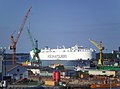
The Kaiserhafen III was built from 1907 to 1909. The west side (Bückingstraße) was the legendary "Banana Pier" from 1926. About half of all bananas consumed in the (old) Federal Republic were landed here. When unloading the perennials, some Central American venomous snakes woke up from their cold sleep, and the tarantula in the former aquarium of the “animal grottos” also came from here. In 1983 transshipment was moved to the new fruit terminal opposite the Lloyd shipyard . The continuous conveyors were dismantled and scrapped in 2012 due to the changeover to transport in refrigerated containers.
Harbor ferry
The harbor ferry in the Kaiserhafen operated from 1931 to 1964; Operated by the Bremerhaven AG transport company from the mid-1950s . The ferry route led from the old ferry route at the Rotersand customs office via the Lloyd shipyard and Frigus to the Columbus station , then via the Kaiserschleuse pier back to the Rotersand.

Lock to the New Harbor

Harbor ferry

Kaiserhafen I, MWB

Tripods in the Kaiserhafen II
Kaiserhafen III

Meeting point at Kaiserhafen


.jpg)
Nordhafen / Osthafen

.jpg)
The North Lock was built in 1928 for the transatlantic liners and the large warships of the Reichsmarine . When the turning basin was built, the old fortress Brinkamahof I disappeared . To the west of the abandoned Weddewarden airfield is the adjoining northern harbor . With Kaiserhafen II, it is now at the center of the handling of motor vehicles with 120,000 parking spaces.
The north port was built for the aircraft carriers of the Kriegsmarine . In the fall of 1957, the American aircraft carrier Forrestal moored in the north port. The Osthafen was built between 1960 and 1963. From 1965 to 1993, the southern pier served as the “ore port” for handling ore. Up to 1993 up to 4 million tons of iron ore were unloaded annually , mainly for the Klöckner-Hütte Bremen . The two unloading bridges could each move 1000 tons of ore per hour from the ship onto wagons of block trains or (via a conveyor belt ) to the storage area. Today the southern and northern piers are used for the handling of motor vehicles.

Connection port
The connecting port was built between 1908 and 1915. It stretches from the swing bridge at the Nordschleuse to the outer dock of the Lloyd shipyard . Before the Kaiserschleuse was enlarged, large ships could only reach the shipyard via the connecting port. There are tank farms on the west side at Columbusbahnhof .
England ferry

The England ferry to Harwich used to be dispatched at the north end of the Columbuskaje . The city of Bremen and the Bremer Lagerhausgesellschaft had set up a 3,000 m² ferry yard. Motor vehicles reached him via the driveway at the outer port of the north lock and drove into the ship via a tide ramp. The Swedish Lion Ferry AB Halmstad opened this first ferry connection between Germany and Great Britain with the Prins Hamlet on May 23, 1966. The ship, which was built in Finland, was one of the most modern and largest ships of its type in north-western Europe with a weight of 7,680 GRT, a length of 135 m and a width of 20 m. It could accommodate 200 passengers and 250 cars. The cruising speed was 20 knots . In the same year there were over 50,000 passengers and a cargo volume of 32,000 tons . In 1967 the line carried 72,114 people, more passengers than the transatlantic travel from Bremerhaven. The much smaller Viking III (3657 GRT) was used in winter .
In 1969, the Prins Hamlet was sold to the Hamburg Prinzenlinie , in which Lion Ferry held a 50% stake. The departures changed daily between Hamburg and Bremerhaven. On June 8, 1970, the new Prins Oberon building began sailing under the Swedish flag. The ship was 7,932 GRT and 134 m long. It could carry 1040 passengers, 702 of them in cabins. 238 cars and 47 trailers fit in the vehicle deck. At 22 knots the ship took 16 hours to cross to Harwich. In December 1978 the ship was registered in Bremen as Prinz Oberon . In 1982 the connection was discontinued.
See also

- Hanseatic City of Bremen Office
- List of significant ship departures and arrivals in Bremerhaven
- Rail traffic in Bremerhaven
- Ton yard Bremerhaven
- Shipyards in Bremerhaven
literature
- Lars U. Scholl : Bremerhaven - a port history guide . German Maritime Museum, Ditzen 1984.
Web links
Remarks
- ↑ According to Bollen, there was a solid bridge, a brick passage.
- ↑ THOR and ROLAND participated in the clearance of the Suez Canal in 1974.
- ↑ The captain of ENAK was Gottfried Hilgerdenaar .
- ↑ As Ambassador II of the Comarit ferries , the ship came to New Orleans on January 16, 2011 for scrapping.
Individual evidence
- ↑ Frank Binder: New barrage against storm surges · Bremen and Lower Saxony are investing around 31 million euros in Bremerhaven · The dike line must be relocated. In: Daily port report of December 3, 2015, p. 4
- ^ Harry Gabcke : 150 years of Bremerhaven . Nordwestdeutscher Verlag Ditzen, 1976.
- ↑ Location of the former lock
- ↑ Holzhafen (bremerhaven.de) ( Memento from July 14, 2015 in the Internet Archive )
- ↑ More access to the "sea" and greater attractiveness: Geestemünde goes to the water (2012) ( Memento from July 23, 2015 in the Internet Archive )
- ↑ Offshore Wind Port Bremerhaven
- ↑ Schleusentor (zeno.org)
- ↑ Commemorative plaque at the old port lock (bremerhaven.de)
- ↑ Bascule bridges at the old port
- ↑ New lock at the Loschen tower
- ↑ a b c d Kaiserhafen (bremerhaven.de) ( Memento from August 6, 2015 in the Internet Archive )
- ↑ Wolfgang Bronner : Old entrance to Emperor I haven . In Lars U. Scholl (ed.): Bremerhaven - a port history guide . Deutsches Schifffahrtsmuseum / Ditzen, Bremerhaven 1980, pp. 123/124.
- ↑ Detlev Ellmers : View into the Kaiserhafen I , in: Lars U. Scholl (ed.): Bremerhaven - a port history guide . Deutsches Schifffahrtsmuseum / Ditzen, Bremerhaven 1980, p. 122.
- ↑ An era is coming to an end: banana elevators at the fruit terminal are being scrapped. (2012) ( Memento from July 22, 2015 in the Internet Archive )
- ^ Paul Homann: Bremerhaven route networks (ÖPNV). In: Bremerhaven route networks. Retrieved October 5, 2019 .
- ↑ Erzhafen ( Memento from July 10, 2015 in the Internet Archive )
- ^ Siegfried Stölting: Umschlaganlagen . In: Lars U. Scholl (ed.): Bremerhaven - a port history guide . Deutsches Schifffahrtsmuseum / Ditzen, Bremerhaven 1980, pp. 134/135.
- ↑ M / F Prinz Oberon (The ferry site)
- ^ Arnold Kludas : England ferry . In: Lars U. Scholl: Bremerhaven - a port history guide . 1980, pp. 141/142
- ↑ Ferry to Harwich for the last time tomorrow . Nordsee-Zeitung from December 14, 1982