
Höhbeck
| coat of arms | Germany map | |
|---|---|---|

|
Coordinates: 53 ° 4 ′ N , 11 ° 26 ′ E |
|
| Basic data | ||
| State : | Lower Saxony | |
| County : | Lüchow-Dannenberg | |
| Joint municipality : | Gartow | |
| Height : | 30 m above sea level NHN | |
| Area : | 19.4 km 2 | |
| Residents: | 647 (Dec. 31, 2019) | |
| Population density : | 33 inhabitants per km 2 | |
| Postal code : | 29478 | |
| Area code : | 05846 | |
| License plate : | DAN | |
| Community key : | 03 3 54 010 | |
| LOCODE : | DE HOK | |
| Community structure: | 4 districts | |
| Address of the municipal administration: |
Hauptstrasse 21 29478 Höhbeck |
|
| Mayor : | Hans-Joachim Schenk (FWGH) | |
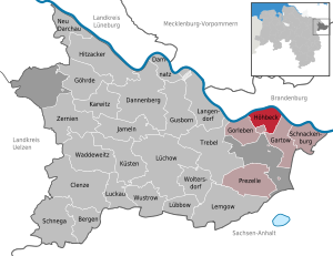
| Location of the community of Höhbeck in the Lüchow-Dannenberg district | ||
  |
||


Höhbeck is a municipality in the Lüchow-Dannenberg district in eastern Lower Saxony , which is largely located on the Höhbeck elevation , which rises up to 76 meters above sea level . The community is located in the Lower Saxony Elbe Valley Biosphere Reserve directly on the Elbe . It is part of gartow that its administrative headquarters in the spots Gartow has.
geography
location
It is named after the elevation of the Höhbeck, a glacially formed compression terminal moraine , which is a striking plate of Pleistocene gravel, sand and marl in the middle of the Holocene Elbe valley lowlands. Due to its natural and biogeographical location - in the transition between the Atlantic and the continental region of Central Europe - the Höhbeck, whose slopes steeply sloping towards the Elbe are wooded, has a particularly large variety of flora and fauna. Lean and sandy dry grasslands form a diverse contrast with forests, fields and the water-rich lowlands of the Elbe and the Elbe tributary Seege .
At the highest point of the moraine there were two over 324 and 344 meter high directional radio towers of the transmitter Höhbeck , which shaped the landscape. In 2009 the smaller of the two transmission masts was blown up.
To the west and south of the elevation of Höhbeck is the approximately three kilometer long Laasch Lake , considered Altwasserarm applies the Elbe. In the south is also the Restorfer See . Most of the villages in the municipality of Höhbeck are located on or on the edge of the hill in the flood-safe area.
Community structure
The districts of the municipality are:
- Brünkendorf
- Pevestorf
- Restorf
- Vietze (seat of the municipality)
history
The elevation of the Höhbeck with its location within the Elbe valley was a settlement chamber that was used as a settlement and burial site for over 2000 years, from the younger Stone Age to the early Iron Age . This was shown by excavations of the Lower Saxony State Museum on the Pevestorf site in the 1960s. The occasion was chance finds from the Stone Age during the construction of a house in Pevestorf. The excavation led to the discovery of floor plans of houses from several prehistoric periods, including a hall house 23 meters long. The finds revealed connections to the Bernburg culture .
Fortifications
Two historical fortifications are known on the elevation of the Höhbeck, which were castle walls that were built in strategically favorable locations. It is about the Vietzer Schanze , which is considered to be the Höhbeck fort (castellum hohbuoki) of the Franks, which was handed down in the Franconian annals in 811 . Another rampart on the Höhbeck is the Schwedenschanze .
Incorporations

The municipality of Höhbeck was newly formed as part of the municipal reform on July 1, 1972 from the four previously independent municipalities of Brünkendorf, Pevestorf, Restorf and Vietze.
politics
The municipality Höhbeck belongs to the state electoral district 48 Elbe and to the federal electoral district 38 Lüchow-Dannenberg - Lüneburg .
Municipal council
The community council from Höhbeck consists of nine members.
(Status: local elections 2016 )
mayor
The honorary mayor Hans-Joachim Schenk was re-elected in November 2016. Deputies are Johann Purwing (SPD) and Matthias Gallei (Greens).
Culture and sights
The list of monuments in Höhbeck includes all the monuments of the municipality of Höhbeck. The local history museum in Vietze shows archeology, shipping and special exhibitions.
Economy and Infrastructure
economy
The Voelkel company has been based in the Pevestorf district since 1936 (2017: around 200 employees), which mainly produces fruit juices.
In the district of Vietze, on bridle path 8 of the Gartower bridle path network, there is the "Reitsportanlage Vietze" (total length of 124 km).
traffic
- The B 493 Lüchow - Schnackenburg leads south past the community.
- About two kilometers north of the district of Pevestorf there is a ferry station on the Elbe with a connection to Lenzen (Elbe) in Brandenburg .
Personalities
- Lieselotte Wollny (1926–2019), civil rights activist and politician ( Bündnis 90 / Die Grünen ), lived in Vietze
literature
- Jens Schneeweiß: Archäologische Streiflichter vom Höhbeck (2010) ISBN 978-3-00-031553-4 , (Book title: Online )
Web links
- Information about the community Höhbeck on the website of the joint community Gartow
- Tourism Höhbeck
Individual evidence
- ↑ State Office for Statistics Lower Saxony, LSN-Online regional database, Table 12411: Update of the population, as of December 31, 2019 ( help ).
- ^ Federal Statistical Office (ed.): Historical municipality directory for the Federal Republic of Germany. Name, border and key number changes in municipalities, counties and administrative districts from May 27, 1970 to December 31, 1982 . W. Kohlhammer GmbH, Stuttgart / Mainz 1983, ISBN 3-17-003263-1 , p. 231 .
- ↑ Landtag constituencies from the 16th electoral term. Constituency division for the election to the Lower Saxony state parliament. Annex to § 10 para. 1 NLWG, p. 4. ( PDF ( Memento of the original from July 25, 2011 in the Internet Archive ) Info: The archive link has been inserted automatically and has not yet been checked. Please check the original and archive link according to the instructions and remove then this note .; 87 kB)
- ↑ Description of the constituencies. Annex to Section 2, Paragraph 2 of the Federal Election Act. In: Eighteenth law amending the federal electoral law. Annex to Article 1. Bonn, March 18, 2008, p. 325. ( PDF ( Memento of the original from July 25, 2011 in the Internet Archive ) Info: The archive link has been inserted automatically and has not yet been checked. Please check the original and archive link according to the instructions and then remove this note .; 200 kB)
- ↑ Pevestorf was once a “suburb of Berlin” and now has a juice factory . In: Elbe-Jeetzel-Zeitung , September 5, 2017.
Bergen on the stupid | Clenze | Damnatz | Dannenberg (Elbe) | Gartow | Goehrde | Gorleben | Gusborn | Hitzacker (Elbe) | Höhbeck | Jameln | Karwitz | Coasts | Langendorf | Lemgow | Lübbow | Lüchow (Wendland) | Luckau (Wendland) | New Darchau | Precell | Schnackenburg | Schnega | Trebel | Waddeweitz | Woltersdorf | Wustrow (Wendland) | Ceremonies
Municipality-free areas in the Lüchow-Dannenberg
Gartow district |
Goehrde