Canton of La Presqu'île
| Canton of La Presqu'île | |
|---|---|
| region | Nouvelle-Aquitaine |
| Department | Gironde |
| Arrondissement | Bordeaux |
| main place | Ambarès-et-Lagrave |
| Residents | 51,704 (Jan. 1, 2017) |
| Population density | 352 inhabitants / km² |
| surface | 146.94 km² |
| Communities | 9 |
| INSEE code | 3326 |
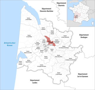
 Location of the canton of La Presqu'île in the Gironde department |
|
The District of La Presqu'ile is a French administrative unit in the Arrondissement Bordeaux in the Gironde in the region Nouvelle-Aquitaine ; its main town is Ambarès-et-Lagrave .
Communities
The canton consists of nine municipalities with a total of 51,704 inhabitants (as of 2017) on a total area of 146.94 km 2 :
| local community | Residents January 1, 2017 |
Area km² |
Density of population / km² |
Code INSEE |
Post Code |
|---|---|---|---|---|---|
| Ambarès-et-Lagrave | 16,344 | 24.76 | 660 | 33003 | 33440 |
| Ambès | 3.128 | 28.85 | 108 | 33004 | 33810 |
| Beychac-et-Caillau | 2,227 | 15.62 | 143 | 33049 | 33750 |
| Carbon blanc | 8.091 | 3.86 | 2,096 | 33096 | 33560 |
| Sainte-Eulalie | 4,631 | 9.06 | 511 | 33397 | 33560 |
| Saint-Loubès | 9,509 | 25.07 | 379 | 33433 | 33450 |
| Saint-Louis-de-Montferrand | 2.153 | 10.80 | 199 | 33434 | 33440 |
| Saint-Sulpice-et-Cameyrac | 4,614 | 15.04 | 307 | 33483 | 33450 |
| Saint-Vincent-de-Paul | 1.007 | 13.88 | 73 | 33487 | 33440 |
| Canton of La Presqu'île | 51,704 | 146.94 | 352 | 3326 | - |