Ambès
| Ambès | ||
|---|---|---|

|
|
|
| region | Nouvelle-Aquitaine | |
| Department | Gironde | |
| Arrondissement | Bordeaux | |
| Canton | La Presqu'île | |
| Community association | Bordeaux metropolis | |
| Coordinates | 45 ° 1 ′ N , 0 ° 32 ′ W | |
| height | 0-8 m | |
| surface | 28.85 km 2 | |
| Residents | 3,128 (January 1, 2017) | |
| Population density | 108 inhabitants / km 2 | |
| Post Code | 33810 | |
| INSEE code | 33004 | |
| Website | http://www.mairie-ambes.fr | |
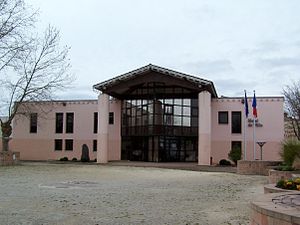
 Hôtel de ville (town hall) |
||
Ambès is a French town in the Gironde department in the region Nouvelle-Aquitaine . The municipality is located in the catchment area of the city of Bordeaux . While Ambès had 2,046 inhabitants in 1962, there are currently 3,128 inhabitants (as of January 1, 2017). The community is served by the TBC bus lines.
The municipality belongs to the canton of La Presqu'île in the Arrondissement of Bordeaux .
Ambès belongs to the Entre-Deux-Mers region .
geography
Ambès lies between the Garonne and Dordogne rivers . The point formed at the confluence is called Bec d'Ambès ( French le bec is the beak). The Gironde estuary begins here .
history
A Roman road ran through today's municipality, which was popularly called chemin de la vie (way of life).
In the 17th century, with the help of Dutch experts, the extensive moorland was drained and then used for agriculture.
Population development
| 1962 | 1968 | 1975 | 1982 | 1990 | 1999 | 2006 | 2011 | 2016 |
|---|---|---|---|---|---|---|---|---|
| 2046 | 2243 | 2545 | 2715 | 2567 | 2824 | 2910 | 2868 | 3143 |
economy
Until the phylloxera crisis in 1860, intensive viticulture was practiced in the municipality .
In the 1920s, a port for the transshipment of oil was built and in 1930 an oil refinery was built.
In 1957 a thermal power plant was completed.
Attractions
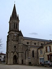
- Notre-Dame church
- Sainte-Barbe Castle ( Monument historique )
literature
- Le Patrimoine des Communes de la Gironde. Flohic Éditions, Volume 2, Paris 2001, ISBN 2-84234-125-2 , pp. 909-910.

