Canton of Rambervillers
| Former canton of Rambervillers |
|
|---|---|
| region | Lorraine |
| Department | Vosges |
| Arrondissement | Epinal |
| main place | Rambervillers |
| Dissolution date | March 29, 2015 |
| Residents | 13,123 (Jan. 1, 2012) |
| Population density | 42 inhabitants / km² |
| surface | 312 km² |
| Communities | 29 |
| INSEE code | 8821 |
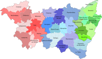
The canton of Rambervillers was a French canton in the Arrondissement Épinal , in the Département Vosges and in the Lorraine region until 2015 ; its main town was Rambervillers . The last representative in the General Council of the Département was Martine Gimmilaro-Weitmann ( UMP ) from 2001 to 2015 .
location
The canton was in the north of the Vosges department.
Communities
The canton consisted of 29 municipalities:
| local community | Population year | Area km² | Population density | Code INSEE | Post Code |
|---|---|---|---|---|---|
| Anglemont | 160 (2013) | 5.93 | 27 inhabitants / km² | 88008 | 88700 |
| Autrey | 283 (2013) | 17.42 | 16 inhabitants / km² | 88021 | 88700 |
| Bazias | 85 (2013) | 3.21 | 26 inhabitants / km² | 88042 | 88700 |
| Brû | 581 (2013) | 8.95 | 65 inhabitants / km² | 88077 | 88700 |
| Bult | 306 (2013) | 9.86 | 31 inhabitants / km² | 88080 | 88700 |
| Clézentaine | 222 (2013) | 13.11 | 17 inhabitants / km² | 88110 | 88700 |
| Deinvillers | 64 (2013) | 5.60 | 11 inhabitants / km² | 88127 | 88700 |
| Domptail | 351 (2013) | 18.63 | 19 inhabitants / km² | 88153 | 88700 |
| Doncières | 148 (2013) | 7.63 | 19 inhabitants / km² | 88156 | 88700 |
| Fauconcourt | 124 (2013) | 4.90 | 25 inhabitants / km² | 88168 | 88700 |
| Hardancourt | 41 (2013) | 3.33 | 12 inhabitants / km² | 88230 | 88700 |
| Housseras | 505 (2013) | 19.61 | 26 inhabitants / km² | 88243 | 88700 |
| Jeanménil | 1,127 (2013) | 18.24 | 62 inhabitants / km² | 88251 | 88700 |
| Menarmont | 61 (2013) | 5.24 | 12 inhabitants / km² | 88298 | 88700 |
| Ménil-sur-Belvitte | 312 (2013) | 8.60 | 36 inhabitants / km² | 88301 | 88700 |
| Moyemont | 221 (2013) | 12.30 | 18 inhabitants / km² | 88318 | 88700 |
| Nossoncourt | 106 (2013) | 5.34 | 20 inhabitants / km² | 88333 | 88700 |
| Ortoncourt | 88 (2013) | 4.39 | 20 inhabitants / km² | 88338 | 88700 |
| Rambervillers | 5,505 (2013) | 20.64 | 267 inhabitants / km² | 88367 | 88700 |
| Romont | 366 (2013) | 19.26 | 19 inhabitants / km² | 88395 | 88700 |
| Roville-aux-Chênes | 404 (2013) | 8.59 | 47 inhabitants / km² | 88402 | 88700 |
| Sainte-Barbe | 284 (2013) | 30.38 | 9 inhabitants / km² | 88410 | 88700 |
| Saint-Benoît-la-Chipotte | 444 (2013) | 2.77 | 160 inhabitants / km² | 88412 | 88700 |
| Saint-Genest | 132 (2013) | 6.26 | 21 inhabitants / km² | 88416 | 88700 |
| Saint-Gorgon | 407 (2013) | 5.77 | 71 inhabitants / km² | 88417 | 88700 |
| Saint-Maurice-sur-Mortagne | 182 (2013) | 6.78 | 27 inhabitants / km² | 88425 | 88700 |
| Saint-Pierremont | 165 (2013) | 5.51 | 30 inhabitants / km² | 88432 | 88700 |
| Vomécourt | 282 (2013) | 7.30 | 39 inhabitants / km² | 88521 | 88700 |
| Xaffévillers | 165 (2013) | 8.43 | 20 inhabitants / km² | 88527 | 88700 |
Population development
| 1962 | 1968 | 1975 | 1982 | 1990 | 1999 | 2006 | 2012 |
|---|---|---|---|---|---|---|---|
| 14.004 | 13,892 | 13,279 | 12,831 | 12,436 | 12,814 | 12,995 | 13,123 |

