
Canton of Bains-les-Bains
| Former canton of Bains-les-Bains |
|
|---|---|
| region | Lorraine |
| Department | Vosges |
| Arrondissement | Epinal |
| main place | Bains-les-Bains |
| Dissolution date | March 29, 2015 |
| Residents | 3,576 (Jan 1, 2012) |
| Population density | 21 inhabitants / km² |
| surface | 169.97 km² |
| Communities | 11 |
| INSEE code | 8801 |
The canton of Bains-les-Bains was a French canton in the Arrondissement Épinal , in the Département Vosges and in the Lorraine region until 2015 ; its main town was Bains-les-Bains . The last representative in the General Council of the Département was Frédéric Drevet ( PS ) from 2008 to 2015 .
geography
The canton of Bains-les-Bains was 169.97 km² and had 3,857 inhabitants (2006), which corresponded to a population density of 23 inhabitants per km².
location
The canton was on the southern border of the Vosges department.

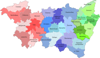
Location of the canton of Bains-les-Bains within the arrondissement of Épinal
Location of the canton of Bains-les-Bains within the Vosges department


Communities
The canton consisted of eleven municipalities:
| local community | Population year | Area km² | Population density | Code INSEE | Post Code |
|---|---|---|---|---|---|
| Bains-les-Bains | 1,204 (2013) | 25.37 | 47 inhabitants / km² | 88029 | 88240 |
| Fontenoy-le-Château | 586 (2013) | 38.13 | 15 inhabitants / km² | 88176 | 88240 |
| Grandrupt-de-Bains | 85 (2013) | 3.6 | 24 inhabitants / km² | 88214 | 88240 |
| Gruey-lès-Surance | 255 (2013) | 27.1 | 9 inhabitants / km² | 88221 | 88240 |
| Harsault | 381 (2013) | 10.85 | 35 inhabitants / km² | 88234 | 88240 |
| Hautmougey | 149 (2013) | 7.87 | 19 inhabitants / km² | 88235 | 88240 |
| La Haye | 124 (2013) | 7.34 | 17 inhabitants / km² | 88236 | 88240 |
| Montmotier | 50 (2013) | 4.24 | 12 inhabitants / km² | 88311 | 88240 |
| Trémonzey | 215 (2013) | 9.07 | 24 inhabitants / km² | 88479 | 88240 |
| Vioménil | 145 (2013) | 23.59 | 6 inhabitants / km² | 88515 | 88260 |
| Les Voivres | 336 (2013) | 12.81 | 26 inhabitants / km² | 88520 | 88240 |
Since January 1, 2013, the former municipality of Le Magny has been part of Fontenoy-le-Château .
Population development
| 1962 | 1968 | 1975 | 1982 | 1990 | 1999 | 2006 | 2012 |
|---|---|---|---|---|---|---|---|
| 5,324 | 4,939 | 4,430 | 4.155 | 3,944 | 3,838 | 3,857 | 3,576 |