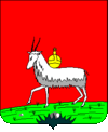
Koselets
| Koselets | ||
| Козелець | ||

|
|
|
| Basic data | ||
|---|---|---|
| Oblast : | Chernihiv Oblast | |
| Rajon : | Koselets district | |
| Height : | no information | |
| Area : | 8.44 km² | |
| Residents : | 8,760 (2004) | |
| Population density : | 1,038 inhabitants per km² | |
| Postcodes : | 17000-17003 | |
| Area code : | +380 4646 | |
| Geographic location : | 50 ° 55 ' N , 31 ° 7' E | |
| KOATUU : | 7422055100 | |
| Administrative structure : | 1 urban-type settlement | |
| Address: | вул. Ф. Сидорука 9 17000 смт. Козелець |
|
| Statistical information | ||
|
|
||
Koselez ( Ukrainian and Russian Козелець ) is an urban-type settlement in the Ukrainian Oblast Chernihiv with 8,900 inhabitants (as of January 1, 2005).
The settlement on the banks of the Oster is the administrative center of the Rajon of the same name .
history
Koselets was first mentioned in 1098 as a fortress of the Kievan Rus . In the 17th century the place was known as a great fortress and was granted Magdeburg city charter in 1656 . After the Tatar invasion of 1669, Koselets was partially destroyed.
After the collapse of the Russian Empire and the civil war that followed, Koselets became part of the Soviet Union , was revoked its urban status in 1924 and instead became an urban-type settlement.
Ilja Ehrenburg reports on Koselez in Menschen Jahre Leben Volume III, page 116.
cathedral
The most outstanding attraction of the city is the Cathedral of the Nativity of the Virgin , which was built between 1752 and 1763 in the Ukrainian Baroque style with elements of Rococo and Classicism according to the design of the Ukrainian architect Ivan Hryhorowytsch-Barskyj , which is now an architectural monument of national importance.
Sons and daughters of the church
- Marija Pavlova (1854–1938), Russian palaeontologist and university professor
- Vladimir Alexandrowitsch Negowski (1909–2003), famous doctor and resuscitation specialist


