Varva
| Varva | ||
| Варва | ||

|
|
|
| Basic data | ||
|---|---|---|
| Oblast : | Chernihiv Oblast | |
| Rajon : | Varva Raion | |
| Height : | no information | |
| Area : | 8.50 km² | |
| Residents : | 8,089 (2017) | |
| Population density : | 952 inhabitants per km² | |
| Postcodes : | 17600-17602 | |
| Area code : | +380 4636 | |
| Geographic location : | 50 ° 29 ′ N , 32 ° 43 ′ E | |
| KOATUU : | 7421155100 | |
| Administrative structure : | 1 urban-type settlement , 1 village | |
| Mayor : | Vyacheslav Hylenko | |
| Address: | вул. Пилипенка 3 17600 смт. Варва |
|
| Statistical information | ||
|
|
||
Varva (Ukrainian and Russian Варва ) is an urban-type settlement in the southeast of the Ukrainian Chernihiv Oblast with 8,000 inhabitants (2017) and the administrative center of the raion of the same name.
The settlement was first mentioned in writing in 1079 and at that time belonged to the sphere of influence of the Kievan Rus . After being destroyed by the Mongols in 1239, it was rebuilt and became part of the Grand Duchy of Lithuania in 1356 and, from 1569, the aristocratic republic of Poland-Lithuania . In 1782 the area with Varwa became part of the Russian Empire and was incorporated into the Chernigov governorate . From 1802 it was then under the Poltava Governorate . In 1966 the town was granted the status of an urban-type settlement, and Varwa has been the main town of the raion of the same name since 1966.
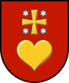
coat of arms
Description: In red a golden heart , above which a golden cross of paws , accompanied by a blue six-pointed star in the corners, hovers.
Sons and daughters of the village
- Ossip Maximowitsch Bodjanski (1808–1877), Slavist, writer and historian.
- Alla Hilenko (* 1992), biathlete
Web links
Individual evidence
- ↑ Cities and Settlements of Ukraine on pop-stat.mashke.org , accessed on April 19, 2018

