List of natural monuments in the Gmunden district
The list of natural monuments in the district of Gmunden lists the 80 objects designated as natural monuments in the district of Gmunden in the federal state of Upper Austria .
Natural monuments
| photo | Surname | ID | Location | description
|
surface | date |
|---|---|---|---|---|---|---|

|
"Kessel" (giant karst spring) | nd117 |
Hallstatt KG: Hallstatt GrStNr: 391; 372/22; 373/25 location |
The source ( cadastral number 1546/2) is located on Hallstätter Landesstraße around 1.5 km from Hallstatt in the direction of Obertraun. The rock basin of the karst spring is 10 m long and up to 6 m wide and filled with water. | 11/30/1978 | |

|
1000 year old linden tree | nd137 |
Bad Ischl KG: Bad Ischl GrStNr: 602 location |
The summer lime tree ( Tilia platyphyllos ) stands on the right bank of the Traun around 40 m in front of the old Traun bridge, south of the Lindenvilla. At the time it was placed under protection, it had a circumference of 5.45 m (measured at a height of one meter), a crown diameter of 14 m and a height of 20 m. Their age has been estimated to be 400 to 500 years. | December 18, 1980 | |
| 2 old yew trees | nd135 |
Ebensee KG: Oberlangbath GrStNr: 181/1 location |
The two European yew trees ( Taxus baccata ) can be found at the Ebensee ship landing stage on the grounds of a playground. At the time they were placed under protection, they had a trunk circumference of 1.9 or 1.6 m and were estimated to be 200 years old. | 06/30/1980 | ||
| 2 chapel linden trees | nd477 |
Ebensee KG: Ebensee GrStNr: 386/14 location |
The two unspecified linden trees stand next to the old Traunstraße in front of the Steinkogler sawmill next to a chapel. At the time they were placed under protection, they had a circumference of 3.1 or 3.3 m (measured at a height of one meter), a common crown diameter of 27 m and a height of 28 m each. | 11/19/1991 | ||

|
2 Linden trees in Theresientalstrasse in Gmunden | nd632 |
Gmunden KG: Ort-Gmunden GrStNr: .75 / 3; 320/5 location |
The two winter linden trees ( Tilia cordata ) are located in the park of the house at Theresientalstrasse 77 and opposite. At the time they were placed under protection, they had a circumference of 3.65 or 3.95 m (measured at a height of one meter), a common crown diameter of 17 or 18 m and a height of around 22 m each. The age was estimated to be around 150 years. | 09/11/2003 | |
| 2 English oaks | nd062 |
Altmünster KG: Eben GrStNr: 47/1; 60/2 location |
The two English oaks ( Quercus robur ) stand in a meadow southwest of the villa “Traunblick” in Altmünster. At the time they were placed under protection, the oaks had a circumference of 4.2 m at chest height. | 02/02/1972 | ||
| 3 yew trees | nd408 |
St. Wolfgang im Salzkammergut , Markt 173 KG: St. Wolfgang GrStNr: 120/2 location |
The three yew trees ( Taxus baccata ) are estimated to be between 200 and 250 years old and at the time they were placed under protection, at a height of 1.5 meters, had a circumference of 1.5 to 1.7 meters and a trunk diameter of 0.47 to 0.54 meters. The crown diameter was 6 to 10 meters, the height was estimated at 13 to 15 meters. | 03/06/1990 | ||
| 3 linden trees | nd260 |
Altmünster KG: Ort-Altmünster GrStNr: 617; 620 location |
Two of the three summer linden trees are at least 500 years old. The third is estimated to be 200 years old. The largest of the three trees had a circumference of 5.9 m and a height of 20 m at the time it was placed under protection. | 04/18/1984 | ||
| 3 linden trees | nd510 |
Bad Ischl KG: Reiterndorf GrStNr: 236/2 location |
Two of these summer linden trees of unknown age are standing together on a garden plot, the third is about 50 m away. The trees were placed under protection because of their landscape-defining character. | 04/02/1993 | ||
| Trees in the Rauhgarten Bad Ischl | nd167 |
Bad Ischl KG: Kaltenbach GrStNr: 206/6 location |
The Rauhgarten is a park-like area west of Bad Ischl. There are several groups of trees on the site. One of them is arranged in a circle and consists of 13 individual beeches . | 09/15/1981 | ||
| Sycamore maple | nd425 |
St. Wolfgang im Salzkammergut KG: St. Wolfgang GrStNr: 242/1 location |
The approx. 200 to 250 year old sycamore maple was placed under nature protection in 1990. At that time the tree had a circumference of 5.3 m and a height of 33 m. | 11/21/1990 | ||
| Sycamore maple and 2 oaks | nd405 |
St. Wolfgang im Salzkammergut KG: St. Wolfgang GrStNr: 134/2 location |
The group consisting of two English oaks and a sycamore maple . The oaks are thought to be around 350 years old, the sycamore maple is estimated to be around 150 years old. The sycamore maple had a circumference of 1.5 m and a height of 30 m when it was placed under protection. The two oaks had 1.35 m and 4.1 m trunk circumference. Together they form a crown with a height of 32 m. | 01/23/1990 | ||
| Mountain elm | nd139 |
Ebensee KG: Oberlangbath GrStNr: 256/1 location |
The mountain elm has been protected by decision of the Upper Austrian provincial government since 1980. It stands on the edge of the parking lot at the Langbathseen . | December 18, 1980 | ||

|
Mountain elm | nd147 |
Gosau KG: Gosau GrStNr: 206/4 location |
At the forest administration in Gosau there is a mountain elm with a height of 27 m. It is one of the largest examples of this rare species in Upper Austria. | December 18, 1980 | |
|
Copper beech | nd097 |
Gmunden KG: Gmunden GrStNr: 95/10 location |
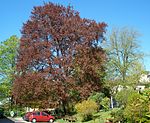
The 130 year old copper beech stands on Anton-von-Satori-Straße in Gmunden next to the listed former event hall. It belongs to the variety Fagus silvatica atropunicea and has been placed under protection because of its location, nature and typical appearance. | 06/08/1977 | |

|
Copper beech | nd148 |
Gosau KG: Gosau GrStNr: 206/4 location |
The copper beech is located near the forest administration in Gosau. The tree was placed under protection because of its location and the pronounced spherical shape of the crown. | December 18, 1980 | |

|
Copper beech | nd216 |
Gmunden KG: Ort-Gmunden GrStNr: 176/1 location |
The group stands north of the Gmunden hospital and consists of two specimens of the common beech variety Fagus silvatica atropunicea. The trees have a common crown and are about 30 m high. The diameter of the trunks is given as about 3 m. | 09/27/1983 | |
|
Book on the Bäckerberg | nd662 |
Scharnstein KG: Dorf GrStNr: 2351/3 location |
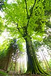
This common beech (Fagus sylvatica) stands quite secluded in a forest on the Bäckerberg in the municipality of Scharnstein. It should be around 250 years old. In 2011 it had a trunk circumference of 5.3 m and a height of about 30 m. | December 21, 2011 | |
|
Buchmooslinden | nd150 |
Gmunden KG: Ort-Gmunden GrStNr: 423/1 location |
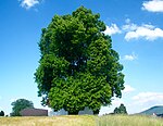
The two approx. 170 year old summer linden trees stand next to each other at the Buchmooshof, are approx. 25 m high and form a common crown. | December 18, 1980 | |

|
Dachstein mammoth cave and surroundings | nd614 |
Obertraun KG: Obertraun GrStNr: 471/1 location |
The Dachstein mammoth cave ( cadastral number 1547/9) was officially entered for the first time in 1910. It can be assumed that the cave was known earlier. It is open to tourists as a show cave in summer and can be reached from Obertraun with the Dachstein Krippenstein cable car .
Note: Formerly protected under gnd064. |
1910 | |

|
Dachstein giant ice cave | nd597 |
Obertraun KG: Obertraun GrStNr: 471/1 location |
The official date of the discovery of the Dachstein giant ice cave ( cadastral number 1547/17) is given as July 17, 1910. It is likely that locals knew the cave earlier.
Note: Formerly protected under gnd063. |
07/17/1910 | |

|
Double linden tree in building construction | nd149 |
Ohlsdorf KG: Ohlsdorf GrStNr: 131 location |
The summer lime tree in the village of Hochbau stands next to a chapel. Its main trunk divides into two trunks at a height of about 3 m. It has a total height of approx. 30 m, is visible from afar and is a unique specimen of its kind due to its size. | December 18, 1980 | |

|
Village wood | nd145 |
Obertraun KG: Obertraun GrStNr: .100; 185/3 location |
The yew tree is approx. 200 years old and is a village monument for Obertraun. When placed under protection, it had a circumference of 136 cm and a height of approx. 10 m. | December 18, 1980 | |
| yew | nd038 |
Ebensee KG: Oberlangbath GrStNr: 171 location |
This yew tree stands on private property behind the cemetery wall near the parish church of Ebensee and is not open to the public. | 06/15/1965 | ||

|
yew | nd437 |
Hallstatt KG: Hallstatt GrStNr: 89/2 location |
At the landing stage in Hallstatt, near the parish church, there is a yew tree , which has been protected since 1991 . With a trunk circumference of more than 2.6 m and a height of approx. 15 m, it is formative for the landscape of Hallstatt. | 03/04/1991 | |
| Yew tree (Taxus baccata) | nd015 |
Bad Goisern am Hallstättersee KG: Obersee GrStNr: 321/1; 321/3 location |
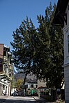
Standing in an open meadow in Obersee (Bad Goisern), this tree was declared a natural monument in 1960. The Yew had then m a circumference of 2.1. | 07/22/1960 | ||
|
Yew tree at the parish church in Bad Goisern | nd650 |
Bad Goisern am Hallstättersee KG: Goisern GrStNr: 446; 535/3 location |
The age of the yew tree next to the Bad Goiserer parish church is estimated to be around 200 years. It is about 15 m high and in 2006 had a trunk circumference of 2.25 m. | 08/04/2006 | |
|
Mixed yew forest on Johannisberg | nd353 |
Traunkirchen KG: Traunkirchen GrStNr: 19; 20 location |
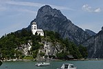
The protected mixed yew forest is located on the Johannesberg around the listed chapel. The Johannesberg consists of Jura limestone and determines the appearance of Traunkirchen. The forest has a proportion of yew trees of approx. 80% and covers an area of more than one hectare. In addition to the yews, beech trees, oaks, summer linden trees and maple trees also grow here. On March 23, 2007, T-Mobile Austria GmbH received the special permit for excavation work and the laying of an underground line on the Johannesberg. The reason for this was the erection of a mobile radio system in the tower of the listed Johanneskapelle. | 08/19/1986 | |

|
Ash on the Siriuskogel in Bad Ischl | nd639 |
Bad Ischl KG: Reiterndorf GrStNr: 325/8 location |
The approx. 150 year old ash tree is in a garden of a private house near the cemetery . It is about 23 m high and has a diameter of more than one meter. | 11/27/2003 | |

|
Boulder made of flysch sandstone | nd486 |
Gmunden KG: Gmunden GrStNr: 99/3 location |
The flysch core of the Gmundner Hochkogel comes to light here at an altitude of around 400 m . Here the Traungletscher of the Würm glaciation came to a standstill and the bedrock was only lightly covered. The approximately 10 m² outcrop is a geological rarity of particular scientific value. | 11/18/1992 | |
| Gasselniedernhöhle | nd601 |
Traunkirchen location |
The Gasselniedernhöhle ( cadastral number 1618/1) is located on the north side of the Gasselkogel in the municipality of Traunkirchen. Note: The coordinates are only accurate to the plot and do not correspond to the actual location of the cave. |
|||

|
Gassel stalactite cave | nd599 |
Ebensee KG: Ebensee GrStNr: 616/263 Location |
The Gassel cave ( cadastral number 1618/3) is accessible as a show cave with a cave guide from around the beginning of May to around mid-September. | ||
| Ginkgo tree at the BBK Gmunden | nd519 |
Gmunden KG: Traundorf GrStNr: 104/5; 104/9 location |
The ginkgo at the district chamber of farmers in Gmunden was identified as a natural monument in 1993. | 11/16/1993 | ||
| Glacial cut | nd211 |
Ebensee KG: Ebensee GrStNr: 603/2 location |
In a former gravel pit on the northern edge of Rindbach there is an approx. 500 m² smooth surface made of Hirlatz lime. The Traungletscher created this area 70,000 to 10,000 years before our time. | 13.09.1983 | ||

|
Gsanglinde in Viechtwang | nd143 |
Scharnstein KG: Viechtwang GrStNr: 193; 196/1 location |
The approximately 30 m high Gsanglinde stands on the edge of a meadow above Viechtwang. At the bottom it has a circumference of more than 5 meters and divides into 10 trunks at a height of about 2 m. The linden tree is a lookout point and a destination for walkers. | December 18, 1980 | |

|
House tree linden | nd134 |
Altmünster KG: Ebenzweier GrStNr: 14 location |
The large-leaved lime at the railway underpass the Gmunden district road had in place in the year 1980 under protection m a height of about 27 m and a circumference of the fifth | 08/29/1980 | |
| House lime tree in Großreith | nd482 |
Ohlsdorf KG: Hafendorf GrStNr: 952 location |
According to oral tradition, the winter linden tree in Großreith is around 200 years old. The 27 m high tree can be seen from afar and towers over all the buildings in its vicinity. | 04/01/1992 | ||

|
Hexenstein or Einsiedlerstein on Siriuskogel | nd184 |
Bad Ischl KG: Reiterndorf GrStNr: 303 location |
The Hexenstein or Einsiedlerstein, on Siriuskogel is a boulder of dolomite , which was shipped from the glacier at its location. The block is approx. 5 m high and takes up an area of approx. 50 m². | 07/01/1983 | |

|
Hirlatz cave | nd600 |
Hallstatt location |
The Hirlatzhöhle ( cadastral number 1546/7) is the third longest of the known caves in Austria. It has been explored to a depth of 1560 m and a length of 112.9 km. (As of September 30, 2018) | 1971 | |

|
High licking cave | nd602 |
Altmünster KG: Neukirchen GrStNr: 632/1 location |
The Hochlecken large cave ( cadastral number 1567/29) is located in the municipality of Altmünster and is the longest known cave in the Höllengebirge. | 1969 | |
| Kaltenbach pond | nd185 |
Bad Ischl KG: Kaltenbach GrStNr: 306/1 location |
The Kaltenbachteich in the Kaltenbachau is approx. 200 m long and has an average width of approx. 10 m. The water is probably an old arm of the Traun . Alders and willows stand on the bank, rushes and reeds grow in the transition area. The biotope is important for birds and amphibians. | 07/05/1983 | ||
|
Kapellen-Linde by Ruhsam | nd467 |
Ohlsdorf KG: Ehrenfeld GrStNr: 1025/1 location |
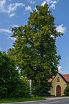
In 1991 the two linden trees had trunk circumferences of 2.3 m and 2.9 m respectively. They stand close together and their common crown is 27 m high. The remarkable group is thought to be around 120 years old and can be seen from afar. In 2018 only one of the two linden trees is left. | 10/01/1991 | |
| Karlgraben Cave | nd615 |
Location |
The Karlgrabenhöhle ( cadastral number 1563/2) is located in the Hausergraben in Hallstatt. | |||

|
Church linden tree | nd144 |
Scharnstein KG: Viechtwang GrStNr: 184/2 location |
The church linden tree was planted around 1880 to replace a linden tree that used to stand there. | December 18, 1980 | |
| Kirchschlagerloch | nd621 |
Obertraun GrStNr: 454/9; 449/2 |
The Kirchschlagerloch ( cadastral number 1611/6) is located in the southwestern slopes of the Sarstein . It is a stratum boundary cave in the strata within the Dachstein Limestone . | |||

|
Koppenbrüller cave | nd610 |
Obertraun KG: Obertraun GrStNr: 473/12 location |
The Koppenbrüller cave ( cadastral number 1549/1) is a show cave that has been opened since 1910. | 1973 | |

|
Krottensee | nd151 |
Gmunden KG: Schlagen GrStNr: 229/1 location |
The Krottensee is a dead lake in a worm moraine , a eutrophic clear water lake with extensive silting stocks . | December 18, 1980 | |
| Long wall cave | nd657 |
Bad Ischl KG: Rettenbach GrStNr: 487/1; 491/1 |
The long wall cave ( cadastral number 1616/67) was discovered in 2005 and declared a natural monument in 2009 due to the rich stalactite decorations. It is located in a remote area of the Hohe Schrott ( 1839 m ) in the Dead Mountains . It is a typical karst cave of this region. The cave has been declared a specially protected cave . | 2009 | ||
|
Linden tree | nd493 |
Scharnstein KG: Dorf GrStNr: 2065/2 location |
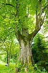
The summer lime tree next to house Bäckerberg 8 in Scharnstein shapes the landscape and serves as a breeding ground for birds. At the time it was placed under protection, it had a height of approx. 27 m and a trunk circumference of 5.3 m. | 12/18/1992 | |

|
Linden tree on the Bäckerschlag-Alm | nd448 |
Grünau im Almtal KG: Grünau GrStNr: 868/1 location |
The winter lime tree (Tilia cordata) on the Bäckerschlagalm in Grünau was noticeable in 1991, when it was placed under protection, due to its beautiful shape and its height of approx. 30 m. In the meantime one of the main branches has broken off and the tree now looks a bit crooked. The linden tree stands at approx. 740 m above sea level on an alpine pasture area that is rarely used by tourists. | 03/04/1991 | |
| Linden at the Blumauer in Scharnstein | nd652 |
Scharnstein KG: Viechtwang GrStNr: 925/3 location |
This winter linden tree stands in a park-like open space behind a house and is difficult to see because of the high hedges that surround the property on Grubbachstrasse in Scharnstein. It has a height of approx. 25 m and a trunk circumference of approx. 6 m. | 08/27/2007 | ||
| Linden tree in Bachgasse | nd529 |
Bad Ischl KG: Reiterndorf GrStNr: 116/2 location |
In 1994 the summer linden tree had a trunk circumference of 3.1 m and a height of approx. 26 m. The trunk is divided into several main branches at a height of about 4 m, which together form a beautiful crown. | 04/12/1994 | ||
| Mittagskogel cave | nd616 |
Obertraun KG: Obertraun GrStNr: 471/1 |
The Mittagskogel cave ( cadastral number 1547/68) is one of the numerous caves that are located on the approx. 62.8 km² large property 471/1 of the cadastral and local community of Obertraun . The protection applies not only to the cave, but also to the area within 35 m of the cave, as well as the area of the sinkhole "M1". | |||
| Mörkhöhle on the Schönbergalpe | nd603 |
Obertraun KG: Obertraun GrStNr: 471/1 |
The Mörk cave ( cadastral number 1547/12) is one of the numerous caves that are located on the approx. 62.8 km² large property 471/1 of the cadastral and local community of Obertraun. | |||
| Morton cave near the Schönbergalpe | nd611 |
Obertraun KG: Obertraun GrStNr: 472/144 location |
The entrance to the Morton Cave ( cadastral number 1547/8) is on the east face of the Mittagskogel near the Schönbergalpe in Obertraun. The dome-like crevices in the entrance area are connected by breaks and ravines. The long corridor that follows crosses the Mittagskogel. Skeletal parts and animal bones were found in several places. The cave is connected to the Dachstein Mammut Cave and is named after the botanist and cave explorer Friedrich Morton . | 02/25/1970 | ||

|
Most tree avenue | nd457 |
Bad Goisern am Hallstättersee KG: Goisern GrStNr: 347/6; 347/8; 347/9; 347/10; 347/13; 347/14; 347/15; 532/2 location |
In 1989 the avenue consisted of 36 cider pear trees ( Pyrus pyraster ) of which 24 were identified as natural monuments. | 06/19/1989 | |
| Upper Brandgrabenhöhle | nd624 |
Hallstatt KG: Hallstatt GrStNr: 399/1 location |
The Obere Brandgrabenhöhle ( cadastral number 1546/6) is an active water cave with lakes and siphons. The respective water flow determines the accessibility of the cave. | 01/14/1971 | ||
| Oedl cave near the Schönbergalpe | nd604 |
Obertraun KG: Obertraun GrStNr: 471/1 |
The Oedl cave ( cadastral number 1547 / 9d) is located in the western part of the Schönbergalpe in Obertraun and is one of the numerous caves that are located on the approx. 62.8 km² large property 471/1 of the cadastral and local community Obertraun. | |||
| Eastern Almberg Ice Cave | nd622 |
Obertraun KG: Obertraun GrStNr: 471/1 |
The Eastern Almberg Ice Cave ( cadastral number 1547/34) is located between Almberg and Hirschberg and is one of the numerous caves that are located on the approx. 62.8 km² large property 471/1 of the cadastral and local community of Obertraun. | |||
| plane | nd205 |
Gmunden KG: Ort-Gmunden GrStNr: 176/5 location |
The plane tree (Platanus hispanica) is at the Gmunden regional hospital on Anton-von-Satori-Straße. It has a trunk circumference of 2.6 m and a height of approx. 10 m | |||

|
Giant karst spring "Hirschbrunn" | nd118 |
Hallstatt KG: Hallstatt GrStNr: 378 location |
The giant karst cave Hirschbrunn ( cadastral number 1546/1) is a spring mainly active when the snow melts. Since the meltwater takes about 5 hours to flow through the cave system, the spring is usually only active after noon. The water then falls into Lake Hallstatt from a height of more than 30 m . The watercourse is overgrown and therefore hardly accessible. | ||

|
Rindbach Falls | nd194 |
Ebensee KG: Ebensee GrStNr: 734/19 location |
The Rindbach Falls are approx. 20 minutes away from the village of Rindbach. The torrent falls here in several stages into the deeply indented valley. A hiking trail leads to the falls, but a storm in 2013 washed away some footbridges and stairs that led past the falls. | ||
| Rötelseehöhle | nd605 |
Gmunden KG: Traunstein GrStNr: 187/1 location |
The Rötelsee ( cadastral number 1618/1) is an underground lake in the Rötelspitz, a mountain on the edge of the Traunsee . A climb with safety ropes leads up to the cave (2011). | |||
|
Red pine in the OKA settlement | nd223 |
Gmunden KG: Ort-Gmunden GrStNr: 197/35 Location |
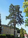
The red pine (Pinus sylvestris) had a height of approx. 27 m and a trunk circumference of 2.36 m in 1983. It is in a housing estate on Lindenstrasse in Gmunden. | 11/10/1983 | |
| Schlosslinden | nd142 |
Scharnstein KG: Viechtwang GrStNr: .214 location |
In 1777, on the occasion of the 1000th anniversary of the Kremsmünster Abbey , 6 summer linden trees were planted in the Scharnstein castle courtyard . When it was placed under protection in 1980, five of these trees were still present. | December 18, 1980 | ||
| Schoenbergalpe | nd607 |
Obertraun GrStNr: 472/146; 192/47; .336 (.355; 471/1; 472/144; 472/159) location |
The karst area around the Schönberghaus is a natural monument. | |||

|
School lime tree in Gosau | nd403 |
Gosau KG: Gosau GrStNr: 393 location |
This summer linden tree stands approx. 50 m southwest of the Protestant church in Gosau . It is believed to have been planted around 1790 and when it was identified as a natural monument it was 3.7 m in circumference and around 21 m in height. | January 17, 1990 | |

|
Summer linden tree | nd160 |
Scharnstein KG: Dorf GrStNr: 1896/1 location |
The summer linden tree on the southern slope of the Hacklberg in Viechtwang (Scharnstein) is one of the mightiest linden trees in Upper Austria. When it was placed under protection, it had a trunk circumference of 6.4 m at a height of approx. 21 m. From a height of approx. 3 m it divides into 18 main branches that form a spherical crown. As it stands deep in the forest, only part of the crown is visible from the valley. | 03/06/1981 | |
| Summer linden tree | nd404 |
St. Wolfgang im Salzkammergut KG: St. Wolfgang GrStNr: 134/1 location |
The approximately 200-year-old summer linden tree was about 31 m high in 1990 and had a trunk diameter of 1.06 m. It is on the Schafbergbahn route shortly before it crosses the state border with Salzburg. | 01/23/1990 | ||
| Summer linden tree | nd406 |
St. Wolfgang im Salzkammergut KG: St. Wolfgang GrStNr: 26/2 location |
Shortly before car park 3 / center of St. Wolfgang im Salzkammergut there is an approx. 250 year old summer linden tree on private property . When it was placed under protection, it had a height of approx. 27 m and a trunk diameter of 1.3 m. | 02/01/1990 | ||

|
Summer linden tree near Kogl | nd246 |
Kirchham KG: Kogl GrStNr: 413 location |
This summer lime tree is located at an altitude of around 700 m next to the Kogl 12 farm in the municipality of Kirchham. With a trunk circumference of 8.3 m and a height of approx. 22 m, it is one of the mightiest linden trees in Upper Austria. | 04/16/1984 | |

|
Summer linden tree in the Lahn | nd648 |
Grünau im Almtal KG: Grünau GrStNr: 1178/1 location |
The age of the summer lime tree in the Lahn is estimated to be around 400 years. It has a very wide spreading crown with a diameter of about 22 m, a height of about 25 m and a circumference of 6.5 m. | 12/01/2005 | |
| Sterzen's evening seat - 6 linden trees | nd138 |
Bad Ischl KG: Reiterndorf GrStNr: 259/1 location |
Of the seven summer linden trees that were protected by a decision in 1980 , six still exist in 2014. The trees stand on a moraine hill and are arranged in a circle around a plateau with seats. They have an average trunk circumference of 2.2 m and a common crown with a diameter of about 22 m. | December 18, 1980 | ||
| Pedunculate oak in Satoripark | nd206 |
Gmunden KG: Ort-Gmunden GrStNr: 176/1 location |
The pedunculate oak is a remnant of the former Satoripark in Gmunden. In 1983 it had a height of about 18 m and a circumference of 2.43 m. | 13.09.1983 | ||
|
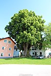
Millennial linden from Eisengattern | nd168 |
Kirchham KG: Krottendorf GrStNr: 293/9 location |
The summer lime tree in Eisengattern is more than 800 years old. It stands next to the “Wirt zu Eisengattern” inn and has a trunk circumference of 13.6 m. From a height of about three meters, the trunk branches into 5 main branches that form a crown about 15 m in diameter. A long time ago a hole was cut in the trunk. The cave can be entered via a short flight of stairs. | 10/28/1981 | |

|
Teufelsloch near the Schönbergalpe | nd609 |
Obertraun KG: Obertraun GrStNr: 471/1 |
The Teufelsloch ( cadastral number 1547/23) is a 150 m long through cave and today part of the Dachstein Mammut Cave. It is one of the numerous caves that are located on the approx. 62.8 km² large property 471/1 of the cadastral and local community of Obertraun. | ||
| Thuje | nd203 |
Gmunden KG: Ort-Gmunden GrStNr: 176/5 location |
The Thuja is a remnant of the former Satoripark in Gmunden. In 1983 it had a height of approx. 18 m and a circumference of 2.2 m. | 13.09.1983 | ||
| Stalactite cave in the hanging Kogel | nd619 |
Ebensee GrStNr: 678/1 location |
The cave ( cadastral number 1626/16) is located in the northern slopes of the Hangenden Kogel ( 1895 m ) at a little more than 1500 m above sea level in impassable terrain. | |||
| Western Almberg ice cave | nd623 |
Obertraun KG: Obertraun GrStNr: 471/1 |
The western Almberg ice cave ( cadastral number 1547/39) is one of the numerous caves that are located on the approx. 62.8 km² large property 471/1 of the cadastral and local community of Obertraun. In addition to the cave, the area within 50 meters of the entrance is also protected. | |||
| Carpentry pond | nd146 |
Altmünster KG: Ort-Altmünster GrStNr: 489/3; 500/2; 504/1 location |
The approx. 200 m² pond is a dead ice hole that was created at the end of the last glacial period. It was placed under protection in 1980. In 2005 the pond, which had meanwhile been completely dried out, was renovated and the water surface restored. Immediately after the renovation was completed, numerous animals settled in the renewed biotope. | December 18, 1980 |
Former natural monuments
| photo | Surname | ID | Location | description
|
surface | date |
|---|---|---|---|---|---|---|
| Linden tree in Aftersee | gnd532 |
Altmünster |
||||
| yew | gnd166 |
Bad Goisern am Hallstättersee |
The yew in lasers was with an estimated age of 800 to 1000 years and a trunk circumference (measured at 1.5 m height) of 3 m one of the most important trees of this species in Upper Austria. | |||
| buckeye | gnd169 |
Bad Ischl |
The horse chestnut at a street crossing in Kaltenbach was 100 to 120 years old and had a trunk circumference of 3.63 m. | |||
| Redwoodtree | gnd133 |
Gmunden |
The sequoia tree ( Sequoiadendron giganteum ) was on the esplanade in Gmunden, southwest of the esplanade café in Gmunden. This tree, which occurs very rarely in Upper Austria, was around 18 m high, had a crown diameter of 10 m and a trunk circumference of 4.6 m. | |||
| plane | gnd204 |
Gmunden |
Plane tree in the Satoripark | |||
| Ash | gnd136 |
Gmunden |
The ash tree at the approach to Schloss Ort was around 15 m high, had a crown diameter of 15 m and a trunk circumference of 3.45 m. The whole tree was overgrown with ivy right down to the branches. | |||
| Linden tree | gnd502 |
Gmunden |
||||
| Sycamore maple | gnd170 |
Gosau |
The sycamore maple in the village of Ramsau had a height of 20 m, a crown diameter of 15 m and a trunk circumference of 3.6 m. | |||
| Linden tree in further pitch | gnd449 |
Grünau im Almtal |
||||
| yew | gnd141 |
Scharnstein |
The yew tree at the east entrance of Scharnstein Castle was around 8 m high and had a crown diameter of 12 m. With a trunk circumference of 2.35 m, it was one of the mightiest trees of its kind in Upper Austria. | |||
| Linden tree | gnd140 |
Scharnstein |
The Mangerlinde was in the community of Scharnstein. |
Notes / legend
| Photo: | Photography of the natural monument. Click the photo generates an enlarged view. There are also two symbols:
|
||||
| Surname: | Designation of the natural monument according to official sources | ||||
| ID | Identifier | ||||
| Location: | The municipality and, if available, the address are given. The cadastral community (KG) and the property number are listed below. By calling up the link Location , the location of the monument is displayed in various map projects. | ||||
| description | Brief description of the natural monument | ||||
| surface | Area of the natural monument in hectares (ha) | ||||
| date | Date or year of protection |
literature
- Office of the Upper Austrian State government, agricultural and forest law department (ed.): Natural monuments in Upper Austria. Linz 1989, pp. 33–41 ( PDF; 99.1 MB )
Web links
Commons : Natural monuments in the Gmunden district - collection of images, videos and audio files
- State of Upper Austria nature conservation database and nature conservation book