List of natural monuments in the Kirchdorf district
The list of natural monuments in the Kirchdorf district lists the objects designated as natural monuments in the Kirchdorf district in the state of Upper Austria .
Natural monuments
| photo | Surname | ID | Location | description
|
surface | date |
|---|---|---|---|---|---|---|

|
Linde at the elementary school in Mitterweng | nd491 |
Edlbach KG: Edlbach GrStNr: 1163 location |
The summer lime tree ( Tilia platyphyllos ) is at the entrance to the elementary school in Mitterweng. At the time it was placed under protection, it had a trunk circumference of 3.5 m (at a height of one meter), a crown diameter of 15 m and a height of around 25 m. Their age was estimated to be 120 years. | December 21, 1992 | |
| Sessile oak | nd663 |
Edlbach , Edlbach 169 KG: Edlbach GrStNr: 181/6 location |
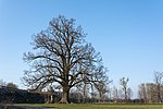
The sessile oak ( Quercus petraea ) is located on the north side of the Edlbach 169 property. At the time it was placed under protection, it had a trunk circumference of 3.85 m (at a height of one meter), a crown diameter of 16 m and a height of about 25 m. Their age was estimated at 150 years. | 01/20/2012 | ||
| Eislueg | nd618 |
Hinterstoder KG: Hinterstoder GrStNr: 525/1 location |
The ice cave ( cadastral number 1625/28) is in the area of the Brandleck . Note: No notification linked. Coordinates approximate. |
|||

|
Chalk grooves | nd620 |
Hinterstoder KG: Hinterstoder GrStNr: 167/1; 167/2; 167/3; 167/4 location |
The natural cave ( cadastral number 1628/2) was explored for the first time by Hans Hauenschild , the cave entrance being in the Steyr valley between Kleinem Priel and Poppenberg . Note: initial notification not linked. Coordinates approximate. |
||

|
Schwarzbach | nd608 |
Hinterstoder KG: Hinterstoder GrStNr: 167/1 location |
The Schwarzbach is a karst phenomenon in connection with the Kreidelucke . It is located on the left Steyrufer in the Steyr breakthrough valley between Kleinem Priel and Poppenberg . Note: Notification not linked. Coordinates approximate. |
||

|
Huebmer oak | nd499 |
Inzersdorf im Kremstal , Haselböckau 63 KG: Unterinzersdorf GrStNr: 1599/2 location |
The pedunculate oak ( Quercus robur ) is located around 300 m east of the Haselböckau 63 farmhouse at the foot of the Pyhrn motorway . At the time it was placed under protection, it had a trunk circumference of 5.85 m, a crown diameter of 28 m and a height of around 30 m. Their age has been estimated to be more than 100 years. | 01/08/1993 | |

|
Conglomerate wall | nd092 |
Klaus an der Pyhrnbahn KG: Klaus GrStNr: 631, 632, 560/1, 560/3 location |
The conglomerate wall consists of hardened, glacial gravel. It reaches a height of 38 m and is around 200 m long. The wall is located on the Steyr after the confluence of the Teichl on the left bank and represents a unique landscape type of a canyon valley formed by ice age conglomerates, which was once characteristic of most of the Steyr valley. | 11/12/1976 | |

|
Lettenmayr cave | nd617 |
Kremsmünster KG: Kirchberg GrStNr: 32/1 location |
The Lettenmayr cave ( cadastral number 1673/1), a diluvial bank cave, is located in an abandoned quarry in Kremsmünster. The washed out conglomerate rock wall was discovered in the years 1880/81 during quarry work on the property of the builder Lettenmayr. It measures around 25 × 20 m and contained weapons from the Hallstatt period, fragments of clay pots and numerous remains of bones from cave bears. Note: initial notification not linked. Coordinates approximate. |
||

|
Wolfgangstein quarry | nd313 |
Kremsmünster KG: Wolfgangstein or Kirchberg GrStNr: 57 or 64/2 location |
The quarry can be reached from Kremsmünster-Landesstraße via the Wolfgangstein supply route and Römergasse. It is an extraction site of the so-called “Weißen Nagelfluh” from the Günz-Mindel interglacial, which consists almost exclusively of dolomite and limestone rubble. It is of international importance for geological exploration of the Ice Age. | 09/02/1985 | |
| Sweet chestnut | nd331 |
Micheldorf in Upper Austria , Seebach 53 KG: Untermicheldorf GrStNr: 33 Location |
The sweet chestnut ( Castanea sativa ) is on the farm in Seebach 53. At the time it was placed under protection, the tree had a trunk circumference of 6.8 m, a crown diameter of 15 m and a height of around 24 m. | 11/29/1985 | ||

|
Linden tree in Micheldorf | nd647 |
Micheldorf in Upper Austria KG: Mittermicheldorf GrStNr: 1937; 1954/1 location |
The linden tree stands on a hill west of the village of Heiligenkreuz. At the time it was placed under protection, it had a trunk diameter of 2.2 m or a trunk circumference of 6.9 m (measured at a height of one meter), a crown diameter of 19 m and a height of around 29 m. | 12/02/2005 | |
| Sycamore maple | nd561 |
Molln KG: Molln GrStNr: 1325/1 location |
The sycamore maple ( Acer pseudoplatanus ) stands at the foot of the Reitberg on the east side of the building at Bräugrabenstrasse 6, with the trunk branching out into numerous small main branches at a height of 4 m. At the time it was placed under protection, the tree had a trunk circumference of 3.75 m (measured at a height of one meter), a crown diameter of 21 m and a height of around 27 m. | December 16, 1998 | ||

|
Linden in the municipality of Molln | nd497 |
Molln KG: Molln GrStNr: 933/4 location |
The summer lime tree ( Tilia platyphyllos ) is in the front garden of the Dachstein ski boot factory. At the time it was placed under protection, the tree had a trunk circumference of 5.2 m (measured at a height of one meter), a crown diameter of 20 m and a height of around 33 m. | 12/18/1992 | |

|
Flowing wall in Molln | nd567 |
Molln KG: Auserbreitenau GrStNr: 1173; 1176; 1172; 1177/1; 1171; 1174; 1175/1; 1178/1 location |
The conglomerate walls with trickled rocks are on the steep slope of the Steyr . | March 24, 1999 | |

|
Linden tree in the municipality of Nussbach | nd407 |
Nussbach , Natzberg 17 KG: Mandorf GrStNr: 383 location |
The winter lime tree ( Tilia cordata ) is located next to the Natzberg 17 farm, next to a Marienkapelle. At the time it was placed under protection, the tree had a trunk circumference of 3.65 m, a crown diameter of 19 m and a height of around 25 m. The age of the tree has been estimated to be 300 to 400 years. | 05.03.1990 | |

|
yew | nd152 |
Pettenbach KG: Seisenburg GrStNr: 1231/2 location |
The European yew tree ( Taxus baccata ) stands northwest of the Seisenburg ruins below the access road in the area of the last bend. At the time it was placed under protection, the tree had a trunk circumference of 1.85 m (measured at a height of one meter), a crown diameter of 6 m and a height of 15 m. | 07/17/1986 | |

|
Ivy stick on the church tower | nd256 |
Ried im Traunkreis KG: Ried im Traunkreis GrStNr: 20/1 location |
The ivy stick ( Hedera helix ) grows over the steeple of the parish church in Ried im Traunkreis . | 04/13/1984 | |

|
Book on the Zaglbauernalm | nd490 |
Rosenau am Hengstpaß KG: Rosenau GrStNr: 1498 location |
The common beech is on the Zaglbauernalm and can be reached via the Ackermayrstraße forest path. At the time it was placed under protection, the tree had a trunk circumference of 6.6 m (measured at a height of one meter), a crown diameter of 20 m and a height of around 40 m. | 12/17/1992 | |

|
Klarahöhle | nd646 | Rosenau am Hengstpaß , Roßleithen | The Klarahöhle is an extensive cave system in the Kalkalpen National Park . Note: No notification linked |
||

|
2 summer linden trees | nd402 |
Roßleithen KG: Roßleithen GrStNr: 104/3 location |
The two summer linden trees ( Tilia platyphyllos ) are around 50 m northwest of the Roßleithen school to the left and right of a chapel. At the time they were placed under protection, they had a trunk circumference of 3.8 m each, a common crown diameter of 30 m and a height of around 25 m. | 01/24/1990 | |

|
Piesling origin | nd103 |
Roßleithen KG: Roßleithen GrStNr: 1010/1; 1010/4; 1010/5, 1133; 1134; 1079/3 location |
The origin of the Piesling is one of the strongest giant karst springs in the Northern Alps. It is located around 1 km south of Roßleithen and consists of an oval spring pot with a diameter of around 30 m and a depth of 32 m under the overhanging "original walls". The amount of water in the spring varies between 300 and 2000 l / s between winter and summer. | 06/19/1978 | |

|
Rettenbach cave | nd598 |
Roßleithen KG: Rading GrStNr: 544/17 location |
The temporarily active water cave ( cadastral number 1651/1) is located on the southern slope of the Sengsengebirge . Note: No notification linked |
||

|
Veichlteich | nd213 |
Roßleithen KG: Rading GrStNr: 485 location |
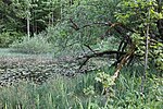
The 800 m² pond with silted vegetation and a high rush belt offers a habitat for common toads, common frogs, dragonflies and rare beetles. The pond is around 1.5 km north of Windischgarsten in the Veichl valley. | 13.09.1983 | |

|
Rumpelmayrlinde | nd324 |
Roßleithen KG: Rading GrStNr: 721 location |
The summer lime tree ( Tilia platyphyllos ) stands next to the Rumplmayr farm. At the time it was placed under protection, the tree had a trunk circumference of 4.6 m (chest height), a crown diameter of 25 m and a height of 35 m. | October 29, 1985 | |

|
Sycamore maple in Buglreut | nd480 |
Spital am Pyhrn KG: Fahrenberg GrStNr: 72 location |
The sycamore maple ( Acer pseudoplatanus ) stands in the Haller Walls on the Buglreut. At the time it was placed under protection, the tree had a trunk circumference of 4.95 m (measured at a height of one meter), a crown diameter of 18 m and a height of around 23 m. The age was estimated to be 350 to 400 years. Note: Coordinates now “tree-specific”, searched for and then found by chance; GStNr. is 70; bam oida is written there! |
04/01/1992 | |

|
Dr Vogelgesang Gorge | nd181 |
Spital am Pyhrn KG: Spital am Pyhrn GrStNr: 1198; 888; 801; 804; 884/2; 887; 765/5 location |
The Dr. Vogelgesang Gorge is the second longest of the Austrian rock gorges and is located on the Trattenbach. | 10/09/1978 | |
| Gamssulzenhöhle | nd625 |
Spital am Pyhrn KG: Gleinkerau GrStNr: 1814/4 location |
The cleft-bound cave ( cadastral number 1624/27) with shaft sections and bone finds of large Pleistocene mammals is located southeast of the Gleinkersee . Note: No notification linked. Coordinates approximate. |
|||

|
Bone cave in Ramesch | nd627 |
Spital am Pyhrn KG: Spital am Pyhrn GrStNr: 1082 location |
The bone cave ( cadastral number 1636 / 08a) at the foot of the Ramesch north face houses extensive deposits of cave bear bones. | 05.09.1977 | |

|
Kreuzlinden at the blacksmith in the Au | nd113 |
Spital am Pyhrn KG: Gleinkerau GrStNr: 1614/2 location |
The five winter linden trees ( Tilia cordata ) stand around a cross column on the road through Gleinkerau. At the time they were placed under protection, the linden trees were estimated to be around 130 years old, with the age of the linden trees indicating the erection of the cross column (marked 1845 ). The linden trees were 1.7 to 2.75 m in circumference. | 10/10/1978 | |

|
Blessing tree | nd483 |
Spital am Pyhrn KG: Spital am Pyhrn GrStNr: .59 location |
The Sade tree ( Juniperus sabina ) grows on the facade of the Spital am Pyhrn 93 building. At the time it was placed under protection, it was estimated to be around 250 years old. | 04/24/1992 | |

|
Devil's Church in the front Rettenbachtal | nd268 |
St. Pankraz KG: St. Pankraz GrStNr: 520/2 location |
The Devil's Church is a natural rock arch made of Jurassic limestone with a span of 16 m and a height of 12 m. It is located in a valley at the foot of the Sengsengebirge in the municipality of St. Pankraz . The Vordere Rettenbach rises near the Teufelskirche . | 05/14/1984 | |

|
Apothecary linden tree | nd091 |
Windischgarsten KG: Windischgarsten GrStNr: 969; 957/29 location |
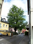
The summer lime tree ( Tilia platyphyllos ) is in the center of Windischgarsten near the (former) Zeller pharmacy on Schulstrasse. The linden tree was planted in memory of the fire accident in Windischgarsten in 1885. | 09/27/1976 | |

|
Forsthoflinde | nd090 |
Windischgarsten KG: Windischgarsten GrStNr: .96; 944/1 location |
The summer lime tree ( Tilia platyphyllos ) is in the garden of the Rosenau forest administration. | 09/27/1976 | |

|
Linde at the Schöffmannsäge | nd121 |
Windischgarsten KG: Windischgarsten GrStNr: 903/2 location |
The winter lime tree ( Tilia cordata ) stands on the Hengstpass state road in front of an indoor tennis center. | 11/20/1979 |
Former natural monuments
| photo | Surname | ID | Location | description
|
surface | date |
|---|---|---|---|---|---|---|
| Linden tree | gnd089 |
Windischgarsten |
The linden tree at the eastern end of Windischgarsten had a height of 27 m, a trunk circumference of 4.9 m, a crown diameter of 16 m and an age of around 250 years. | |||
| Linden tree | gnd111 |
Vorderstoder |
The Filzmoser Joch-Linde stood on the saddle between Vorderstoder and Roßleithen next to a chapel. It had a height of around 28 m, a trunk circumference of 6.35 m, a crown diameter of 20 m and an age of around 600 years. Three leaders of the peasant uprising are said to have been hanged on the tree in 1597 . | |||
| Linden tree | gnd112 |
Spital am Pyhrn |
||||
| Linden tree | gnd114 |
Spital am Pyhrn |
||||
| Horse chestnut in Wartberg adKr. | gnd421 |
Wartberg an der Krems |
The horse chestnut was at the dairy in the center of Wartberg an der Krems. It had a height of around 16 m, a trunk circumference of 2.7 m, a crown diameter of 12 m and a distinctive spherical growth. | |||
| elm | gnd053 |
Kremsmünster |
||||
| elm | gnd115 |
Spital am Pyhrn |
The elm was visible from afar at an altitude of around 840 m above sea level. A. With a height of around 22 m, a trunk circumference of 4.9 m and a crown diameter of 20 m, it was one of the largest elms in Upper Austria. | |||
| Elm on the Egglalm | gnd543 |
Rosenau am Hengstpaß |
Notes / legend
| Photo: | Photography of the natural monument. Click the photo generates an enlarged view. There are also two symbols:
|
||||
| Surname: | Designation of the natural monument according to official sources | ||||
| ID | Identifier | ||||
| Location: | The municipality and, if available, the address are given. The cadastral community (KG) and the property number are listed below. By calling up the link Location , the location of the monument is displayed in various map projects. | ||||
| description | Brief description of the natural monument | ||||
| surface | Area of the natural monument in hectares (ha) | ||||
| date | Date or year of protection |
Web links
Commons : Natural monuments in the Kirchdorf district - collection of images, videos and audio files
- State of Upper Austria nature conservation database and nature conservation book
- Natural monuments (Province of Upper Austria) at data.gv.at
Individual evidence
- ↑ a b c Office of Upper Austria. Provincial government, agricultural and forest law department (ed.): "Natural monuments in Upper Austria." Linz 1989, pp. 43–46 ( PDF; 99.1 MB )
- ↑ Office of Upper Austria. State government, agricultural and forest law department (ed.): "Nature Conservation Report 1986–1990." Linz 1991, p. 29 ( PDF; 94.7 MB )