List of Canadian regions
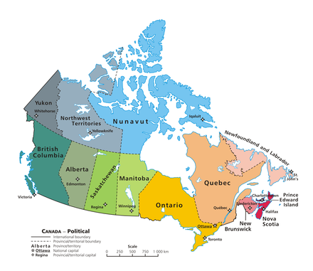
The term region en is ambiguous in Canada : On the one hand, there are national regions for the division of the Canadian state. They combine individual territories and provinces. On the other hand, there are official census and administrative regions and unofficial geographic regions within the territories and provinces.
National regions
Provinces and territories of Canada are usually grouped into the following regions (generally from west to east):
Other regions are:
- English Canada , sometimes known as the rest of Canada (excluding Quebec) when it comes to languages
- French Canada
- Pacific Canada (British Columbia)
- Acadia
- Quebec-Windsor Corridor
- Four Corners
Seats in the Canadian Senate are evenly distributed across four regions: Maritime Provinces, Quebec, Ontario, and West, with Newfoundland and the North having a special status.
Provincial regions
The provinces and territories are all divided into regions for various official and unofficial purposes. In some provinces, the regions have been officially determined by the government.
