
Maliana (administrative office)
| Maliana Administration Office | |||
|
|||

|
|||
| Administrative headquarters | Maliana ( Holsa ) | ||
| surface | 237.04 km² | ||
| population | 28,908 (2015) | ||
| Sucos | Population (2015) | ||
| Holsa | 4,972 | ||
| Lahomea | 4,604 | ||
| Odomau | 4,501 | ||
| Raifun | 1,623 | ||
| Ritabou | 6,617 | ||
| Saburai | 2,268 | ||
| Tapo / memo | 4,323 | ||
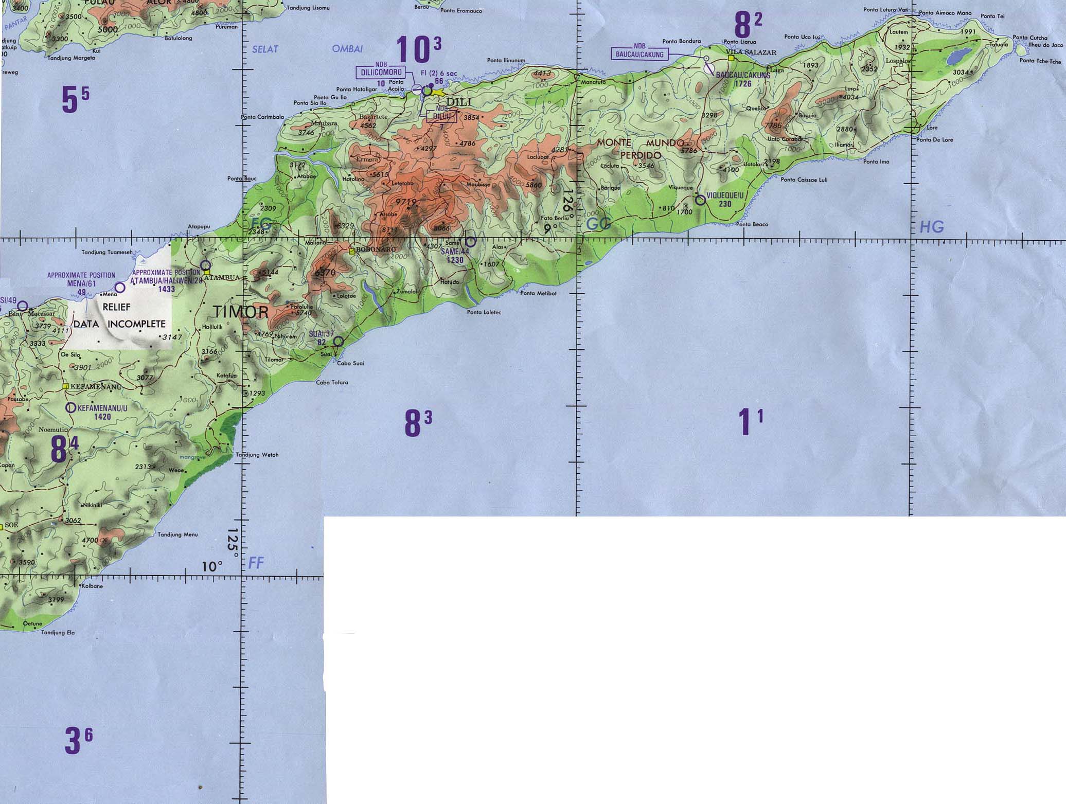
| Overview map | |||

|
|||

|
|||

Maliana is an East Timorese administrative office ( Portuguese Posto Administrativo ) in the municipality of Bobonaro . The administrative headquarters are in Suco Holsa in the city of Maliana .
geography


Until 2014, the administrative offices were still referred to as sub-districts . Before the 2015 regional reform, Maliana had an area of 239.35 km². Now there are 237.04 km².
Southwest of the river Malibaka lies the Indonesian West Timor . The Malibaka unites with the Talau and now forms as Nunura in the west the border to the East Timorese administrative offices of Balibo and Atabae . The Bulobo river has its source near the town of Maliana and forms part of the border with the administrative office of Cailaco in the north until it flows into the Nunura. To the southeast of the Maliana administrative office is the Bobonaro administrative office and the Lolotoe administrative office at the southern tip .
The Maliana administrative office is divided into seven sucos : Holsa , Lahomea , Odomau ( Odamau , Oromau ), Raifun ( Rai Fun ), Ritabou , Saburai ( Sebura ) and Tapo / Memo ( Tapo Memo ). The sucos Holsa and Ritabou are classified as " urban ".
The Leolaco dominates the landscape as the highest mountain in the region ( 1929 m ).
There is a reforestation project in Lahomea.
The affiliation of an area of 37 hectares between Memo (Suco Tapo / Memo) and the Indonesian Dilumi ( Belu administrative district ) was disputed for a long time. It was not until March 2013 that an agreement on the demarcation of the two countries was reached.
- Climate data
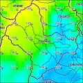
Annual rainfall (2000)
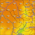
Average annual temperature (2000)

Climate diagram of Maliana


Residents
28,908 people (2015) live in the Maliana administrative office, of which 14,538 are men and 14,370 women. The population density is 122.0 inhabitants / km². The average age is 19.1 years (2010, 2004: 18.5 years). The largest language group is formed by the speakers of the national language Kemak . In Tapo / Memo, Saburai, Holsa and Odomau, however, Bunak is spoken. The official language Tetum is widely used as a second language . Bahasa Indonesia was used during the occupation, the elders still speak Portuguese . This is also taught in schools.
history

.jpg)
The current administrative office of Maliana used to belong to the Bunak Empire of Lamaquitos ( Lamakitu ), which ruled an area between Cailaco in the north and Maucatar in the south.
In 1719 several Timorese rulers ( Liurai ) agreed an alliance against the Portuguese; the beginning of the Cailaco rebellion . The Lamaquitos neighboring Cailaco became the headquarters of the rebels. At that time, 40,000 people lived relatively isolated in the Marobo Valley with the Marobo and Lóis rivers . In 1726 the Portuguese governor António Moniz de Macedo dispatched troops from Dili and Batugade against the Pedras de Cailaco ( Cailaco rocks). The steep walls of the Leolaco offered the empire of Cailaco a natural fortress and were considered impregnable. On October 23, the Portuguese gathered a total of 4,000 men at the foot of the mountain, including Topasse and allied Timorese. After 40 days, however, they had to give up the siege in December, also because of heavy rain.
In the Treaty of Lisbon (1859) , the colonial powers established the border between their territories on Timor. Lamaquitos formed the border of the Portuguese territory. In 1897 a war broke out between Lamaquitos and the southern Bunak kingdom of Lakmaras over areas in the Lamaknen in between . Since Lamaquitos belonged to the Portuguese territory, but Lakmaras and Lamaknen belonged to the Dutch, there were also skirmishes with dead between the two colonial troops in Lakmaras. In addition, Lakmaras was the only connection to the Dutch region of Maucatar , which was now an enclave in Portuguese territory. In 1902 the two colonial powers tried to reach an agreement through negotiations. A compromise was reached with the The Hague Convention of October 1, 1904. Portugal should get Maucatar and waived llama for it. But it was not until 1916 that the limit was finally determined. Lakmaras stayed on the Dutch side.
Only a few generations ago, Bunak from the east founded villages in the lowlands around Maliana, for example Tapo / Memo . Even today these villages have ritual relations with their ancestral villages in the highlands.
During the decolonization of Portuguese Timor in 1975, a civil war broke out between the UDT and FRETILIN . Former soldiers of the 5th Portuguese Cavalry Squadron in Bobonaro, who supported FRETILIN, came to Maliana and forced supporters of UDT and APODETI , including the Liurai von Memo and residents from Odomau, Holsa and Raifun, to flee to West Timor . Some residents were also forced by the Liurai and the UDT to go to West Timor to be recruited by the Indonesian armed forces. In the end, the entire population from Memo, Odomau and 500 people from Raifun fled to West Timor. From mid-1975 Indonesia began to occupy the border regions of Portuguese Timor. On October 16, Indonesian troops entered Maliana. It was not until December 7 that Indonesia openly carried out the military occupation of East Timor with the invasion of Dili .
Violent clashes broke out in East Timor in 1995 after an Indonesian official made derogatory comments about the Catholic faith. In Maliana, the market square was almost completely burned down.
Before and after the independence referendum in East Timor in 1999, there was violence in Maliana by Indonesian soldiers and pro-Indonesian militias . Several people were murdered by soldiers in March. Independence activists like local CNRT leader José Andrade da Cruz have been threatened, arrested and beaten. On the day of the vote, pro-Indonesian militias trooped the city so that 54 UN helpers had to be evacuated to Dili. Hundreds of opponents of independence besieged the UN representation. The UN helpers and their families fled to the police station on September 3, 1999. When the result of the referendum became known the next day, the militias threatened the several hundred refugees. On the afternoon of September 8th, Dadarus Merah Putih militiamen in Holsa, Lahomea and Ritabou were prepared by the Indonesian military for the attack on the police station. The militias were led by the regional militia chief João Tavares and the Indonesian lieutenant Sutrisno. In Ritabou they received a death list. The militias, including the Halilintar militia and Indonesian soldiers, entered the police station complex on the evening of September 8th and began attacking the refugees with knives, machetes and swords, while the police remained inactive. They just closed the door to their office. A total of 14 people were killed including, Julio Barros , a former administrator of the then sub-district of Maliana and Domingos Gonçalves Pereira , the Chefe de Suco of Ritabou. The victim, José Barros Soares, was only twelve years old. The bodies of the victims were brought to Batugade and sunk there in the sea. Other sources report 47 deaths. Another 13 people who initially managed to escape from the station were killed near Maliana the next day. A total of 71 people were murdered in the Maliana sub-district between September 2 and 29. Apart from the church, the whole of Maliana was burned down by the militia.
In 2001 martial arts groups competed against each other in the Maliana market. There were deaths.
An Indonesian soldier was injured in an exchange of fire on April 21, 2005 near Maliana between Indonesian soldiers and East Timorese police officers from the Unidade de Patrulhamento de Fronteira (UPF).
On January 30, 2010, the city of Maliana was declared the seat of the third diocese of East Timor, the diocese of Maliana .
politics
The administrator of the administrative office is appointed by the central government in Dili. In 2014 this was Adelino Goveia Brito and in 2015 Alípio Moniz .
Former Malianas administrator Julio Barros was murdered along with others on September 8, 1999 when pro-Indonesian militias assaulted the police station.
economy

39% of the households in Maliana grow coconuts, 48% in the fertile plain of Nunura rice, 40% cassava, 49% corn, 31% vegetables and 10% coffee.
The Maliana power substation was opened on July 4, 2012 and now supplies the administrative office with electricity 24 hours a day.
Web links
- Attack on UN staff in Maliana in 1999 ( Memento from March 11, 2007 in the Internet Archive )
- The Widows of Maliana
Individual evidence
- ↑ a b c d e Direcção-Geral de Estatística : Results of the 2015 census , accessed on November 23, 2016.
- ↑ Jornal da República : Diploma Ministerial no 24/2014 de 24 de Julho - Orgânica dos Postos Administrativos ( Memento of March 4, 2016 in the Internet Archive )
- ↑ a b Direcção Nacional de Estatística: 2010 Census Wall Chart (English) ( Memento from August 12, 2011 in the Internet Archive ) (PDF; 2.5 MB)
- ^ Map from 1989
- ↑ Vivanews, November 7, 2009, Indonesia - E Timor under Borderline Dispute ( Memento of February 25, 2010 in the Internet Archive )
- ^ Suara Timor Lorosae: Batugade and Suai borders have had agreement , March 11, 2013
- ↑ a b c Seeds of Life
- ↑ Direcção Nacional de Estatística: Census of Population and Housing Atlas 2004 ( Memento of November 13, 2012 in the Internet Archive ) (PDF; 14 MB)
- ^ Friends of Balibo
- ↑ Bobonaro District Development Plan 2002/2003 ( Memento of March 28, 2009 in the Internet Archive ) (PDF file; 566 kB)
- ↑ Timorlorosae 2000
- ↑ a b Hague Justice Portal: Island of Timor: Award, June 25, 1914 (English)
- ↑ History of Timor - Technical University of Lisbon ( Memento of March 24, 2009 in the Internet Archive ) (PDF; 824 kB)
- ↑ Antoinette Schapper: Finding Bunaq: The homeland and expansion of the Bunaq in central Timor ( Memento of October 24, 2013 in the Internet Archive ), pp. 163-186, in: Andrew McWilliam, Elizabeth G. Traube: Land and Life in Timor -Leste: Ethnographic Essays , 2011, p. 171
- ↑ Antoinette Schapper: Crossing the border: Historical and linguistic divides among the Bunaq in central Timor , pp. 7-8.
- ↑ Schapper: Finding Bunaq , p. 174.
- ^ Geoffrey C. Gunn: History of Timor. ( Memento of March 24, 2009 in the Internet Archive ), p. 77, Technical University of Lisbon (PDF file; 805 kB).
- ↑ Schapper: Finding Bunaq , p. 173.
- ↑ "Chapter 7.3 Forced Displacement and Famine" ( Memento of November 28, 2015 in the Internet Archive ) (PDF; 1.3 MB) from the "Chega!" Report of the CAVR (English)
- ^ TAZ: Suharto threatens East Timor , September 12, 1995 ( Memento of March 12, 2007 in the Internet Archive )
- ↑ Refugee Transitions Issue 5: Escaping East Timor , February 2000 , accessed July 24, 2020.
- ↑ "Chapter 7.2 Unlawful Killings and Enforced Disappearances" (PDF; 2.5 MB) from the "Chega!" Report of the CAVR (English)
- ↑ Master of Terror, Natalino Monteiro
- ↑ Master of Terror: Maliana - 8/09/1999 - Maliana police station massacre
- ↑ 1999 East Timor Crimes Against Humanity: Maliana Police Station Massacre, September 8, 1999 ( Memento of February 3, 2011 in the Internet Archive )
- ^ Fundasaun Mahein: Victims of Independence , accessed on May 26, 2012
- ↑ Sukehiro Hasegawa: Routledge Revivals: Peacebuilding and National Ownership in Timor-Leste (2013) . limited preview in Google Book Search, April 21, 2005
- ↑ January 30, 2010, Catholic News Agency, Benedict XVI erects new diocese in East Timor
- ^ Ministry of State Administration: Maliana , accessed June 19, 2020.
- ↑ Ministério da Administração Estatal: Administração Municipal ( Memento from June 1, 2016 in the Internet Archive )
- ↑ Direcção Nacional de Estatística: Suco Report Volume 4 (English) ( Memento from April 9, 2015 in the Internet Archive ) (PDF; 9.8 MB)
- ^ Government of Timor-Leste: Government Opening of the Maliana Power Substation , July 16, 2012 , accessed July 29, 2012
Coordinates: 9 ° 0 ′ S , 125 ° 13 ′ E
The administrative borders within East Timor changed in 2015. This article must therefore be checked and updated if necessary. See New Administrative Boundaries .