Minucciano
| Minucciano | ||
|---|---|---|

|
|
|
| Country | Italy | |
| region | Tuscany | |
| province | Lucca (LU) | |
| Coordinates | 44 ° 10 ' N , 10 ° 13' E | |
| height | 697 m slm | |
| surface | 57 km² | |
| Residents | 1,918 (Dec. 31, 2019) | |
| Population density | 34 inhabitants / km² | |
| Post Code | 55034 | |
| prefix | 0583 | |
| ISTAT number | 046019 | |
| Popular name | Minuccianesi | |
| Patron saint | San Michele Arcangelo (September 29th) | |
| Website | Minucciano | |
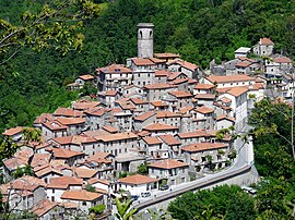
 Panorama of Minucciano |
||
Minucciano is an Italian municipality with 1918 inhabitants (as of December 31, 2019) in the province of Lucca in Tuscany .
geography
Minucciano is located around 45 km northwest of the provincial capital Lucca and 90 km northwest of the regional capital Florence in the upper Garfagnana mountains to the right of the Serchio on the border with the province of Massa-Carrara . The highest mountain in Tuscany, Monte Pisanino, is located in the municipality . Parts of the municipality belong to the National Park of the Apuan Alps . The place is in the climatic classification of Italian municipalities in zone F, 3 112 GG. Important bodies of water in the municipality are the Torrenti Acqua Bianca (8 of 12 km in the municipality) and Serchio di Gramolazzo (every 8 km in the municipality).
The districts include Agliano, Albiano, Antognano, Canepaia, Carpinelli, Castagnola, Foresto, Gorfigliano, Gramolazzo, Metra, Pieve San Lorenzo, Pugliano, Sermezzana and Verrucolette.
The neighboring municipalities are Camporgiano , Casola in Lunigiana ( MS ), Fivizzano (MS), Massa (MS), Piazza al Serchio , Sillano Giuncugnano and Vagli Sotto .
history
The main town of Minucciano emerged from a medieval fortress, of which a tower and parts of the wall are still preserved today.
Attractions
- Pieve di San Lorenzo , Pieve in the Pieve San Lorenzo district
- Chiesa di San Jacopo , church in Pugliano
- Chiesa dei Santi Simone e Giuda , church in the Castagnola district
- Eremo della Beata Vergine del Soccorso , hermitage just outside the town center
economy
The most important industry today is marble quarrying , which has existed on a larger scale since the 20th century. Before that, agriculture was mainly done.
literature
- Emanuele Repetti: MINUCCIANO in Garfagnana (Minuccianum) sul principio della Valle del Serchio. In: Dizionario Geografico Fisico Storico della Toscana (1833–1846), online edition of the University of Siena (PDF, ital.)
Web links
- Official website of the Municipality of Minucciano (Italian)
- Minucciano at visittuscany.com (Italian)
Individual evidence
- ↑ Statistiche demografiche ISTAT. Monthly population statistics of the Istituto Nazionale di Statistica , as of December 31 of 2019.
- ↑ Website of the Agenzia nazionale per le nuove tecnologie, l'energia e lo sviluppo economico sostenibile (ENEA) , accessed on March 16, 2016 (Italian) (PDF; 330 kB)
- ↑ Official website of the Sistema Informativo Ambientale della Regione Toscana (SIRA) on the rivers in Minucciano , accessed on March 16, 2016 (Italian)


