Schlichtes Moor nature reserve
Coordinates: 53 ° 48 ′ 35.1 ″ N , 12 ° 21 ′ 20.1 ″ E
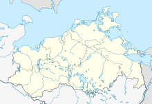
The Schlichtes Moor nature reserve is a 56 hectare nature reserve in Mecklenburg.
location
It is located 1 km west of the village of Schlieffenberg in the middle of a deciduous forest complex. It was placed under protection on August 22, 1976 with an extension in 1982 and the aim is to protect one of the few remaining boiler bogs in the country. The state of the area is considered to be very good, as the Kesselmoor has an optimal water supply. The nature reserve may not be entered. Large parts of the nature reserve are part of the FFH area Nebeltal with tributaries, connected lakes and adjacent forests .
History and water balance
The protected area areas were created as excavation during the last Ice Age . The surrounding area is the Schlieffenberger Oszug to the east and a compression moraine to the north in the shadow of a former nunatak near Schmooksberg . The excavated hollow shape represents a 20 meter deep Osbegleitgraben. Today's protected area consists of two largely separate basins: the Schlichten Moor to the north and the Black Lake to the south . The two open lakes without drainage silted up in the following millennia and the surrounding mineral soil became forested.
The Schlichte Moor bears the name Bad Moor on old land maps , which points to the original Low German origin of the name, as it had a low utility value due to the high water content of the peat. As a boiler bog, it is also fed by mineral ground water.
In Wiebeking's map from 1786, the moor areas are free from forests and without drainage. Only in the east of the area are coppice-like stands. It was a beech coppice that is still recognizable today and is interspersed with individual oaks. The areas are currently not used, as the moor areas are not allowed to be entered. The surrounding forest areas are used for forestry.
Flora and fauna
The center of the protected area, the actual 100 by 300 meter plain moor , is an unforested moor area with the typical high moor plant species mud sedge , round-leaved and long-leaved sundew , white beak reed , narrow-leaved cotton grass and swamp pore . It has a very vital peat moss vegetation . The dominant species is Sphagnum recurvum . The thickness of the peat reaches 19 meters in places, making the plain moor one of the deepest boiler moorlands in Mecklenburg-Western Pomerania.
The Black Lake is a dystrophic silting body of water. Marsh lobe fern , marsh calla and sedges grow on the banks . An alder and willow belt joins inland . Acidic mixed oak and beech forest grows on the surrounding areas. The crane breeds in the area.
literature
- Plain bog 114 . In: Ministry of Environment Mecklenburg-Western Pomerania (Hrsg.): The nature reserves in Mecklenburg-Western Pomerania . Demmler-Verlag, Schwerin 2003, ISBN 3-910150-52-7 , p. 286 f .
Web links
- Map portal environment MV with geodata, u. a. Protected area border
- Presentation of the protected area supervisors
- Area presentation on the side of the Nature Conservation Association MV


