Binsenbrink nature reserve in Teterower See
|
Binsenbrink nature reserve in Teterower See
|
||
|
The Sauerwerder peninsula is located in the nature reserve |
||
| location | Northeast of Teterow in Mecklenburg County Rostock | |
| surface | 74 ha | |
| Identifier | LU MV 2 (PDF; 217 kB) | |
| WDPA ID | 162424 | |
| Geographical location | 53 ° 47 ' N , 12 ° 35' E | |
|
|
||
| Sea level | from 0 m to 3 m | |
| Setup date | December 19, 1931 | |
| administration | LUNG | |
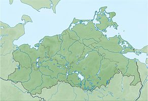
The Binsenbrink nature reserve in Teterower See is a 70 hectare nature reserve in Mecklenburg-Western Pomerania . It is located half a kilometer north of the city of Teterow and serves to protect and preserve a Seerandmoor and the shores of the Teterower See with the Sauerwerder peninsula as a habitat for rare bird species.
The legal protection took place on December 19, 1931, covered 120 hectares and also contained the northeastern peninsula Schnakenlang and the castle wall island. Legal changes were made in 1941 (expansion) and 1963 (reduction).
The current state of the area is rated as satisfactory. In addition to the exposure to high nutrient inputs in the past, anglers and boaters penetrate the reed belt and disturb the breeding birds.
The path to Burgwallinsel leads through the area. The Naturschutzbund Deutschland has a station on the Sauerwerder peninsula. The castle wall island on the edge of the protected area can be reached by ferry.
history
The nature reserve was created during the last ice age . The glacier excavated the Teterow Basin from surrounding terminal moraine trains that tower up to 100 meters . After the ice thawed, a lake remained and silted up. Lake marl encamped, and Vermoorung with throughflow and silting bogs began, which today up to three meters mighty peat led.
One kilometer to the northwest there is a Neolithic megalithic grave .
Modern settlement has been documented since the 6th century. The word Brink goes back to the Germanic meaning as bank. Zirzipans settled on the castle wall island to the east and formed the nucleus for the development of the city of Teterow. The water level of the lake has been regulated at different levels since the 13th century. Owners of watermills and farmers led intense disputes about it. The Wiebekingsche map from 1786 shows the areas with a high water level. Today's Sauerwerder peninsula was still an island. From 1860 the water level was lowered to the current level. The areas were used as grassland and peat was extracted. During the GDR era, the lake eutrophied through sewage from the Teterow slaughterhouse.
Flora and fauna
Stocks of pond roses can be found in sheltered areas. Common pond sedge , narrow-leaved cattails and reeds form extensive reeds. On the land side, swamp forests adjoin . 64 breeding species are detected for the area including Blaukehlchen , Beutelmeise , Grebe , Black Milan , Kingfisher , Drosselrohrsänger , bittern and bittern , warbler , Bekassine , Coot and Löffelente . The black-headed gull breeds in a colony. The otter lives in the area.
literature
- Binsenbrink in Teterower See 2 . In: Ministry of Environment Mecklenburg-Western Pomerania (Hrsg.): The nature reserves in Mecklenburg-Western Pomerania . Demmler-Verlag, Schwerin 2003, ISBN 3-910150-52-7 , p. 334 f .
Web links
Individual evidence
- ↑ Großdolmen north of Teterow ( Memento from April 30, 2011 in the Internet Archive )


