Lower Warnowland nature reserve
|
Lower Warnowland nature reserve
|
||
|
View from the Pölchow train station |
||
| location | North of Schwaan in Mecklenburg County Rostock | |
| surface | 1163 ha | |
| Identifier | LU MV 224 (PDF; 217 kB) | |
| WDPA ID | 319248 | |
| FFH area | 1163 ha | |
| Bird sanctuary | 1163 ha | |
| Geographical location | 54 ° 2 ' N , 12 ° 8' E | |
|
|
||
| Sea level | from -2 m to 7 m | |
| Setup date | September 28, 1990 | |
| administration | LUNG | |
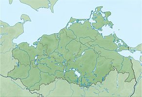
The Lower Warnowland nature reserve is a 1163 hectare nature reserve in Mecklenburg-Western Pomerania . It includes the lower Warnow course north of Schwaan to the confluence with the Unterwarnow . The nature reserve was designated on September 28, 1990 and expanded in 2001. The protection goal is the preservation of a river valley moor landscape with wet meadows, moor forests and sedges.
The state of the area is considered to be good. Disturbances arise from fishing and boat tourism. The grassland areas are still partially damaged by previous upheavals and drainage measures. Numerous overland paths provide insight into the protected area. The Warnow is navigable by boat. The areas are owned by the Foundation for Nature and Environmental Protection Mecklenburg-Vorpommern.
According to EU law, the nature reserve is designated as part of the FFH area Warnowtal with small tributaries and the bird sanctuary Warnowtal, Sternberger Seen and lower Mildenitz .
history
The Warnow was created over 10,000 years ago through a crevice in the glacier ice from the last glaciation and meltwater that formed. After the iron had thawed, the slowly flowing river initially became muddy with a layer of mud up to 10 meters thick and then extensive fens formed , which in the area of today's nature reserve are up to 750 meters wide, with a peat thickness of up to 3 meters.
Human settlement in the area has been documented since the Bronze Age. There were settlements of the Slavs on fen sites since the 12th century and the edge areas of the Warnow valley were grazed. The Slavic castle Kessin was important . The first drainage began in the 16th century to increase the use of grassland and to create small peat pits. The management of the more humid grassland areas was discontinued after 1990. The lower course of the Warnow serves the city of Rostock to produce drinking water.
Flora and fauna
Trollius , broad-leaved orchid , meadow knotweed and sedges grow on the wet meadows . The river course lined with bushes breakage and laurel willow and gray alder . Lean lawns can be found in places on the valley slopes. Particularly noteworthy breeding birds are corncrake , spotted rail , common snipe as well as bluethroat , whorl and bag tit . The river is a habitat for river lamprey and sea trout .
The otter lives in the area. Since 2018, beavers have been sighted several times , which have also built a building and left feeding marks in the vicinity.
literature
- Lower Warnowland 224 . In: Ministry of Environment Mecklenburg-Western Pomerania (Hrsg.): The nature reserves in Mecklenburg-Western Pomerania . Demmler-Verlag, Schwerin 2003, ISBN 3-910150-52-7 , p. 304 f .
Web links
- NSG regulation
- Map portal environment of the State Office for the Environment, Nature Conservation and Geology Mecklenburg-Western Pomerania ( information ) with geodata
Individual evidence
- ↑ Foundation-owned areas (number 62)
- ↑ Standard data sheet FFH area Warnowtal with small tributaries (PDF; 72 kB)
- ↑ Standard data sheet EU bird sanctuary Warnowtal, Sternberger Seen and lower Mildenitz (PDF)
- ↑ Gragetopshof double grave in the KLEKS


