Riedensee nature reserve
Coordinates: 54 ° 8 ′ 59.8 ″ N , 11 ° 40 ′ 49.4 ″ E
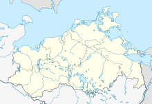
The Riedensee nature reserve is a 90 hectare nature reserve in Mecklenburg-Western Pomerania and is located one kilometer north of Kägsdorf . The designation took place on July 7, 1993 and aims to preserve the last remaining and largely intact beach lake as a refuge for specialized animal and plant species. The state of the area is only rated as satisfactory. Nutrient inputs from surrounding agricultural areas, disturbed hydrological conditions and the high number of visitors by beach holidaymakers in summer lead to impairments.
The area can be seen from the surrounding paths. The beach can be entered.
History and water balance
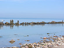
The Riedensee was created after the last Ice Age as a flat hollow in a ground moraine . With the melting of the glacier, up to five meters thick meltwater sands were deposited. The rise in sea level in the Littorina transgression led to permanent flooding and a beach lake was created that was integrated into the compensation coast. The lake was separated from the Baltic Sea by a beach wall and was only flooded in the event of storms and associated flooding. The shallower areas of the lake are moored with sedges and reeds influenced by salt water, as well as broken forest . Due to the decline in the coast over the past millennia, these peat peats, which are up to five meters thick, are currently visible in the beach area.
The Wiebekingsche map from 1786 shows the lower-lying areas as a meadow and tube advertising space and the higher areas for grazing. In order to be able to use the land better, drainage ditches were dug in the 20th century, which drained to the Baltic Sea via a sewer flap. In the 1930s, the Wehrmacht used the dune and beach area as part of the military training area west of Kühlungsborn . In the 1960s, the National People's Army continued this use and built new facilities, the remains of which can still be seen today. Dikes were made in the agriculturally usable part of today's protected area. Two pumping stations drained the area. During the storm flood on November 4, 1995, the areas were completely flooded. Then the dikes were opened, the pumping stations dismantled and extensive grassland use was introduced. The catchment area of the Riedensee continues to be used intensively for agriculture.
Flora and fauna
The Riedensee is of Meersalde and pondweed settled, forming the flat lawns. Brackish reeds can be found on the shores of the lake . The lake is surrounded by species-rich salt marshes with rushes of salt , ornamental centaury , nodding dandelions and beach tridents . The breakthrough points to the Baltic Sea are heavily exposed to the water that forms, so that new pioneer sites are often created. This is where highly specialized salt-loving species such as the coastal algae beetle Bembidion pallidipenne find their habitat . Towards the Baltic Sea there are white dunes with beach grass . Numerous birds such as gray herons , limicoles , seagulls and terns rest in the reserve in spring and autumn. Notable breeding birds are ringed plover , lapwing , snipe , redshank and bearded tit .
literature
- Riedensee 271 . In: Ministry of Environment Mecklenburg-Western Pomerania (Hrsg.): The nature reserves in Mecklenburg-Western Pomerania . Demmler-Verlag, Schwerin 2003, ISBN 3-910150-52-7 , p. 76 f .


