Neuses (Wendelstein)
|
News
Wendelstein market
Coordinates: 49 ° 20 ′ 6 ″ N , 11 ° 5 ′ 19 ″ E
|
|
|---|---|
| Height : | 325 (318-330) m above sea level NHN |
| Residents : | 311 (2014) |
| Postal code : | 90530 |
| Area code : | 09122 |
|
Neuses through-town
|
|
Neuses is a district of the Wendelstein market in the Roth district of Central Franconia .
Geographical location
The village is about 13 kilometers south of Nuremberg and five kilometers east of Schwabach on the state road 2239 between Kleinschwarzenlohe and Penzendorf an der Schwarzach . This crosses under the Main-Danube Canal in the west of the village and flows into the Rednitz on the northwestern edge of the municipality near Schwabach . The Vogelherd corridor area is to the north, the Grund and Espan corridor areas to the northeast and Hohenrain to the east.
The state road 2239 leading to Kleinschwarzenlohe (2.2 km north-east) and a ramp onto this highway-like -developed national road 2 (km southwest 1.3) containing 1 km further north on the motorway A 6 flows ( AS 57 Roth).
history
The Schwarzachtal was already settled by people in the Stone Age, as individual finds show. Some Bronze Age graves are only a few kilometers upstream. These date from around 1600 to 1300 BC. In the municipality of Wendelsteins around 20 ground monuments from the Mesolithic , Neolithic and Latène times have been qualified. At the turn of the century, the entire Regnitz river system was considered to be the area where the Narisker rivers (see map 1). Around the year 650, Boirian settlers advanced into the Schwarzachtal from the southeast, but were pushed back again by the Franks coming from the west around 725 .
The place was first mentioned in 1299 as "Newsezze". The place originally consisted of a mill and five farms. The Ebrach monastery originally had a farm there, but it was sold in 1302. However, it can be assumed that rural settlement was much earlier, as the neighboring towns of Schwabach in 1117 and Königshammer in 1200 were already mentioned in a document. Neuses lies on their straight line connection and without already settled farmers there would have been no taproom or mill.
From 1505 to 1806 Neuses was one of the border towns between the Principality of Ansbach and the area of the imperial city of Nuremberg (see map 2).
Towards the end of the 18th century there were 10 properties and a community shepherd's house in Neuses. The high court north of the Schwarzach exercised the Brandenburg-Ansbach judgeship Kornburg , south of the Schwarzach the judgeship Schwand . The village and township government had the imperial city of Nuremberg held. All properties had Nuremberg owners as landlords ( von Holzschuher : 2 whole courtyards, 1 whole courtyard with tavern , 1 three-quarter courtyard, 1 half courtyard , 1 Köblergut , 1 Gütlein; von Praun : 2 Gütlein, 1 grinding mill). In 1801 there were still 10 properties in the village.
As part of the community edict , in 1808 Neuses was assigned to the Großschwarzenlohe tax district , II. Section. It belonged to the rural community Kleinschwarzenlohe formed in 1818 .
The historic mill has been expanded and reshaped several times and has been family-owned since 1880, according to the operators. Milling still takes place, but no longer with a classic mill wheel. Instead, the hydropower is used to generate electricity using two fish-friendly Kaplan turbines . A mill shop is also operated.
On May 1, 1978 Neuses was incorporated into Wendelstein as part of the regional reform in Bavaria .
Architectural monuments
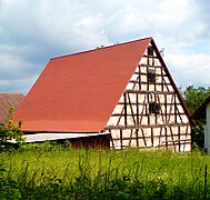
- At the mill 5: associated half-timbered barn
- Hembacher Weg 4: Associated half-timbered barn
- Penzendorfer Str .: parish hall
- Penzendorfer Str. 1: Former farmhouse
- Penzendorfer Str. 2: Gasthaus Weißes Roß
- Schäferstrasse 1: Associated half-timbered barn
Population development
| year | 1818 | 1840 | 1861 | 1871 | 1885 | 1900 | 1925 | 1950 | 1961 | 1970 | 1987 | 2014 |
|---|---|---|---|---|---|---|---|---|---|---|---|---|
| Residents | 87 | 95 | 105 | 84 | 109 | 87 | 86 | 136 | 119 | 110 | 240 | 311 |
| Houses | 15th | 14th | 15th | 15th | 15th | 21st | 24 | 65 | ||||
| source |
religion
Since the Reformation the place has been predominantly Evangelical-Lutheran. The residents of the Evangelical Lutheran denomination north of the Schwarzach were originally parish according to Our Lady (Katzwang) , the residents south of the Schwarzach were parish in the town church of St. Johannes and St. Martin (Schwabach) . Today the entire place belongs to the parish of St. Nikolaus (Kornburg) .
Events
The annual mill festival takes place on Whit Monday. The local volunteer fire brigade organizes a summer party; Kirchweih is celebrated every September .
Others
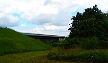
The Rhine-Main-Danube Canal runs directly to the west of Neuses and spans the lower reaches of the Schwarzach and State Road 2239 with an imposing 219 meter long steel trough bridge. In 1979, before the complete completion of the canal, which had already been flooded in this section, a dam broke in the neighboring village of Katzwang, 4 km to the north . In less than three hours, all ran attitude , and taught at extensive devastation. There was one fatality and several injuries. After repairs and structural improvements, the sewer went into (bagging) operation in this section in 1987, initially as far as Lände Roth . It has been passable from the Main to the Danube since 1992. Since 2008, the canal and the Schwarzach in Neuses have been connected to a flood relief power plant that can generate up to 550 kW of electrical energy.
To the west, right next to the canal, runs a municipal road that connects State Road 2239 with State Road 2407 , a former service route. In the past, huge deposits of building sand were mined there. The exploited sand pits were used as residual and household garbage dumps from 1950 to 1975 and were backfilled. During the construction phase of the Main-Danube Canal, the landfills were closed, sealed and covered with excavated canals. The area was then partially renatured . Today, building rubble is mainly recycled there. However, there are occasional unpleasant smells from residents right up to neighboring towns if landfill gas escapes or if one of the landfills has to be opened for control purposes.
Local public transport
A local public transport stop , via which Schwabach, Wendelstein and Feucht can be reached, is served by a bus line on weekdays. There is no public transport connection on Saturdays, Sundays and public holidays.
photos
literature
- Johann Kaspar Bundschuh : New . In: Geographical Statistical-Topographical Lexicon of Franconia . tape 3 : I-Ne . Verlag der Stettinische Buchhandlung, Ulm 1801, DNB 790364301 , OCLC 833753092 , Sp. 775 ( digitized version ).
- Friedrich Eigler : Schwabach (= Historical Atlas of Bavaria, part of Franconia . I, 28). Michael Laßleben, Kallmünz 1990, ISBN 3-7696-9941-6 , p. 408, 475-476 .
- Willi Ulsamer (Ed.): 100 Years of the Schwabach District (1862–1962). A home book . Schwabach 1964, DNB 984880232 , p. 352 .
Web links
- Neuses on the website wendelstein.de
- New items in the location database of the Bayerische Landesbibliothek Online . Bavarian State Library
- New items in the Topographia Franconiae of the University of Würzburg , accessed on September 24, 2019.
- New in the historical directory of the Association for Computer Genealogy
Individual evidence
- ↑ Neuses in the Bavaria Atlas
- ↑ Wendelstein Monument List, pages 20–22.
- ^ So F. Eigler, p. 314. According to Neuses on the website wendelstein.de first mentioned in 1435.
- ↑ a b F. Eigler, p. 408.
- ↑ JK Bundschuh, Vol. 3, Col. 775.
- ↑ a b F. Eigler, p. 475f.
- ^ Description of the mill in Neuses
- ↑ Only inhabited houses are given. In 1818 these were designated as fireplaces , in 1840 as houses , and from 1871 to 1987 as residential buildings.
- ↑ Alphabetical index of all the localities contained in the Rezatkkreis according to its constitution by the newest organization: with indication of a. the tax districts, b. Judicial Districts, c. Rent offices in which they are located, then several other statistical notes . Ansbach 1818, p. 63 ( digitized version ).
- ↑ Eduard Vetter (Ed.): Statistical handbook and address book of Middle Franconia in the Kingdom of Bavaria . Self-published, Ansbach 1846, p. 236 ( digitized version ).
- ^ Joseph Heyberger, Chr. Schmitt, v. Wachter: Topographical-statistical manual of the Kingdom of Bavaria with an alphabetical local dictionary . In: K. Bayer. Statistical Bureau (Ed.): Bavaria. Regional and folklore of the Kingdom of Bavaria . tape 5 . Literary and artistic establishment of the JG Cotta'schen Buchhandlung, Munich 1867, Sp. 1086 , urn : nbn: de: bvb: 12-bsb10374496-4 ( digitized ).
- ↑ Kgl. Statistical Bureau (ed.): Complete list of localities of the Kingdom of Bavaria. According to districts, administrative districts, court districts and municipalities, including parish, school and post office affiliation ... with an alphabetical general register containing the population according to the results of the census of December 1, 1875 . Adolf Ackermann, Munich 1877, 2nd section (population figures from 1871, cattle figures from 1873), Sp. 1252 , urn : nbn: de: bvb: 12-bsb00052489-4 ( digitized ).
- ↑ K. Bayer. Statistical Bureau (Ed.): Localities directory of the Kingdom of Bavaria. According to government districts, administrative districts, ... then with an alphabetical register of locations, including the property and the responsible administrative district for each location. LIV. Issue of the contributions to the statistics of the Kingdom of Bavaria. Munich 1888, Section III, Sp. 1187 ( digitized version ).
- ↑ K. Bayer. Statistical Bureau (Ed.): Directory of localities of the Kingdom of Bavaria, with alphabetical register of places . LXV. Issue of the contributions to the statistics of the Kingdom of Bavaria. Munich 1904, Section II, Sp. 1260 ( digitized version ).
- ↑ Bavarian State Statistical Office (ed.): Localities directory for the Free State of Bavaria according to the census of June 16, 1925 and the territorial status of January 1, 1928 . Issue 109 of the articles on Bavaria's statistics. Munich 1928, Section II, Sp. 1297 ( digitized version ).
- ↑ Bavarian State Statistical Office (ed.): Official place directory for Bavaria - edited on the basis of the census of September 13, 1950 . Issue 169 of the articles on Bavaria's statistics. Munich 1952, DNB 453660975 , Section II, Sp. 1125 ( digitized version ).
- ↑ Bavarian State Statistical Office (ed.): Official city directory for Bavaria, territorial status on October 1, 1964 with statistical information from the 1961 census . Issue 260 of the articles on Bavaria's statistics. Munich 1964, DNB 453660959 , Section II, Sp. 824 ( digitized version ).
- ^ Bavarian State Statistical Office (ed.): Official place directory for Bavaria . Issue 335 of the articles on Bavaria's statistics. Munich 1973, DNB 740801384 , p. 180 ( digitized version ).
- ↑ Bavarian State Office for Statistics and Data Processing (Ed.): Official local directory for Bavaria, territorial status: May 25, 1987 . Issue 450 of the articles on Bavaria's statistics. Munich November 1991, DNB 94240937X , p. 349 ( digitized version ).
- ↑ W. Eigler, p. 311.
- ↑ Pictures of the dam breach in Katzwang 1979
- ↑ Illustrated report on the Wendelstein hydropower plant ( Memento of the original from January 7, 2015 in the Internet Archive ) Info: The archive link was automatically inserted and not yet checked. Please check the original and archive link according to the instructions and then remove this notice. (PDF file)


