
Waidmannsfeld
|
Waidmannsfeld
|
||
|---|---|---|
| coat of arms | Austria map | |
 |
|
|
| Basic data | ||
| Country: | Austria | |
| State : | Lower Austria | |
| Political District : | Wiener Neustadt-Land | |
| License plate : | WB | |
| Surface: | 21.47 km² | |
| Coordinates : | 47 ° 52 ' N , 15 ° 59' E | |
| Height : | 495 m above sea level A. | |
| Residents : | 1,499 (January 1, 2020) | |
| Population density : | 70 inhabitants per km² | |
| Postcodes : | 2761, 2763 | |
| Area code : | 02632 | |
| Community code : | 3 23 31 | |
| NUTS region | AT122 | |
| Address of the municipal administration: |
Schulstrasse 20 2763 Waidmannsfeld |
|
| Website: | ||
| politics | ||
| Mayor : | Andreas Knabel ( SPÖ ) | |
|
Municipal Council : ( 2020 ) (19 members) |
||
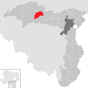
| Location of Waidmannsfeld in the Wiener Neustadt-Land district | ||
  |
||
| Source: Municipal data from Statistics Austria | ||

Waidmannsfeld is a municipality with 1499 inhabitants (as of January 1, 2020) in the Wiener Neustadt-Land district in Lower Austria .
geography
The municipality of Waidmannsfeld stretches from the valley of the Waidmannsbach (a right tributary of the Piesting ) to the Kitzberg and the Neukogel to the Neusiedl district and the Rotte Ortmann (SCA paper mill) in the industrial district in Lower Austria. The area of the municipality covers 21.38 square kilometers. 77.9 percent of the area is forested.
Community structure
The municipality includes the following three localities (population in brackets as of January 1, 2020):
- Neusiedl (1086)
- Schallhof (25)
- Waidmannsfeld (388)
The community consists of the cadastral communities Neusiedl bei Pernitz and Waidmannsfeld.
Neighboring communities
The neighboring communities of Waidmannsfeld are Gutenstein , Miesenbach , Pernitz and Waldegg , which also belong to the Wiener Neustadt-Land district .
history
Before the birth of Christ, the area was part of the Celtic Kingdom of Noricum and belonged to the surroundings of the Celtic hill settlement Burg on the Schwarzenbacher Burgberg , which was the main town for the entire north-east Noricum .
Later under the Romans, today's Waidmannsfeld was then in the province of Pannonia .
Population development

religion
According to the data of the 2001 census , 72.9% of the population are Roman Catholic and 3.5% Protestant . 4.4% are Muslims , 1.2% belong to Orthodox churches . 16.1% of the population have no religious denomination.
politics
The municipal council has 19 members.
- With the municipal council elections in Lower Austria 2010 , the municipal council had the following distribution: 12 SPÖ, 4 ÖVP, 3 citizens' list "We".
- With the municipal council elections in Lower Austria in 2015 , the municipal council had the following distribution: 15 SPÖ, 3 Team Weißenberger, and 1 FPÖ.
- With the municipal council elections in Lower Austria 2020 , the municipal council has the following distribution: 16 SPÖ and 3 ÖVP.
- mayor
- until 1945 Adalbert Winkler
- 1945/1946 Anton Pospisek (KPÖ)
- 1946–1970 Franz Cibulka (SPÖ)
- 1970–1980 Anton Kadluba (SPÖ)
- 1980–1990 Franz Knabel (SPÖ)
- 1990-2006 Josef Stadler (SPÖ)
- 2006–2015 Kurt Cykel (SPÖ)
- since 2015 Andreas Knabel (list SPÖ)
Culture and sights
economy
In 2001 there were 51 non-agricultural workplaces, and according to the 1999 survey there were 34 in agriculture and forestry. According to the 2001 census, the number of people in employment at home was 790. The 2001 employment rate was 45.04 percent.
Personalities
- Michaela Dorfmeister (* 1973), ski racer and two-time Olympic champion
- Josef Reixenartner (1928–1988), member of the state parliament and councilor (SPÖ)
- Franz Rottensteiner (* 1942), publicist and critic
- Franz Schönthaler (1821–1904), former kuk court sculptor, born in the Neusiedl district
Web links
- 32331 - Waidmannsfeld. Community data, Statistics Austria .
Individual evidence
- ↑ Statistics Austria: Population on January 1st, 2020 by locality (area status on January 1st, 2020) , ( CSV )
- ↑ Results of the municipal council election 2020 in Waidmannsfeld. Office of the Lower Austrian state government, January 26, 2020, accessed on February 9, 2020 .
- ^ Josef Stadler: Waidmannsfeld . In: The Lower Austrian district of Wiener Neustadt and its communities . 2nd Edition. Lower Austria. Verlag GesmbH, Wiener Neustadt 1996, p. 213 .

Bad Erlach | Bad Fischau-Brunn | Bad Schönau | Bromberg | Ebenfurth | Eggendorf | Felixdorf | Gutenstein | Hochneukirchen-Gschaidt | Hochwolkersdorf | High wall | Hollenthon | Katzelsdorf | Kirchschlag in the Bucklige Welt | Krumbach | Lanzenkirchen | Lichtenegg | Lichtenwörth | Market Piesting | Matzendorf-Hölles | Miesenbach | Muggendorf | Pernitz | Pipe in the mountains | Schwarzenbach | Sollenau | Theresienfeld | Waidmannsfeld | Waldegg | Walpersbach | Weikersdorf am Steinfelde | Wiesmath | Winzendorf-Muthmannsdorf | Wöllersdorf-Steinabrückl | Zillingdorf
Cadastral communities: Neusiedl bei Pernitz | Waidmannsfeld
Locations: Neusiedl | Schallhof | Waidmannsfeld
Villages: Neusiedl | Waidmannsfeld Group of houses: Ortmann Rotte: Schallhof | Quarb Scattered Houses: Kitzberg | Waidmannsbach
Counting area: Waidmannsfeld | Neusiedl-Ortmann