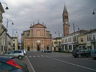
Occhiobello
| Occhiobello | ||
|---|---|---|

|
|
|
| Country | Italy | |
| region | Veneto | |
| province | Rovigo (RO) | |
| Local name | Ug'bèl | |
| Coordinates | 44 ° 55 ' N , 11 ° 35' E | |
| height | 8 m slm | |
| surface | 32.62 km² | |
| Residents | 12,092 (Dec. 31, 2019) | |
| Population density | 371 inhabitants / km² | |
| Post Code | 45030 | |
| prefix | 0425 | |
| ISTAT number | 029033 | |
| Popular name | Occhiobellesi | |
| Patron saint | Lawrence of Rome | |
| Website | Occhiobello | |
Occhiobello is an Italian municipality ( comune ) with 12,092 inhabitants (as of December 31, 2019) in the province of Rovigo in Veneto . The municipality is located about 23 kilometers southwest of Rovigo and about 10 kilometers northwest of Ferrara on the Po . Occhiobello borders directly on the province of Ferrara .
history
The municipality lies on the edge of the Polesine , a swampy area that extends over the entire Po Delta to Castelnuovo Bariano inland . The close location on the Po was always associated with the threat of flooding. Furthermore, the place is opposite Ferrara or its Vorwerk Pontelagoscuro (a district of Ferrara with around 6,000 inhabitants today). This explains the influence of the rule of Ferrara in the Middle Ages.
Parish partnership
Occhiobello maintains a partnership with the French community of Mennecy in the Essonne department and the city of Renningen in Baden-Württemberg .
traffic
Occhiobello is crossed by the A13 autostrada from Bologna to Padua . There is a motorway connection in the district of San Gaetano . The Occhiobellos station is on the Padua – Bologna railway line. The Strada Statale 16 Adriatica also leads through the village .
Web links
Individual evidence
- ↑ Statistiche demografiche ISTAT. Monthly population statistics of the Istituto Nazionale di Statistica , as of December 31 of 2019.


