
Olga (Primorye)
| Urban-type settlement
Olga
Ольга
|
||||||||||||||||||||||||||||||||
|
||||||||||||||||||||||||||||||||
|
||||||||||||||||||||||||||||||||
.png)


Olga ( Russian Ольга ) is an urban-type settlement in the Primorye Territory in Russia with 4026 inhabitants (as of October 14, 2010).
geography
The place is about 280 km as the crow flies east of the regional administration center Vladivostok on the Olga Bay of the Sea of Japan , at the confluence of the Olga river of the same name.
Olga is the administrative center of the Rajons Olginski and seat of the municipality Olginskoje gorodskoje posselenije, also heard the good 12 km to the north village Serafimowka to.

Olga harbor on the Olga Bay

River and settlement of Olga
Local museum

Church in Olga

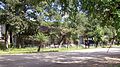
Stele at the entrance to Olga


history
The place goes back to a military post established in 1858, the year the region was occupied by the Russian Empire as a result of the Treaty of Aigun . The bay was named after Saint Olga in 1857 from the later Admiral Nikolai Tschichachev , who, as commander of Corvette America, mapped the coast.
On January 4, 1926, Olga became the administrative seat of a Rajons named after him, and since July 4, 1945 it has had the status of an urban-type settlement.
Population development
| year | Residents |
|---|---|
| 1939 | 2949 |
| 1959 | 3377 |
| 1970 | 3349 |
| 1979 | 4435 |
| 1989 | 4802 |
| 2002 | 4453 |
| 2010 | 4026 |
Note: census data
traffic
The settlement is on the regional road 05N-131 (formerly R447) which km in the well 320 remote Nachodka begins through the southwest adjacent Rajonzentrum Laso leads and well 80 km north of Olga at kavalerovo the 05N-100 (formerly A181) is reached, the Ossinowka in Ussuriysk about Arsenyev with Dalnegorsk and Rudnaja pristane connects. Olga owns a seaport .
Web links
Individual evidence
- ↑ a b Itogi Vserossijskoj perepisi naselenija 2010 goda. Tom 1. Čislennostʹ i razmeščenie naselenija (Results of the All-Russian Census 2010. Volume 1. Number and distribution of the population). Tables 5 , pp. 12-209; 11 , pp. 312–979 (download from the website of the Federal Service for State Statistics of the Russian Federation)
| Cities |
Arsenyev S | Artyom S | Bolshoi Kamen S / G | Dalnegorsk S | Dalnerechensk S / R | Fokino S / G | Lessosavodsk S | Nachodka S | Partisansk S | Spassk-Dalni S / R | Ussuriysk S | Vladivostok S. |
|
| Urban-type settlements |
Chassan | Khrustalny | Dunai G | Gornoretschensky | Gorny | Gornye Klyuchi | Yaroslavsky | Kawalerowo R | Kirowski R | Kraskino | Lipowzy | Lutschegorsk R | Novoshakhtinsky | Olga R | Plastun | Pogranichny R | Possjet | Preobraschenije | Primorsky | Putyatin G | Sarubino | Zhkotovo | Sibirzewo | Slavyanka R | Smolyaninovo R | Svetlaja | Ternei R | Vostok |
|
| Other Rajon centers |
Anuchino | Chorol | Yakovlevka | Kamen-Rybolov | Laso | Mikhailovka | Novopokrovka | Pokrovka | Chernigovka | Chuguevka | Vladimiro-Alexandrovskoye | Wolno-Nadeschdinskoje |