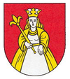
Pata (Slovakia)
| Pata | ||
|---|---|---|
| coat of arms | map | |

|
|
|
| Basic data | ||
| State : | Slovakia | |
| Kraj : | Trnavský kraj | |
| Okres : | Galanta | |
| Region : | Dolné Považie | |
| Area : | 17.549 km² | |
| Residents : | 3,174 (Dec. 31, 2019) | |
| Population density : | 181 inhabitants per km² | |
| Height : | 139 m nm | |
| Postal code : | 925 53 | |
| Telephone code : | 0 31 | |
| Geographic location : | 48 ° 16 ' N , 17 ° 50' E | |
| License plate : | GA | |
| Kód obce : | 503959 | |
| structure | ||
| Community type : | local community | |
| Administration (as of November 2018) | ||
| Mayor : | Jozef Berčík | |
| Address: | Obecný úrad Pata Hlohovecká 103 92553 Pata |
|
| Website: | www.obecpata.sk | |
| Statistics information on statistics.sk | ||
Pata (Hungarian Vágpatta - until 1907 Patta ) is a municipality in Okres Galanta within Trnavský kraj in Slovakia .
The place is located in the Danube lowlands in the vast Waagal valley on the Jarčie river at an altitude of 139 m nm Pata is about halfway between Trnava (26 km to the west) and Nitra (25 km to the east)
The place was first mentioned as Pta in 1156 and was a royal property. Since the 15th century it was part of the Schintau estate . The place was predominantly agricultural, in addition, some residents dealt with viticulture and weaving. During the revolution of 1848/49 there was a battle between the imperial army and Hungarian Honvéden.
In 1923 the Hungarian table tennis player Ferenc Sidó was born here.
Web links
Commons : Pata - collection of images, videos and audio files

