Tomášikovo
| Tomášikovo / Tallós | ||
|---|---|---|
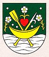
| coat of arms | map | |

|
|
|
| Basic data | ||
| State : | Slovakia | |
| Kraj : | Trnavský kraj | |
| Okres : | Galanta | |
| Region : | Dolné Považie | |
| Area : | 21.135 km² | |
| Residents : | 1,687 (Dec. 31, 2019) | |
| Population density : | 80 inhabitants per km² | |
| Height : | 114 m nm | |
| Postal code : | 925 04 | |
| Telephone code : | 0 31 | |
| Geographic location : | 48 ° 5 ' N , 17 ° 42' E | |
| License plate : | GA | |
| Kód obce : | 504076 | |
| structure | ||
| Community type : | local community | |
| Administration (as of November 2018) | ||
| Mayor : | Zoltán Horváth | |
| Address: | Obecný úrad Tomášikovo Hlavná 319 925 04 Tomášikovo |
|
| Website: | www.tomasikovo.sk | |
| Statistics information on statistics.sk | ||
Tomášikovo / Tallós (until 1948 Slovak "Tallós"; Hungarian Tallós ) is a municipality in the west of Slovakia with a population of 1,687 (December 31, 2019), which for Okres Galanta , part of kraj Trnavský belongs.
geography
The municipality is located in the Slovak Danube lowlands on an arm of the river Čierna voda called Stará Čierna voda and not far from the Little Danube . The center of the village is at an altitude of 114 m nm and is 14 kilometers from Dunajská Streda and 16 kilometers from Galanta .
history
Settlement of today's municipal area has existed since the Middle Stone Age. Nevertheless, the place is mentioned relatively late in the year 1646 and was part of the Schintau estate at that time .
Until 1918, the place in Pressburg County belonged to the Kingdom of Hungary and then came to Czechoslovakia or now Slovakia. 1938-45 he was again part of Hungary due to the First Vienna Arbitration .
To erase the Hungarian-sounding name, the place was renamed Tomášikovo / Tallós in 1948 in honor of Samo Tomášik .
population
According to the 2011 census, there were 1601 inhabitants in Tomášikovo / Tallós, of which 1351 were Magyars, 188 Slovaks, 30 Roma, seven Czechs and two Moravians; one resident was of a different ethnicity. 22 residents did not provide any information. 1474 residents belonged to the Roman Catholic Church, 17 residents each to the Evangelical Church AB and 17 to the Reformed Church, two residents to the Evangelistic Church and one resident to the Czechoslovak-Hussite Church. 70 inhabitants had no denomination and the denomination of 20 inhabitants has not been determined.
Results after the 2001 census (1569 inhabitants):
|
By ethnicity:
|
By denomination:
|
Attractions
- Roman Catholic Trinity Church from 1801
- Esterházy Palace in baroque-classical style together with a park, built around 1760
- Wooden watermill built in 1895 on the Little Danube west of the village, today a technical monument and museum
Individual evidence
Web links
- Entry on e-obce.sk (Slovak)


