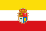
Province of Cuenca
|
Cuenca, Castile-La Mancha , Spain |
|
|---|---|
 coat of arms |
 flag |
| Basic data | |
| Autonomous Community : | Castile-La Mancha |
| Capital : | Cuenca (Spain) |
| Official language : | Spanish |
| Area : | 17,141 km² |
| Residents : | 196,329 (Jan 1, 2019) |
| Population density : | 11.45 inhabitants / km² |
| ISO 3166-2 : | ES-CU |
| Website : | dipucuenca.es |
| Location of the province of Cuenca | |
Cuenca is a province in central Spain , in the east of the autonomous region of Castile-La Mancha or the old Kingdom of New Castile.
It borders the provinces of Valencia , Albacete , Ciudad Real , Toledo , Madrid , Guadalajara and Teruel .
The province has 196,329 inhabitants (2019). Their capital is Cuenca , where about a quarter of the province's population lives. The province has a total of 238 municipalities, of which, apart from the city of Cuenca, only six have more than 5,000 inhabitants.
The province of Cuenca shows a divided landscape. It extends from the highlands of Cuenca ( Serranía de Cuenca ) in the north and east, the highest point of which is the 1,800 m high Cerro San Felipe , to the lowlands of the Mancha in the south and west. The most important river in the highlands is the Júcar with its tributaries. The Guadiela , a tributary of the Tagus , is the most important source of water in the plain . The spruce forests of the Serranía de Cuenca are known throughout Spain.
The climate is continental with hot summers and comparatively cold winters.
Traditionally, in the province of Cuenca, pasture farming was in the highlands and grain cultivation in the lowlands. In addition, timber and mining ( iron , copper , salt , saltpeter ) were operated, the latter, however, has largely been abandoned. Today (2nd quarter 2004, source: INE) 49.6% of the workforce is employed in the service sector, 21.6% in agriculture, 17.1% in construction and 11.8% in industry.

Biggest places
(As of January 1, 2019)
| local community | Residents |
|---|---|
| Cuenca | 54,690 |
| Tarancón | 15,271 |
| Quintanar del Rey | 7,586 |
| San Clemente | 6,988 |
| Las Pedroñeras | 6,638 |
| Mota del Cuervo | 5,990 |
| Motilla del Palancar | 5,869 |
| Iniesta | 4,305 |
| Horcajo de Santiago | 3,493 |
| Casasimarro | 3,084 |
| Villamayor de Santiago | 2,481 |
Population development of the province

Web links
Individual evidence
- ↑ Cifras oficiales de población resultantes de la revisión del Padrón municipal a 1 de enero . Population statistics from the Instituto Nacional de Estadística (population update).

