Resende (Viseu)
| Resende | ||||||
|---|---|---|---|---|---|---|
|
||||||
| Basic data | ||||||
| Region : | Norte | |||||
| Sub-region : | Tâmega e Sousa | |||||
| District : | Viseu | |||||
| Concelho : | Resende | |||||
| Coordinates : | 41 ° 6 ′ N , 7 ° 57 ′ W | |||||
| Residents: | 3166 (as of June 30, 2011) | |||||
| Surface: | 11.88 km² (as of January 1, 2010) | |||||
| Population density : | 266 inhabitants per km² | |||||
| politics | ||||||
| Mayor : | Arlindo Pinto Sequeira | |||||
| Resende district | ||||||
|
||||||
| Residents: | 11,364 (as of June 30, 2011) | |||||
| Surface: | 123.35 km² (as of January 1, 2010) | |||||
| Population density : | 92 inhabitants per km² | |||||
| Number of municipalities : | 11 | |||||
| administration | ||||||
| Administration address: | Câmara Municipal de Resende Av. Rebelo Moniz 4660-215 Resende |
|||||
| President of the Câmara Municipal: | António Manuel Leitão Borges ( PS ) | |||||
| Website: | www.cm-resende.pt | |||||
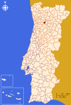
Resende is a small town ( Vila ) and a district ( Concelho ) in Portugal with 11,364 inhabitants on an area of 123.4 km² ( as of June 30, 2011 )
history
Antas and other finds prove a prehistoric settlement. Remains of settlements from the Castro culture and the Lusitans can also be found here. In the 2nd century BC The Romans took the area. It became part of the province of Lusitania , Roman roads to Lamego ran through today's district. After the Suebi drove the Romans out here in the 5th century , the area became part of the Visigoth Empire . In the course of the Arab conquest from 711 , this area also fell to the Moors . In the name of the municipality of São Martinho de Mouros, there is still a reference to this time.
In the course of the Reconquista , two administrative units were created in what is now the district area. In addition to São Martinho de Mouros (probably first city rights in 1058 ), this was the district of Arego, which received its first city rights in 1183 . In the 12th century, King D. Afonso Henriques split off Resende from the Aregos district and gave it to his tutor Egas Moniz .
Resende became a separate district in 1514 and received its first city rights. In 1855 , the districts of Aregos and São Martinho de Mouros were dissolved and merged with the more centrally located Resende to form today's district.
administration
circle
 Resende is the seat of a district of the same name ( concelho ).
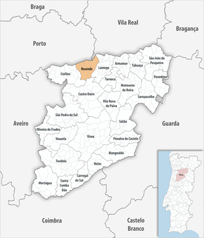
The neighboring areas are (starting clockwise in the north): Baião , Mesão Frio , Lamego , Castro Daire and Cinfães .
With the regional reform in September 2013 , several municipalities were merged into new municipalities, so that the number of municipalities decreased from 15 to eleven.
The following municipalities ( Freguesias ) are in the Resende district:
| local community | Population (2011) |
Area km² |
Density of population / km² |
LAU code |
|---|---|---|---|---|
| Anreade e São Romão de Aregos | 1,471 | 9.83 | 150 | 181316 |
| Barrô | 744 | 10.04 | 74 | 181302 |
| Carquere | 854 | 7.50 | 114 | 181303 |
| Felgueiras e Feirão | 436 | 13.28 | 33 | 181317 |
| Free e Miomães | 790 | 7.43 | 106 | 181318 |
| Ovadas e Panchorra | 409 | 23.82 | 17th | 181319 |
| Break | 528 | 13.40 | 39 | 181310 |
| Resende | 3,166 | 11.88 | 267 | 181311 |
| São Cipriano | 771 | 6.70 | 115 | 181312 |
| Sao Joao de Fontoura | 700 | 5.06 | 138 | 181313 |
| Sao Martinho de Mouros | 1,495 | 14.41 | 104 | 181314 |
| Resende district | 11,364 | 123.35 | 92 | 1813 |
Population development
| Population in the Resende district (1801–2011) | ||||||||
|---|---|---|---|---|---|---|---|---|
| 1801 | 1849 | 1900 | 1930 | 1960 | 1981 | 1991 | 2001 | 2011 |
| 4.128 | 3,506 | 19,334 | 21,894 | 20,226 | 15,356 | 13,675 | 12,370 | 11,364 |
Municipal holiday
- September 29th
Town twinning
traffic
The Linha do Douro railway runs through the district, with several stops (Aregos, Mirão and Ermida).
The national road N108 leads to the A24 motorway about 25 km to the east , junction no. 11 ( Peso da Régua ). About 40 km north (via the N101 / N15) runs the A4 motorway , junction no. 18 ( Padronelo ).
Resende is integrated into the national bus network of Rede Expressos .
sons and daughters of the town
- Manuel Borges Carneiro (1774–1833), lawyer and politician, liberal activist of the Liberal Revolution of 1822
- José Dionísio de Melo e Faro (1834–1877), politician, landowner and journalist
- Adriano Antero (1846–1934), lawyer and writer
- Benedita Serrano (* 1943), painter
- Nel Monteiro (* 1960), entertainment singer
Web links
- Map of the Freguesia Resende (Portugal) at the Instituto Geográfico do Exército
- Official website
Individual evidence
- ↑ www.ine.pt - indicator resident population by place of residence and sex; Decennial in the database of the Instituto Nacional de Estatística
- ↑ a b Overview of code assignments from Freguesias on epp.eurostat.ec.europa.eu
- ↑ a b www.ine.pt - indicator resident population by place of residence and sex; Decennial in the database of the Instituto Nacional de Estatística
- ↑ History page ( Memento of the original from September 21, 2013 in the Internet Archive ) Info: The archive link was inserted automatically and has not yet been checked. Please check the original and archive link according to the instructions and then remove this notice. The district website, accessed September 20, 2013
- ^ Publication of the administrative reorganization in the Diário da República gazette of January 28, 2013, accessed on March 16, 2014
- ↑ www.anmp.pt , accessed on September 20, 2013


