Rupertiweg
| Rupertiweg | |
|---|---|
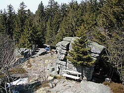
 Starting point at the Bärenstein |
|
| Data | |
| length | 560 km |
| Markers | red-white-red 10 |
| Starting point | Bärenstein 48 ° 41 ′ 0 ″ N , 13 ° 59 ′ 5 ″ E |
| Target point | Nassfeld 46 ° 33 ′ 36 ″ N , 13 ° 16 ′ 33 ″ E |
| Type | Long-distance hiking trail |
| The highest point | Zwernberger Törl (2770 m) |
| Lowest point | Danube near Niederranna (290 m) |
| Level of difficulty | demanding |
| season | summer |
| Months | June to September |
The Rupertiweg (also Austrian long-distance hiking trail 10 ) is a long-distance hiking trail in Austria from Bärenstein to Nassfeld . It runs through the federal states of Upper Austria , Salzburg and Carinthia . Furthermore, part of the route leads through Bavaria . The name Rupertiweg is derived from Rupert von Salzburg , the patron saint of the state of Salzburg. It takes around 25 days to hike through the 560 km long long-distance hiking trail.
course
The path leads south from the striking summit formation of the Bärenstein. On the way through the Mühlviertel you will pass Aigen-Schlägl , Peilstein and Oberkappel . The Danube is crossed near Niederranna and reached via Andorf Haag am Hausruck . Hausruck and Kobernaußerwald are crossed, from Mattighofen to Ostermiething on the banks of the Salzach . The Maria Plain pilgrimage church is reached via the Haunsberg , from where one route leads through the city of Salzburg and another via the Gaisberg .
If the Rupertiweg is considered to be accessible all year round, the alpine part of the path begins at the foot of the Untersberg . The Salzburger and Berchtesgadener Hochthron are crossed, and the Königssee is crossed from Berchtesgaden by ship. From St. Bartholomä it goes up to the Kärlinger and through the Steinerne Meer to the Riemannhaus . From Maria Alm is Hundstein climbed, then at Taxenbach crossed a second time the course of the Salzach.
You hike through the Kitzlochklamm into the Rauriser Valley and change over the Seebachscharte to the Gastein Valley , from where the ascent to the Hagener Hütte , located directly on the main Alpine ridge , begins. The Central Alpine Trail is also crossed there. From Mallnitz the path leads to the Arthur-von-Schmid-Haus , over the long and lonely Reißeck-Höhenweg you get to the Reißeckhütte and over the Rossalmscharte to Spittal an der Drau .
The last section leads through the Latschur group , over the Goldeck to the Weißensee . From Hermagor , the final ascent to the Nassfeld is tackled. The Rupertiweg ends directly at the top of the pass, where it also meets the Südalpenweg .
- Inn and Salzachuferweg
South of the Danube crossing near Niederranna, a variant branches off to the west at the Mittelbach homestead. Via St. Aegidi you hike into the Sauwald (highest peak: Haugstein ) and to Schardenberg . From there, the route is largely based on the course of the Inn, until finally the confluence of the Salzach is reached via Schärding and Braunau . This is now followed upstream until it merges with the main route in Ostermiething.
mark
The path is signposted with the colors red-white-red and path number 10. Sections are marked with 110, 210, 410, 510 and 810 (e.g. 110 in the Mühlviertel). The secondary route along the banks of the Inn and Salzach is number 810A.
The route of the Voralpenweg is determined by the Alpine Association of Austria and Germany, the contact person and information point is the long-distance hikers section of the Austrian Alpine Association .
European long-distance hiking trail E10
Together with the western part of the Südalpenweg , the Rupertiweg forms the Austrian section of the European long-distance hiking trail E10 , whereby the markings of the E10 are only occasionally applied in addition to the two mentioned trails.
literature
- Erika Käfer, Fritz Käfer: Rupertiweg 10. From the Bohemian Forest to the Carnic Alps . Ed .: Austrian Alpine Association, Section Long-Distance Hikers. April 2018.
- Hans Hödl , Werner Rachoy, Robert Wurst: On Austria's great roads. Long-distance hiking trail 01 - 10 . Styria, Graz 1984, ISBN 3-222-11540-0 .
Web links
- Austrian Alpine Association: Rupertiweg 10 at the Long-Distance Hikers section (accessed on February 24, 2020)
- Waymarked Trails: Course of Rupertiweg 10 (main route) (accessed on February 24, 2020)


