
Sao Nicolau (Cape Verde)
| Sao Nicolau | ||
|---|---|---|
 |
||
| Waters | Atlantic Ocean | |
| Archipelago | Ilhas de Barlavento | |
| Geographical location | 16 ° 37 ′ N , 24 ° 16 ′ W | |
|
||
| length | 20 km | |
| width | 45 km | |
| surface | 388 km² | |
| Highest elevation |
Monte Gordo 1312 m |
|
| Residents | 12,700 33 inhabitants / km² |
|
| main place | Ribeira Brava | |
 |
||

São Nicolau (Eng .: "Saint Nicholas ") is one of the smaller (388 km²) and mountainous Cape Verde islands in the north of the archipelago . It belongs to the Ilhas de Barlavento archipelago (German: "Islands above the wind").
geography
São Nicolau is located in the north of the archipelago between the islands of São Vicente and Sal on a common deep-sea shelf with the uninhabited islands of Santa Luzia , Raso and Branco and the island of São Vicente . This creates a comparatively shallow and fish-rich sea basin between the islands mentioned on the otherwise quite deep (5300 m) Cape Verdean sea threshold .
The highest point is the Monte Gordo (1312 m), a younger, even volcanic cone with a round top. The mountainous center of the island receives irregular rainfall, while the low coastal regions and extensive peninsulas are desert-like dry. Only in Fajã can irrigation agriculture be practiced to a significant extent thanks to a freshwater tunnel .
The district town of Vila da Ribeira Brava has now been overtaken in population and economic importance by the port and fishing town of Tarrafal de São Nicolau in the south .
geology
The geological structure of São Nicolau can be broken down as follows (from young to old):
- Quaternary sediments
- Monte Gordo formation
- Preguiça formation
- Main uptiva
- Conglomerates and breccias
- Figueira de Coxe formation
- Upper Miocene marine sediments
- old eruptive complex
The volcanic building São Nicolaus is 131-126 million years BP old oceanic crust from the Barremian on. The basal old eruptive complex , exposed mainly in the north of the island in the valley of the Ribeira Brava , consists of strongly weathered hyaloclastites ( palagonites ), which are interspersed very intensively by a swarm of dikes . The aisles can take up to 90% of the volume. In addition to hyaloclastites, there are also eroded phonolite vents . The old eruptive complex is at least 6.2 million years old, probably even older than 11.8 million years BP.
The Upper Miocene marine sediments overlay the old eruptive complex with a clear erosion discordance . They consist of fossil-rich calcarenites . Their age, determined by means of foraminifera , is given as a period of 11.8 to 5.8 million years BP ( Tortonian and Messinian ), possibly only 6.2 to 5.8 million years BP (Messinian). In terms of fossils , the sediments cirripedia (balanids), echinoderms , mussels , gastropods , isolated corals , foraminifera (redotaliids) and red algae lead .
The overlying Figueira de Coxe formation is made up of submarine lavas and their breccias, predominantly pillow lavas . In the valley of the Ribeira Brava there are also pyroclastites , which indicate an important local eruption center. Significant erosion occurred again in the hanging wall of the Figueira de Coxe Formation and conglomerates and breccias were deposited. Marine sediments then lay on top .
The following main uptiva represent the São Nicolaus shield stage. They can generally be divided into a lower, submarine stage (with pillow lavas, tuffs and hyaloclastites) and an upper, subaeric stage (with lava flows). They can be found all over the island and, in terms of volume, make up the bulk of the rock. Marine carbonates (calcarenites), which contain fossil echinoderms, mussels ( oysters ), corals and red algae (rhodolites), are switched into the submarine stage . The deposits speak for a shelf area of medium energy level. New dates assign the main uptiva to an age of 4.7 to 2.6 million years BP ( Zancleum and Piacenzium ).
After renewed erosion, the young, subaeric lava flows of the Preguiça formation settled over the main eruptiva. They have been dated and have a Pleistocene age of 1.7 to 1.15 million years BP. In the hanging wall of the formation, many cinder and ash cones emerged , some of which are still quite well preserved and can only be easily distinguished from similar deposits of the 100,000 to 50,000 years old, New Pleistocene Monte Gordo Formation .
During the Quaternary there was the formation of extensive abrasion platforms that can reach up to 60 meters above today's sea level . Several alluvial fans flow onto the platforms, and there are also some smaller, pyroclastic cones of the Monte Gordo formation and up to three horizons of fossil-bearing calcarenites.
Petrologically , the São Nicolaus volcanic rocks are primitive, ultramafic to mafic alkaline rocks with a relatively high magnesium content (MgO varies between 8 and 19 percent by weight), including picrobasalts , basanites and nephelinites . Phonolites, which were mainly mined during the shield stage, are to be cited as more differentiated rocks.
The isotope variations found in the basalt rocks are best explained by a mixing process of four end components:
- radiogenic end component that the profound Kapverden-Mantleplume represents
- non-radiogenic end component with MORB composition of the mid-Atlantic ridge
- Sub-Cretaceous MORB component underlying the Cape Verde Archipelago
- São Vicente-like carbonatite component.
This underlines the importance relatively shallow Magmenreservoire in Magmenentstehung below São Nicolau.
history
The island was discovered on December 6, 1460 by the Genoese captain Antonio da Noli , who took possession of it for the Portuguese crown on behalf of Henry the Navigator . A stable settlement through secondary colonization from the southern islands and new immigrants from Madeira and Portugal did not follow until the 18th century . Historically, the island played a major role through the seminary opened in 1866 , the oldest in West Africa , which also included a secular school. The former seminarians include the greatest writers and artists of the archipelago of the 19th and 20th centuries , pioneers of Cape Verdean identity and independence. The historic town center of Vila da Ribeira Brava is grouped around the Episcopal Church Igreja Matriz de N. Senhora do Rosário , formerly the largest church in West Africa, and the birthplace of the poet José Lopes da Silva (pseudonym: Gabriel Mariano , * May 18, 1928 , † February 18, 2002 ). On the other side of the valley is the seminar high school, which has been renovated as a museum.
Today, about 12,700 people live on the island, far less than before the devastating drought - and famine disasters of 1940 years, died of starvation as a large part of the population or to Sao Tome and Principe emigrated.
- photos

Fishermen in Tarrafal de Sao Nicolau

Fishing boats in the port of Tarrafal, São Nicolau (Cape Verde), lit by the evening sun
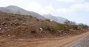
One of the typical gravel roads on São Nicolau
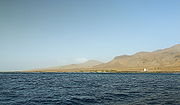
Coast of the island as seen from the boat


administration
The island belongs to the northern group of the Cape Verde Islands, the Ilhas de Barlavento . The most important place and therefore the unofficial capital is Ribeira Brava .
Administratively, São Nicolau is divided into two districts ( concelhos ) with a total of three municipalities ( freguesia ).
| Concelho (circle) | Freguesia (Municipality) |
|---|---|
| Ribeira Brava | Nossa Senhora da Lapa |
| Nossa Senhora do Rosario | |
| Tarrafal de Sao Nicolau | Sao Francisco |
Economy and tourism
Thanks to donations from family members, São Nicolau survived more strongly than other islands in the emigration.
The main livelihoods on site are fishing and the donations from the local people who have emigrated .
Tourism has great opportunities thanks to wide beaches, beautiful hiking trails and a network of small roads. It is still underdeveloped because the transport links by plane and ferry have only improved in recent years. São Nicolau is popular with hikers thanks to its very beautiful mountain and coastal hikes that are less strenuous than Santo Antão .
Individual evidence
- ↑ Macedo, J., Serralheiro, A. & Silva, L .: Notícia Explicativa da Carta Geológica da Ilha de S. Nicolau (Cabo Verde) na escala de 1: 50000 . In: Garcia de Orta, Serviços Geológicos . tape 11 , no. 1-2 , 1988, pp. 1-32 .
- ↑ R. Muller, M. Sdrolias, W. Roest: Age, spreading rates and spreading symmetry of the world's ocean crust . In: Geochemistry Geophysics Geosystems . 9 (Q04006), 2008, p. 1525-2027 .
- ↑ Bernouilli, D. et al .: Miocene shallow-water limestones from São Nicolau (Cabo Verde): Caribbean-type benthic fauna and time constraints for volcanism . In: Swiss Journal of Geoscience . tape 100 (2) , 2007, pp. 215-225 .
- ↑ a b Duprat, HI et al: The volcanic and geochemical development of São Nicolau, Cape Verde Islands: Constraints from field and 40Ar / 39Ar evidence . In: Journal of Volcanology and Geothermal Research . tape 162 (1-2) , 2007, pp. 1-19 .
- ↑ Ramalho, R. et al .: Tracers of uplift and subsidence in the Cape Verde Archipelago . In: J. Geol. Soc. London . tape 167 , 2010, p. 519-538 .
- ↑ Millet, M.-A. including: Mantle plume heterogeneity versus shallow-level interactions: a case study, the São Nicolau Island, Cape Verde archipelago . In: Journal of Volcanology and Geothermal Research . tape 176 , no. 2 , 2008, p. 265-276 .
Web links
Maps and guides
Ilhas de Barlavento : Boa Vista | Ilhéu Sal Rei | Ilhéu Branco | Ilhéu Raso | Sal | Ilhéu Rabo de Junco | Santa Luzia | Santo Antão | São Nicolau | São Vicente | Ilhéu dos Pássaros
Ilhas de Sotavento : Brava | Fogo | Ilhéus do Rombo : Ilhéu Grande | Ilhéu de Cima | Maio | Ilhéu Laja Branca | Santiago