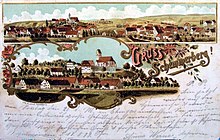
Schemmerberg
|
Schemmerberg
municipality Schemmerhofen
|
|
|---|---|
| Coordinates: 48 ° 11 ′ 20 ″ N , 9 ° 49 ′ 25 ″ E | |
| Height : | 509 m above sea level NHN |
| Area : | 5.94 km² |
| Residents : | 1264 (December 31, 2014) |
| Population density : | 213 inhabitants / km² |
| Incorporation : | 1st January 1974 |
| Postal code : | 88433 |
| Area code : | 07356 |
Schemmerberg is a village on the Riss , a right tributary of the Danube , which has belonged to Schemmerhofen since 1974 . The place currently has 1264 inhabitants, the area of the district is 594 ha.
history
The place is first mentioned in 851. Presumably a castle of the Lords of Schemmern stood on the hill of the village. At the end of the Middle Ages the village was divided. The Counts of Wartstein owned one part, the other the Lords of Sulmetingen as an Austrian fief. Later the Salem monastery acquired part of the village from the Counts of Wartstein. In 1496 the lords of Sulmetingen also sold their property to the Salem monastery.
The jurisdiction lay with the Landvogtei Schwaben . In 1497 the monastery was allowed to set up a court in Schemmerberg. In 1742 the high judiciary followed. The Baltringer Haufen attacked Schemmerberg Castle on March 26, 1525 during the Peasants' War and later destroyed it. It was rebuilt in 1532.
With the secularization of 1803, the area around Schemmerberg first fell to the short-lived imperial principality of Buchau of the Princes of Thurn and Taxis and in 1806 to the Kingdom of Württemberg and was assigned to the Oberamt Biberach . In 1837 the castle was demolished. In 1850 the place got a connection to the southern railway and thus access to the route network of the Württemberg railway .
The administrative reform during the Nazi era in Württemberg led to membership in the Biberach district in 1938 .
In 1945 the municipality became part of the French zone of occupation and thus in 1947 it was assigned to the newly founded state of Württemberg-Hohenzollern , which was incorporated into the state of Baden-Württemberg in 1952.
In the course of community reforms, Schemmerberg was incorporated into Schemmerhofen on January 1, 1974.
Transport and infrastructure
Schemmerberg has its municipal administration in the same place, as well as a mayor and a local council with 10 members. There is a primary school and a church-sponsored kindergarten in the village.
The place is connected to the southern runway . The federal highway 30 runs nearby .
Culture and sights
The townscape is shaped by the Catholic Church of St. Martin.
The Upper Swabian Way of St. James leads through the village from Ulm to Constance .
← Previous location: Obersulmetingen | Schemmerberg | Next town: Äpfingen →
Individual evidence
- ^ Federal Statistical Office (ed.): Historical municipality directory for the Federal Republic of Germany. Name, border and key number changes in municipalities, counties and administrative districts from May 27, 1970 to December 31, 1982 . W. Kohlhammer, Stuttgart / Mainz 1983, ISBN 3-17-003263-1 , p. 544 .


