
Schwartau
| Schwartau | ||
 In Bad Schwartau |
||
| Data | ||
| Water code | DE : 9626 | |
| location | Schleswig-Holstein , Germany | |
| River system | Trave | |
| Drain over | Trave → Baltic Sea | |
| source | Dodauer See 54 ° 8 ′ 7 ″ N , 10 ° 32 ′ 32 ″ E |
|
| Source height | 45 m above sea level NN | |
| muzzle | At Bad Schwartau in the Trave coordinates: 53 ° 54 '26 " N , 10 ° 43' 2" E 53 ° 54 '26 " N , 10 ° 43' 2" E
|
|
| length | 39 km | |
| Right tributaries | Flörkendorfer Mühlenau , Curauer Au | |
| Flowing lakes | Barkauer See | |
| Small towns | Bad Schwartau | |
| Communities | Bosau , Süsel , Scharbeutz , Ratekau | |

The Schwartau is a front of the straightening strongly meandering , now 39 km long tributary of the traveler in the south Schleswig-Holstein in Ostholstein , to the mouth from the source has a height difference of 46 meters.
Hydrological
The water catchment area of the Schwartau is on the north by the south of Lake Dieksee the Holstein Switzerland lying moraines limited.
The Schwartau has its origin in the Dodauer See , which was artificially restored after the construction of the southern bypass road of Eutin . It serves as a drainage channel for the surface water from the hills north of the lake, which rise about 53 m above sea level (between Dodauer See and Kreuzfeld). Since the lake is deeper than the surrounding area (approx. 45 m above sea level), it has no natural runoff. So the course of the Schwartau was initially tunneled under the B 76 (Eutin - Plön ) and led south. The stream crosses the L 176 north of Quisdorf and the L 184 north of Braak , and then joins the Majenfelder Au at the Braaker Mühle (approx. 27 m above sea level).
Since this carries much more water than the Schwartau, this body of water could be seen as the actual source of the Schwartau.
The thus strengthened Schwartau then flows southeast between Braak and Aukamper Moor, through the Barkauer See , further towards Kesdorf , Woltersmühlen, Pönitz , Gleschendorf , Schulendorf and Pansdorf , on to Rohlsdorf, Techau , Hobbersdorf and finally through the city of Bad Schwartau .
The Schwartau temporarily flows in a particularly distinct glacial valley . The river flows into the lower Trave opposite the Schellbruch , after it has crossed the city ports of the Hanseatic city of Lübeck .
The steeply winding lower reaches of the Schwartau had only a slight gradient in relation to its length, which led to occasional floods. To change this, the lower reaches of the Schwartau were straightened in 1933 by the Reich Labor Service . The oxbow lakes are still clearly visible.
The Schwartau forms typical river meadows over large parts of its course .
Larger tributaries to the Schwartau are the Curauer Au , the Flörkendorfer Mühlenau , the Ottenbek and the Sielbek.
Historical
Emergence
The formation of the Schwartau river course - a glacial valley - goes back to a meltwater flow through which large masses of glacier condensation poured into the ice reservoir of the Lübeck basin at the end of the last ice age (the Weichsel ice age ) . The Schwartau glacial valley is particularly easy to recognize on the steep western slopes between Bad Schwartau and the Groß Parin district (and further towards Hobbersdorf) and on the eastern ridge of the Riesebusch .
prehistory
The course of the river is rich in prehistoric sites . In 1946, when digging peat in the Aukamper Moor near a burn site, which had also been found, two roughly three-meter-high wooden figures of a man and woman were found, which were roughly worked and lacking the arms that were originally there. At first it was assumed that it was a pair of gods from the early Slavic period. Other dates suspected the emergence in the late Bronze Age . A recent radiocarbon dating determined the time of origin to be 550 BC. BC, i.e. the pre-Roman Iron Age . The figures are now in the Gottorf Castle Museum . The fire place is seen from research in connection with British Burnt Mounds and Swedish Skärvstenhögar .
middle Ages
At the mouth of the Schwartau is a ground monument of Alt-Lübeck ( Liubice ). This Slavic settlement was on a hill between the Schwartau estuary and a former Trave arch, which was omitted due to a puncture (1882 for the first time, enlarged in 1954). This straightening resulted in the Teerhofinsel next to the Schwartau estuary.
Surname
The name "Schwartau" goes back to a Wendish name that means "(which) meander" (not, as is often assumed by folk etymology , from the Low German name for "black Au") and thus refers to the winding lower course of the river. The first written mention can be found in a document from the Danish King Waldemar from 1215 ( szwartowe ).
Mills
At the Schwartau were due to the relatively large gap for the region by water wheels at least the following mills , Wolter mill (mill at Braaker: operated Woltersteich ) Gleschendorfer mill, school Mühle, Hobbersdorfer mill and Sereetzer mill. The Hobbersdorfer Mühle is now owned by the Ströh company and is run as a successful grain mill. In Gleschendorf, the mill bakery next to the river still reminds us of times gone by. In Schulendorf, the former mill is located at the western end of the village, south of the Schwartau bridge. The mill in today's Bad Schwartau, however, has the most interesting history. It stood where today a road bridge on Eutiner Strasse leads over the Schwartau. It was first mentioned in 1215 and finally demolished in 1828. For their operation, the Schwartau was dammed by a dam, which led to the formation of a mountain and valley-side mill pond. Initially operated as a grain mill, from the 1630s as a tinder mill, it was badly damaged by fire in 1803 and later had to be demolished.
These possible uses are the probable reason that the Schwartau river valley was settled very early and shows a high density of prehistoric traces of settlement beginning with the Mesolithic .

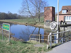
The Schwartau near Gothendorf (Süsel) just before the Barkauer See

Pansdorf / Sarkwitz bridge
Weir at the Hobbersdorf mill

Bad Schwartau-Riesebusch

The Schwartau flows into the Trave at Trave river kilometer 10 (direction of flow of the Trave from right to left)


Individual evidence
- ↑ Max Steen: Bad Schwartau: From past and present . Weiland, Lübeck 1973, ISBN 3-87890-017-1 .
literature
- Werner Neugebauer: Nice Holstein . Verlag Lübecker Nachrichten , Lübeck 1957, p. 75 ff .