
Seropédica
| Seropédica | ||
|---|---|---|
|
Coordinates: 22 ° 45 ′ S , 43 ° 42 ′ W Seropédica on the map of Rio de Janeiro
|
||
 Location of Seropédica in the state of Rio de Janeiro
|
||
| Basic data | ||
| Country | Brazil | |
| State | Rio de Janeiro | |
| City foundation | October 12, 1995 | |
| Residents | 83,667 (2016: estimate as of July 1) | |
| City insignia | ||
 |
 |
|
| Detailed data | ||
| surface | 283,766 km 2 | |
| Population density | 276 inhabitants / km 2 | |
| height | 26 m | |
| prefix | (21) | |
| Time zone | UTC −3 | |
| City Presidency | Anabal Barbosa de Souza ( PDT ) (2017-2020) | |
| Website | ||
 |
||

Seropédica , officially Município de Seropédica , is a municipality in the Brazilian state of Rio de Janeiro and is located about 26 m above sea level, 75 km west of the capital. The population was estimated on July 1, 2016 at 83,667 inhabitants, who live on an area of 283.8 km².
General
Anabal Barbosa de Souza of the Partido Democrático Trabalhista (PDT) has been city prefect since the local elections in 2016 for the 2017 to 2020 term of office .
The neighboring communities of Seropédica are Itaguaí , Japeri , Nova Iguaçu , Paracambi , Piraí , Queimados and Rio de Janeiro Seropédica is the seat of a university, the Universidade Federal Rural do Rio de Janeiro (UFRRJ).
history
Seropédica was separated from the municipality of Itaguaí in 1995 and became independent, but this did not take effect until January 1, 1997.
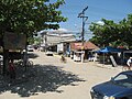
Street view in Seropédica

Web links
Individual evidence
- ↑ a b IBGE : Cidades @ Rio de Janeiro: Seropédica. Retrieved July 14, 2017 (Portuguese).
- ^ Prefeitura de Seropédica: Prefeito e Vice. As of 2017. Accessed July 14, 2017 (Portuguese).
- ^ Universidade Federal Rural do Rio de Janeiro
- ^ Prefeitura de Seropédica: Histórico. Retrieved July 14, 2017 (Portuguese).
Região geográfica intermediária and Região geográfica imediata

| Baixadas mesoregion |
Microregion Bacia de São João: Casimiro de Abreu | Rio das Ostras | Silva Jardim | Lagos Microregion: Araruama | Armação dos Búzios | Arraial do Cabo | Cabo Frio | Iguaba Grande | São Pedro da Aldeia | Saquarema |
|
| Central Fluminense Mesoregion |
Microregion Cantagalo-Cordeiro: Cantagalo | Carmo | Cordeiro | Macuco | Microregion Nova Friburgo: Bom Jardim | Duas Barras | Nova Friburgo | Sumidouro | Microregion Santa Maria Madalena: Santa Maria Madalena | São Sebastião do Alto | Trajano de Morais | Três Rios microregion: Area | Comendador Levy Gasparian | Paraíba do Sul | Sapucaia | Três Rios |
|
|
Mesoregion Metropolitana do Rio de Janeiro |
Itaguaí microregion: Itaguaí | Mangaratiba | Seropédica | Macacu-Caceribu microregion: Cachoeiras de Macacu | Rio Bonito | Microregion Rio de Janeiro: Belford Roxo | Duque de Caxias | Guapimirim | Itaboraí | Japeri | Magé | Maricá | Nilópolis | Niterói | Mesquita | Nova Iguaçu | Queimados | Rio de Janeiro | São Gonçalo | São João de Meriti | Tanguá | Serrana microregion: Petrópolis | São José do Vale do Rio Preto | Teresópolis | Vassouras microregion: Engenheiro Paulo de Frontin | Mendes | Miguel Pereira | Paracambi | Paty do Alferes | Vassouras |
|
| Mesoregion Northeast Fluminense |
Itaperuna microregion: Bom Jesus do Itabapoana | Italva | Itaperuna | Laje do Muriaé | Natividade | Porciúncula | Varre-Sai | Santo Antônio de Pádua micro-region: Aperibé | Cambuci | Itaocara | Miracema | Santo Antônio de Pádua | Sao José de Ubá |
|
| Mesoregion Nord-Fluminense |
Microregion Campos dos Goytacazes: Campos dos Goytacazes | Cardoso Moreira | São Fidélis | São Francisco de Itabapoana | São João da Barra | Macaé microregion: Carapebus | Conceição de Macabu | Macaé | Quissamã |
|
| South Fluminense mesoregion |
Baía da Ilha Grande microregion: Angra dos Reis | Paraty | Barra do Piraí microregion: Barra do Piraí | Rio das Flores | Valença | Vale do Paraíba Fluminense microregion: Barra Mansa | Itatiaia | Pinheiral | Piraí | Porto Real | Quatis | Resende | Rio Claro | Volta Redonda |
