Macaé
| Macaé | ||
|---|---|---|
|
Coordinates: 22 ° 22 ′ S , 41 ° 47 ′ W Macaé on the map of Brazil
|
||
| Basic data | ||
| Country | Brazil | |
| State | Rio de Janeiro | |
| City foundation | July 29, 1813 | |
| - in the metropolitan area | 160.725 | |
| City insignia | ||
| Detailed data | ||
| surface | 1,113.5 | |
| height | 2 m | |
| Waters | Rio Macaé | |
| Time zone | UTC −3 | |
| City Presidency | Aluízio dos Santos Júnior | |
| Website | ||
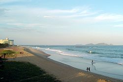
| View of Macaé | ||
Macaé , officially Portuguese Município de Macaé , is a city and also a district ( Municipio ) in the state of Rio de Janeiro in Brazil . With an area of 1,215.904 km² and around 160,000 inhabitants, Macaé is a city of great economic importance, especially after the largest Brazilian oil field was found and developed in the sea area of the Campos Basin (Portuguese: Bacia de Campos). Macaé has a seaport. The oil fields off the coast in the Atlantic are supplied from here.
The road connections run mainly along the coast from Rio das Ostras and there is also a railway connection. This railway connects the state of Rio de Janeiro with the state of Espírito Santo and is used exclusively for the transport of goods.
history
Before the arrival of the Portuguese conquerors in 1580, this area was settled by two indigenous peoples, the Tamoios and the Goitacás .
The first evidence of a Jesuit settlement in Macaé goes back to 1634 and was located on the Rio Macaé river. The places were called Fazenda de Macaé and Fazenda do Sant'Anna. In addition to sugar cane, which was grown here from the beginning, cassava flour was produced and wood was extracted that was used for shipbuilding. Coffee plantations were established later. In 1759 which was Fazenda de Menezes by the manager João Cardoso transferred to the ownership of the Portuguese crown. At this time the Jesuits were expelled from Brazil at the instigation of Sebastião José de Carvalho e Mello, Marquês de Pombal .
In 1813 Macaé was made a district and in 1846 the place Macaé received city rights. Since the port of São João da Barra at that time could no longer keep up with the cargo volume, the Campos-Macaé Canal began in 1872, on which sugar products and coffee were transported from the hinterland to the coast with a total length of 109 km.
In 1875 construction began on the Macaé-Campos railway line, and after completion the port became unimportant and fell into disrepair. The railway line brought new impetus to the region and later the Estrada de Ferro Leopoldina line was added.
With the discovery of oil in 1974, the region, which until then lived almost exclusively on agriculture, underwent a radical change. The population structure of Macaé changed and today there are many domestic and foreign experts in this branch living there. This had a major impact on the local economy, prices and wages. In 2004, the city was awarded the title of Most Dynamic City in Brazil in terms of working life by the Fundação Getúlio Vargas Foundation . The place is exemplary today, especially in terms of child-friendliness and social facilities.
Attractions
Despite or perhaps because of the economic activities in the oil sector, the tourist value of the city and the district with its numerous beaches has increased. Tourist attractions are u. a .:
- The Rio Macaé river that runs through the town. It rises in the Serra de Macaé. The source lies on the district border with the neighboring district of Lumiar . Part of the river is still navigable today and runs through the city of Macaé.
- The mountain Pico do Frade is the highest point of the district at 1429 meters and is about 56 km from Macaé. There are opportunities for guided hikes here. Inquiries should be made at the city's tourist center.
- Peito do Pombo is also a mountain with a height of 1120 meters. A largely untouched nature with waterfalls and small streams is hidden here.
- Imboassica Lake is considered an ecological reserve. Here there is an offer for leisure and observation of nature. The lake is located on the district border to Rio das Ostras and is approx. 11.5 km from Macaé.
- Praia do Pecado beach. In addition to ideal surfing opportunities, there is also a lot of fishing in this region. The beach is near the Imboassica Lake.
- Praia dos Cavaleiros beach. This is a beach in the urban area, which is important for the recreational activities of Macaé.
- Praia Campista beach. This beach is also not far from the urban area, but is on the open sea and is used more for fishing and fishing.
- Prainha do Farol beach is only 120 meters long. On this beach are the ruins of the old Macaé lighthouse, built in 1880.
- The Praia de Imbetiba beach. The Imbetiba terminal, which is used as a port for supplying the oil industry, is located here today.
- Praia de São José do Barreto beach. This beach extends into the National Park Parque Nacional da Restinga de Jurubatiba .
- Jurubatiba Lake is one of the lakes that make up the Parque Nacional da Restinga de Jurubatiba .
- The archipelago of Sant'Anna consists of several offshore islands, which are called Francês, Ilhote Sul and Sant'Anna. The islands are about 8 km from the mainland and can be reached by boat from the center of Macaé. There is a high recreational value here and opportunities for fishing and fishing. In addition, various bird species take a break on their hiking flights here.
- The place Cabeceira do Sana belongs to the district of Macaé and is known for its forests and waterfalls. There are various campsites here and rafting is possible on the rivers.
- The church Igreja de Sant'Anna was built by the Jesuits in 1630.
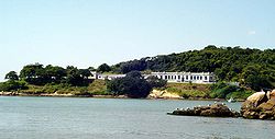
- Fort Marechal Hermes was built in 1761 to defend the coastal region from attackers.


