Sobral de Monte Agraço
| Sobral de Monte Agraço | ||||||
|---|---|---|---|---|---|---|
|
||||||
| Basic data | ||||||
| Region : | Centro | |||||
| Sub-region : | Oeste | |||||
| District : | Lisbon | |||||
| Concelho : | Sobral de Monte Agraço | |||||
| Coordinates : | 39 ° 2 ′ N , 9 ° 9 ′ W | |||||
| Residents: | 3404 (as of June 30, 2011) | |||||
| Surface: | 8.7 km² (as of January 1, 2010) | |||||
| Population density : | 391 inhabitants per km² | |||||
| Postal code : | 2590-017 | |||||
| politics | ||||||
| Address of the municipal administration: | Junta de Freguesia de Sobral de Monte Agraço Campo da Feira 2590-017 Sobral de Monte Agraço |
|||||
| Sobral de Monte Agraço district | ||||||
|
||||||
| Residents: | 10,158 (as of June 30, 2011) | |||||
| Surface: | 52.1 km² (as of January 1, 2010) | |||||
| Population density : | 195 inhabitants per km² | |||||
| Number of municipalities : | 3 | |||||
| administration | ||||||
| Administration address: | Câmara Municipal de Sobral de Monte Agraço Praça Dr. Eugénio Dias, nº 4 2590-016 Sobral de Monte Agraço |
|||||
| President of the Câmara Municipal: | António Lopes Bogalho ( CDU ) | |||||
| Website: | www.cm-sobral-monte-agraco.pt | |||||
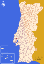
Sobral de Monte Agraço is a small town ( vila ) in Portugal .
history
The first mention of the place can be found in the deed of donation of King D.Sancho I , who gave the area of Soveral on October 1, 1186 to the Bishop of Évora , D.Paio. Over time, a populous village developed on Monte Agraço (Eng .: Mount Agraço), near the Igreja de São Salvador church and the town hall.
King D.João I rewarded the loyalty of the place with some privileges in 1386 in the revolution of 1383 , with which the independence of the Kingdom of Portugal was secured. King D. Manuel I gave Monte Agraço city rights in 1518 .
In the area of Sobral de Monte Agraço, General Wellington built some of his fortifications of the lines of Torres Vedras , a line of defense against the Napoleonic invasions, in 1810 . Sobral de Monte Agraço became an independent circle in 1821 . In the course of the administrative reforms after the Liberal Revolution in 1822 , the district was dissolved in 1832 and re-established in 1836 . In 1887 it was merged with Arruda dos Vinhos and was the seat of the new circle, only to be detached and independent again since 1898 .
administration
The circle
 |
Sobral de Monte Agraço is the administrative seat of a district of the same name ( concelho ) in the Lisbon district . On June 30, 2011, the district had 10,158 inhabitants on an area of 52.1 km². |
The neighboring districts are (starting clockwise in the north): Torres Vedras , Alenquer , Arruda dos Vinhos and Mafra .
The following municipalities ( Freguesias ) are in the district of Sobral de Monte Agraço:
| local community | Population (2011) |
Area km² |
Density of population / km² |
LAU code |
|---|---|---|---|---|
| Santo Quintino | 3,708 | 29.00 | 128 | 111201 |
| Sapataria | 3,046 | 14.40 | 211 | 111202 |
| Sobral de Monte Agraço | 3,404 | 8.70 | 391 | 111203 |
| Sobral de Monte Agraço district | 10.158 | 52.10 | 195 | 1112 |
growth of population
| Population in the district of Sobral de Monte Agraço (1801–2011) | |||||||||
|---|---|---|---|---|---|---|---|---|---|
| 1801 | 1849 | 1900 | 1930 | 1960 | 1981 | 1991 | 2001 | 2011 | |
| 952 | 3,921 | 5,747 | 6 845 | 7 744 | 7 863 | 7 245 | 8 927 | 10 158 | |
Municipal holiday
traffic
With Pero Negro and Sapataria, two stops on the Linha do Oeste railway line are in the district, but Sobral de Monte Agraço, about 5 km east of Pero Negro station, does not have its own station.
The A8 motorway is around 8 km away, with the next slip road number 8 ( Enxara do Bispo ). The national road N248 passes the place and connects it with the 18 km northeast of Torres Vedras and the 10 km southeast of Arruda dos Vinhos .
Local public transport is operated by lines of private bus companies.
sons and daughters of the town
- José António Freire Sobral (1840–1905), large landowner in São Tomé and Príncipe , grandfather of the artist Almada Negreiros
- Trovão Lucas (1907–1993), architect v. a. in Luanda and Lisbon , u. a. the headquarters of the Caixa Geral de Depósitos
- Pedro Caldeira (* 1950), well-known investment advisor and stockbroker
- Joaquim Cruz (* 1979), politician
- Fábio Silvestre (* 1990), cyclist
See also
Web links
- Map of the Freguesia Sobral de Monte Agraço at the Instituto Geográfico do Exército
- Official website of the city administration
Individual evidence
- ↑ www.ine.pt - indicator resident population by place of residence and sex; Decennial in the database of the Instituto Nacional de Estatística
- ↑ a b Overview of code assignments from Freguesias on epp.eurostat.ec.europa.eu
- ↑ a b www.ine.pt - indicator resident population by place of residence and sex; Decennial in the database of the Instituto Nacional de Estatística
- ↑ www.verportugal.net , accessed October 11, 2013


