Lourinhã
| Lourinhã | ||||||
|---|---|---|---|---|---|---|
|
||||||
| Basic data | ||||||
| Region : | Centro | |||||
| Sub-region : | Oeste | |||||
| District : | Lisbon | |||||
| Concelho : | Lourinhã | |||||
| Coordinates : | 39 ° 15 ′ N , 9 ° 19 ′ W | |||||
| Residents: | 9874 (as of June 30, 2011) | |||||
| Surface: | 39.04 km² (as of January 1, 2010) | |||||
| Population density : | 253 inhabitants per km² | |||||
| Postal code : | 2530-126 | |||||
| politics | ||||||
| Mayor : | Pedro Manuel Marques Margarido ( PS ) | |||||
| Address of the municipal administration: | Junta de Freguesia de Lourinhã Largo D. Lourenço Vicente 2530-126 Lourinhã |
|||||
| Website: | www.jf-lourinha.pt | |||||
| Lourinhã County | ||||||
|
||||||
| Residents: | 25,735 (as of June 30, 2011) | |||||
| Surface: | 147.18 km² (as of January 1, 2010) | |||||
| Population density : | 175 inhabitants per km² | |||||
| Number of municipalities : | 8th | |||||
| administration | ||||||
| Administration address: | Câmara Municipal de Lourinhã Praça Marquês de Pombal 2530-127 Lourinhã |
|||||
| President of the Câmara Municipal: | João Duarte Anastácio de Carvalho ( PS ) | |||||
| Website: | www.cm-lourinha.pt | |||||
Lourinhã is a small town ( vila ) in Portugal , about 73 kilometers north of the capital Lisbon. It is known as the “capital of the dinosaurs” in Portugal, thanks to the large number of finds that exist here.

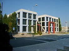
Look at Lourinhã, from Miradouro Castle de Castelo Lourinhã from
|
history
Lourinhã is the district with the most numerous finds of traces and fossils of dinosaurs . The settlement by humans is proven by finds since the Paleolithic Age . Thanks to its advantageous location on the coast, the Celtiberians , Phoenicians , Greeks and Romans settled here . The current place name probably goes back to the nearby Roman estate of the Roman Laurinius, from which Lauriniusanam arose as the name of the local place in the province of Lusitania . Another theory sees the origin of today's place name in the Latin term Laurus-laurii , which originated with the lavishly growing laurel (Latin Laurus, Portuguese Louro).
After the conquest of the Moors in 711 , the place became Arabic . During the Reconquista conquered the first king of Portugal, D.Afonso Henriques , the land and gave it to the French knights D.Jordan, for his achievements in 1147 were made conquest of Lisbon from the Moors. D. Jordan gave the place the first town charter, probably in 1160 , which was granted by the kings D.Sancho I in 1218 and D.Afonso III. were confirmed in 1251 .
In the course of his administrative reforms, King D. Manuel I renewed Lourinhã's town charter in 1512 .
In the course of the Napoleonic invasions, the Battle of Vimeiro took place on August 21, 1808 in Vimeiro near Lourinhã . The defeated French then signed the Cintra Convention and evacuated the Portugal they had occupied.
Culture and sights
Various thematic hiking trails (including dinosaurs, Vimeiro battle, coast) are laid out in a circle.
Cultural sites
The Museu da Lourinhã city museum, opened in 1984, is divided into four areas: archeology , sacred art , ethnography and paleontology . His collection of finds from the Upper Jurassic is considered the largest on the Iberian Peninsula and of international importance. The oldest dinosaur eggs found in the world are located here, and with 100 eggs it is the world's second largest preserved clutch.
A museum visitor center has been set up on the site of the 1808 battle of Vimeiro. Other cultural sites in the district are the Museum of Regional Agricultural History, the Museu Rural do Reguengo Grande , plus the Biblioteca Municipal , and the Arquivo Municipal Archives .
Cultural monuments
The district currently has (October 2013) 67 protected buildings and places in various levels of protection. In addition to various historical buildings and a number of sacred buildings, there is also a monument to the Battle of Vimeiro in 1808. It was built on the centenary in 1908 in the style of the early 19th century and is a listed building. The house in which the commander of the Portuguese-British defense, later General Wellington , resided, is one of the district's monuments .
The historic town center is also a listed building as a whole.
beaches
The district has 12 km of Atlantic coast, on which there are a number of different beaches:
- Praia da Areia Branca
- Paimogo
- Caniçal
- Vale de Frades
- Area
- Peralta
- Porto das Barcas
- Cimbral
- Porto Dinheiro
- Valmitão
Sports
The football club Sporting Clube Lourinhanense has existed since 1926 and today (2013/14 season) plays in the third division, the Campeonato Nacional de Seniores . He plays his home games at the Estádio Municipal da Lourinhã . The club also has a cycling department.
The Hóquei Clube da Lourinhã , founded in 1989, now practices eleven other sports in addition to its main sport, roller hockey .

administration
The circle
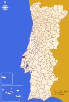
Lourinhã is the administrative seat of a district of the same name ( concelho ) in the Lisbon district . On June 30, 2011 the district had 25,735 inhabitants on an area of 147.2 km².
The neighboring regions are (starting clockwise in the north): Peniche , Óbidos , Bombarral , Cadaval , Torres Vedras and the Atlantic Ocean.
With the regional reform in September 2013 , several municipalities were merged into new municipalities, so that the number of municipalities decreased from eleven to eight.
The following municipalities ( Freguesias ) are located in Lourinhã County:
| local community | Population (2011) |
Area km² |
Density of population / km² |
LAU code |
|---|---|---|---|---|
| Lourinhã e Atalaia | 11,755 | 46.48 | 253 | 110812 |
| Miragaia e Marteleira | 3,583 | 19.47 | 184 | 110813 |
| Moita dos Ferreiros | 1,734 | 24.83 | 70 | 110803 |
| Reguengo Grande | 1,626 | 15.59 | 104 | 110805 |
| Ribamar | 2.141 | 6.11 | 350 | 110810 |
| Santa Bárbara | 1,943 | 7.52 | 258 | 110806 |
| São Bartolomeu dos Galegos e Moledo | 1,483 | 20.10 | 74 | 110814 |
| Vimeiro | 1,470 | 7.08 | 208 | 110808 |
| Lourinhã County | 25,735 | 147.18 | 175 | 1108 |
Population development
| Population in Lourinhã County (1801–2011) | |||||||||
|---|---|---|---|---|---|---|---|---|---|
| 1801 | 1849 | 1900 | 1930 | 1960 | 1981 | 1991 | 2001 | 2011 | |
| 3366 | 6481 | 12,154 | 17,049 | 22,927 | 21,245 | 21,596 | 23,239 | 25,735 | |
Municipal holiday
- June 24th
Town twinning
-
 France : Écully (since 1995)
 -
 Cape Verde : Sal (since 2006)
 -
 France : Deuil-la-Barre (since 2009)
 -
 Germany : Bad Liebenzell (since 2019)
sons and daughters of the town
- Lourenço Vicente (1311–1398), Archbishop of Braga
- Manuela de Sousa Marques (* 1924), Germanist, literary scholar, translator and author
- Manuel Maria Baltazar (1927–1992), naval officer and composer, from 1976 to 1987 director of the Portuguese naval orchestra
- Ana Jorge (* 1950), doctor and politician, Minister of Health from 2008 to 2011
- Sérgio Manuel Patrício Martins (1956–2005), chief police officer, stationed in Yugoslavia in 1993/94, shot dead on duty in 2005
- Rodrigo Maurício (* 1975), accordionist
- Jucie Lupeta (* 1993), soccer player
Web links
- Map of the Freguesia Lourinhã at the Instituto Geográfico do Exército
- Official website of the city administration
Individual evidence
- ↑ www.ine.pt - indicator resident population by place of residence and sex; Decennial in the database of the Instituto Nacional de Estatística
- ↑ a b Overview of code assignments from Freguesias on epp.eurostat.ec.europa.eu
- ↑ a b www.ine.pt - indicator resident population by place of residence and sex; Decennial in the database of the Instituto Nacional de Estatística
- ^ João Fonseca: Dicionário do Nome das Terras. 2nd edition, Casa das Letras, Cruz Quebrada 2007, p. 146 ( ISBN 978-9724617305 )
- ↑ www.verportugal.net , accessed October 26, 2013
- ↑ The Lourinhã City Museum on the district administration's website, accessed on October 26, 2013
- ↑ The Museu Rural do Reguengo Grande on the district administration's website, accessed on October 26, 2013
- ↑ www.monumentos.pt , accessed on October 26, 2013
- ↑ ditto
- ↑ ditto
- ↑ www.foradejogo.net , accessed October 26, 2013
- ↑ Club data from www.mundook.net, accessed on October 26, 2013
- ^ Publication of the administrative reorganization in the Diário da República gazette of January 28, 2013, accessed on March 16, 2014
- ↑ www.anmp.pt , accessed on October 26, 2013
- ↑ Assinado mais um Acordo de Geminação (“Another town twinning agreement signed”), article in No. 301 of August 15, 2019 of the German-Portuguese newspaper Portugal Post , page 7


