
Ingelfingen
| coat of arms | Germany map | |
|---|---|---|

|
Coordinates: 49 ° 18 ' N , 9 ° 39' E |
|
| Basic data | ||
| State : | Baden-Württemberg | |
| Administrative region : | Stuttgart | |
| County : | Hohenlohe district | |
| Height : | 217 m above sea level NHN | |
| Area : | 46.48 km 2 | |
| Residents: | 5480 (December 31, 2018) | |
| Population density : | 118 inhabitants per km 2 | |
| Postal code : | 74653 | |
| Primaries : | 07940, 06294 | |
| License plate : | KÜN, EAR | |
| Community key : | 08 1 26 039 | |
| LOCODE : | DE IGF | |
| City structure: | Core city and 7 districts | |
City administration address : |
Schloßstraße 12 74653 Ingelfingen |
|
| Website : | ||
| Mayor : | Michael Jürgen Bauer (independent) | |
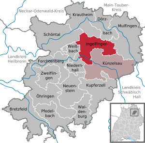
| Location of the city of Ingelfingen in the Hohenlohe district | ||
  |
||


The city of Ingelfingen is a state-approved resort in the Hohenlohe district in the Franconian north-east of Baden-Württemberg . It belongs to the Heilbronn-Franconia region (until May 20, 2003 Franconia region ). It is located on the lower Kocher , over 35 kilometers northeast of Heilbronn and about three kilometers west-northwest of Künzelsau (both as the crow flies).
geography
Geographical location
The core town of Ingelfingen lies on the flat north arch in the approximately 190 m deep valley of the Kocher between Künzelsau and Forchtenberg . The Schulklingenbach runs in a south-southeast direction through the old town and then flows into the river from the right; The Lichteneck castle ruins are halfway up the spur of the mouth . The old parts of the settlement are almost 300 meters away from the northern bank of the river at the transition from the Kocheraue to the right foot of the slope and stretch a good bit up into the Klingental; newer ones fill the full width of the floodplain below the Hohenberg upstream or lie south of the river on the ascent to the Mühlberg.
The district of Criesbach is located a good kilometer downstream in a location analogous to the old town in front of a smaller ridge inlet from the north and at the beginning of a large right valley widening that continues beyond the city limits to Niedernhall . The village of Lipfersberg zu Ingelfingen belongs to the south of the Kocher plateau, as well as two residential areas across from Künzelsau-Nagelsberg: Scheurachshof in the valley or the Kocherstein on its left slope.
Most of the urban area, however, lies on the plateau north of the Kocher, which is divided by flat valley courses. Several smaller farms and hamlets are scattered on this plateau. The more important settlements are in the side valleys of the Kocher and Jagst : Hermuthausen about 6 km east-northeast of Ingelfingen on the upper Österbach, which drains over the Deubach into the Kocher, beyond a tip of the Künzelsau area, and Weldingsfelden about one and a half kilometers north of it on the slope to the Forellenbach, which strives straight north to Dörzbach -Hohenbach zur Jagst. Stachenhausen, Dörrenzimmern and Eberstal follow each other west of it in the valley of the Jagst at Schöntal - Marlach pulling Sindelbachs . Diebach is a little away from Eberstal, also on the western city limits, but in the upper valley of the Langenbach, which flows south to the Kocher near Weißbach .
The southern plateau around Lipfersberg reaches a height of 412.7 m above sea level on the southern city limits . NN , the much larger north at Weldingsfelden 429.3 m above sea level. NN . The Kocher forms the depth axis of the urban area, it flows at about 207 m above sea level. NN and leaves Ingelfingen a little below 200.6 m above sea level. NN .
City structure
Ingelfingen has seven districts in addition to the core city: Criesbach, Diebach , Dörrenzimmern, Eberstal , Hermuthausen, Stachenhausen and Weldingsfelden.
Division of space

According to data from the State Statistical Office , as of 2014.
history
Until the 19th century
Ingelfingen was first mentioned in a document in 1080. During the time of the tribal duchies , the place was in the Duchy of Franconia . Ingelfingen was called an oppidum as early as 1302, making it a fortified place with all the associated rights of a city. In 1323 King Ludwig granted the town market rights. In 1556 Ingelfingen became Protestant in the course of the Reformation. During the Thirty Years' War , the city suffered heavily from numerous epidemics and troop movements. Between 1701 and 1805 the counts and, from 1764, the princes of Hohenlohe-Ingelfingen had their residence here, which brought the town to an economic boom thanks to the settlement of craftsmen. Prince Friedrich Ludwig stood out in particular . In 1806 all seven places in what is now the district in the Kingdom of Württemberg were added. In 1809 they came to the newly founded Oberamt Ingelfingen, which was converted into the Oberamt Künzelsau in 1811 . Since 1892, the establishment of the Ingelfingen Weingärtnergenossenschaft , the forerunner of today's Kochertalkellerei, promoted viticulture . In the 19th century, when searching for hard coal, salt water with great healing properties was found. This has been available for private use since 1994 thanks to a fountain in the spa garden.
Territory and incorporations
From 1938, Ingelfingen belonged to the newly formed district of Künzelsau , and in the course of the district reform of 1973 to the Hohenlohe district.
- January 1, 1972: Criesbach, Diebach, Dörrenzimmern, Hermuthausen and Weldingsfelden
- September 1, 1973: Eberstal
politics
Municipal council
In Ingelfingen, the municipal council is elected using the spurious selection of a part of town. The number of local councils can change due to overhang mandates . The municipal council in Ingelfingen has 19 members after the last election (2009: 20). The turnout was 58.22% (2009: 57.1%). The municipal council consists of the elected voluntary councilors and the mayor as chairman. The mayor is entitled to vote in the municipal council.
| Parties and constituencies |
% 2014 |
Seats 2014 |
% 2009 |
Seats 2009 |
||
| CDU | Christian Democratic Union of Germany | 46.06 | 9 | 48.6 | 10 | |
| FW | Ingelfingen Free Electoral Association | 40.21 | 7th | 36.2 | 7th | |
| SPD | Social Democratic Party of Germany | 13.73 | 3 | 15.3 | 3 | |
| total | 100.0 | 19th | 100.0 | 20th | ||
| voter turnout | 58.2% | 61.4% | ||||
mayor
On May 7, 2006 Michael Jürgen Bauer was elected mayor as successor to Wolfgang J. Schneider with a majority of 55.94% of the votes in the first ballot.
1892–1919: Josef Rilling
1919–1933: Eugen Rilling
1934–1940: Hugo Gaebele
1941–1945: Friedrich Huber (administrative officer)
1945: Georg Seber (appointed by the military government)
1945–1947: Carl Faust (appointed by the military government)
1947 –1948: Hermann Wolf (elected by the local council)
1948–1978: Heinrich Ehrmann
1978–2006: Wolfgang J. Schneider
since 2006: Michael Jürgen Bauer
In March 2014, Bauer was re-elected with 90.5% of the vote.
badges and flags

The blazon of the Ingelfingen coat of arms reads: "A silver crook in blue". The city flag is white-blue.
The crook is already included in the city's first known seal , which has been handed down from the 16th century, but probably dates back to the 15th century. The stick is understood as a reference to Saint Nicholas as the patron saint of the city church, but is also intended to indicate connections to Comburg Abbey . The curvature of the staff was shown with the opening to the left in the 19th century and until around 1920. A municipal council resolution of April 10, 1956 confirmed the current form of the coat of arms.
Town twinning
Ingelfingen has been twinned with the French municipality of Saint-Héand ( Loire department ) near Saint-Étienne since 1991 .
Economy and Infrastructure
Ingelfingen is a wine-growing town whose vineyards belong to the major Kocherberg site in the Kocher-Jagst-Tauber area. It is on the Württemberg Wine Route . The vineyards are partly cultivated by the members of the Kochertalkellerei as well as by self-marketers. A larger fallow area in the immediate vicinity of the Lichteneck ruins was recently redesigned with the initiative and funding of the local entrepreneur Fritz Müller.
traffic
The most important traffic connection for the city of Ingelfingen is the Kochertalstraße (L 1045), which it crosses from Niedernhall in the west to the east in the direction of Künzelsau. A little east of the city center, federal highway 19 runs across this axis from Bad Mergentheim in the north via Künzelsau in a southward direction to Schwäbisch Hall . The Kupferzell junction of the A 6 Heilbronn-Nürnberg is 14 km away via these two roads and the next rail connection in Waldenburg is 15 km.
The former Kochertal Railway through Ingelfingen (from Waldenburg to Forchtenberg ) has been closed and most of the route has been dismantled. Passenger traffic was discontinued on May 30, 1981 in favor of the Hohenlohekreis local traffic model (a pilot project for bus networks in rural areas); the cessation of freight traffic took place on May 15, 1991.
Since then, some bus lines of the Hohenlohekreis (NVH) local transport have connected the city with the neighboring towns and the medium- sized centers of Künzelsau , Öhringen and Bad Mergentheim .
The Ingelfingen-Bühlhof (private) and Ingelfingen-Hermuthausen (club airfields) special airfields are located in the Ingelfingen district ; the next airfields Niederstetten and Schwäbisch Hall-Hessental are both around 30 kilometers away.
Established businesses
Today Ingelfingen has several important industrial companies (control technology, manufacture and sale of assembly parts)
- BTI Fixing Technology , a company belonging to Albert Berner Holding, with around 1,000 jobs.
- Bürkert Fluid Control Systems , with around 2400 employees worldwide.
- REISSER screw technology , which belongs to the Würth Group , with around 220 employees.
- Gemü Group , with over 1800 employees worldwide, of which around 1100 in Germany.
Culture and sights

Buildings
The new castle of the counts and princes of Hohenlohe-Ingelfingen, built between 1705 and 1712, is worth seeing .
In November 2013, the Old Castle, built between 1625 and 1627, was named “Monument of the Month” by the Baden-Württemberg Monument Foundation.
The Schwarze Hof , a remarkable city noble house, and the Hagdorn Muschelkalkmuseum are worth a visit .
The Protestant Nikolauskirche was built around 1500. Your choir has an elaborate Gothic reticulated vault.
The Lichteneck castle ruins are the remaining remnants of a castle built by Kraft von Boxberg around 1250 , which was destroyed in the 15th century.
The Ingelfinger barrel is the second largest wooden barrel in Europe and houses a viticulture museum.
The half-timbered house Schmiedgasse 15 was built according to a dendrochronological investigation around 1295, making it one of the oldest houses in Germany.
Personalities
sons and daughters of the town
- Friedrich Ludwig Prince of Hohenlohe-Ingelfingen (1746–1818), Prussian general and Hohenlohe prince
- Friedrich Karl Wilhelm von Hohenlohe-Ingelfingen (1752–1815), Lieutenant Field Marshal, Prince of Hohenlohe-Ingelfingen
- Karl Mögling (1868–1920), born in Dörrenzimmern, Oberamtmann in Württemberg
- Otto Kirschmer (1898–1967), physicist and university professor
- Georg Fahrbach (1903–1976), functionary in the German, later also European hiking and nature conservation movement. Born in Criesbach, of which he became an honorary citizen on the occasion of his 60th birthday on April 6, 1963.
- Eugen Egner (* 1951), German writer, draftsman and musician
People connected to the city
- Hans Hagdorn (* 1949 in Schwäbisch Hall), teacher, fossil collector and paleontologist, lives in Ingelfingen and founded the Hagdorn Muschelkalkmuseum there
Web links
- ditto Criesbach , Diebach , Dörrenzimmern , Ebersthal , Hermuthausen and Weldingsfelden
Individual evidence
- ↑ State Statistical Office Baden-Württemberg - Population by nationality and gender on December 31, 2018 (CSV file) ( help on this ).
- ↑ Topographic map 1: 25,000 for the geographic data.
- ↑ State Statistical Office, area since 1988 according to actual use for Ingelfingen.
- ^ Hohenlohekreis: Ingelfingen: City with tradition and future. Online at www.hohenlohekreis.de, accessed on October 26, 2014
- ↑ see information board at the castle fountain
- ^ Federal Statistical Office (ed.): Historical municipality directory for the Federal Republic of Germany. Name, border and key number changes in municipalities, counties and administrative districts from May 27, 1970 to December 31, 1982 . W. Kohlhammer, Stuttgart / Mainz 1983, ISBN 3-17-003263-1 , p. 451 .
- ^ Federal Statistical Office (ed.): Historical municipality directory for the Federal Republic of Germany. Name, border and key number changes in municipalities, counties and administrative districts from May 27, 1970 to December 31, 1982 . W. Kohlhammer, Stuttgart / Mainz 1983, ISBN 3-17-003263-1 , p. 466 .
- ↑ From: "Das Ingelfinger Schloß", 1st edition 1999, published by Stadt Ingelfingen
- ↑ Obituary in the online edition of the Heilbronn Voice .
- ↑ https://www.staatsanzeiger.de/staatsanzeiger/wahlen/buergermeisterwahlen/ingelfingen/
- ↑ Heinz Bardua: The district and community coats of arms in the Stuttgart administrative region . Theiss, Stuttgart 1987, ISBN 3-8062-0801-8 (district and municipality coat of arms in Baden-Württemberg, 1). P. 81.
- ↑ BTI fastening technology.
- ↑ Bürkert Fluid Control Systems.
- ↑ GEMÜ Group , about us.
- ↑ The Old Castle in Ingelfingen, "Monument of the Month" November 2013 at denkmalstiftung-baden-wuerttemberg.de (accessed on November 24, 2013)
- ↑ Evang. Nikolauskirche Ingelfingen: Festschrift for the rededication on December 12, 1976.
- ^ Judith Breuer : One of the oldest houses in Germany is in Ingelfingen. A use is sought. In: Preservation of monuments in Baden-Württemberg. Issue 4/2013, pp. 233-235 ( online ).

Bretzfeld | Dörzbach | Forchtenberg | Ingelfingen | Krautheim | Künzelsau | Copper cell | Mulfingen | Neuenstein | Niedernhall | Öhringen | Pfedelbach | Schöntal | Waldenburg | Weissbach | Doubts