
Rainbach in the Mühlkreis
|
market community Rainbach in the Mühlkreis
|
||
|---|---|---|
| coat of arms | Austria map | |
 |
|
|
| Basic data | ||
| Country: | Austria | |
| State : | Upper Austria | |
| Political District : | Free City | |
| License plate : | FR | |
| Surface: | 49.27 km² | |
| Coordinates : | 48 ° 34 ' N , 14 ° 29' E | |
| Height : | 719 m above sea level A. | |
| Residents : | 2,987 (January 1, 2020) | |
| Population density : | 61 inhabitants per km² | |
| Postal code : | 4261 | |
| Area code : | 07949 | |
| Community code : | 4 06 15 | |
| NUTS region | AT313 | |
| Address of the municipal administration: |
Pragerstraße 5 4261 Rainbach im Mühlkreis |
|
| Website: | ||
| politics | ||
| Mayor : | Günter Lorenz ( ÖVP ) | |
|
Municipal Council : (2015) (25 members) |
||
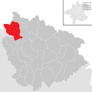
| Location of Rainbach im Mühlkreis in the Freistadt district | ||
  |
||
| Source: Municipal data from Statistics Austria | ||

Rainbach im Mühlkreis is a market town in Upper Austria in the Freistadt district in Mühlviertel with 2987 inhabitants (as of January 1, 2020).
geography
Rainbach im Mühlkreis is 712 m above sea level in the Mühlviertel. The extension is 9.5 km from north to south and 9.8 km from west to east. The total area is 48.9 km². 13.6% of the area is forested and 33.4% of the area is used for agriculture.
Community structure
The municipality includes the following 13 localities (population in brackets as of January 1, 2020):
- Ap-torture (77)
- Dreißgen (35)
- Eibenstein (151) including Enger
- Hearing loss (97)
- Kerschbaum (331)
- Labach (99)
- Rainbach im Mühlkreis (1015) including Kranklau
- Sonnberg (159)
- Stadln (27)
- Foundation (11)
- Summerau (718) with discs
- Fourteen (99)
- Zulissen (168) including Kollern and Süßengraben
The community consists of the cadastral communities Kerschbaum, Rainbach and Summerau.
The community is located in the judicial district of Freistadt .
Neighboring communities
|
Horní Dvořiště (CZ) Vyšší Brod (CZ) |
Leopoldschlag | |
| Reichenthal |
.svg)
|
Grünbach |
| Forest castle | Free City |
history

The clearing of the forest in the municipality begins around 1100. In 1142, the Roman-German King Conrad III. Today's municipality to the Garsten monastery before it came to the Babenbergs . Between 1251 and 1270 the villages in the municipality were first mentioned in a document; Sunneberch (Sonnberg), Laupach (Labach), Rainpach (Rainbach), Apphalter (Apfoltern), Summerowe (Summerau), Zulusse (Zulissen), Herslag (Hörschlag), Dorff ze Cherspaum (Kerschbaum), Ybenstain (Eibenstein). The Linzer Steig , a centuries-old trade route from the Danube region to the north , led through the main town and over the Kerschbaumer Sattel .
The first stone church was built around 1330 and has probably replaced the old wooden church. The Hussites burned the place down in 1422. Since 1490, the municipality has been part of the Principality of Austria ob der Enns . The plague hit the community in 1583. In the first half of the 17th century there were severe famines and epidemics - this historical section was called the period of horror . In the Upper Austrian Peasants' War in 1626 there was the battle at the Schanzen (near Kerschbaum) between 6 and 8 August 1626, which ended with the defeat of the peasants.
1774 to 1776 were difficult years of war. First, the Imperial and Russian troops marched through Rainbach against France before the French arrived in November 1776. In 1832 the Kerschbaum apex station (built in 1837/38) was opened with the Linz – Budweis horse-drawn railway . On July 26, 1853, almost the entire town center burned down. In 1869 Rainbach got a post office and in 1872 with the construction of the Summerau Railway the district of Summerau got a railway connection. Since December 20, 1873, Summerau has been connected to the state capital Linz by rail. The only train station in the municipality, which is operated today by the Austrian Federal Railways (ÖBB), is in Summerau. In 1874 the communities Summerau and Kerschbaum were integrated into Rainbach.
Between 1894 and 1927 the volunteer fire brigades of the respective districts were founded. In 1900 the first car drove through the town. After the First World War , the gendarmerie post was established (1918) and the elementary school in Zulissen (1919). The power supply was established from 1920, and there was a small, private electrical works in the Bruckmühle.
After the annexation of Austria to the German Reich on March 13, 1938, the place belonged to the Gau Oberdonau . During the Second World War , the Reichsstraße (today: B 310 ) was paved.
After 1945 Rainbach was in the Soviet occupation zone, which existed until 1955. In 1951 the new elementary school opened and, from 1956, the canal was built in Rainbach. From 1964 the water supply was established and in 1969 the restoration and expansion of the parish church followed. In 1973 the secondary school moved into a new building and in 1975 the Zulissen elementary school was closed. In 1977, the information age began with the purchase of the first computer for the community. In 1981 Rainbach became the most beautiful village in Upper Austria and in 1985 it was raised to the status of a market town.
The leisure facility at the Feldaist, including the swimming pond, was opened in 1988 and the St. Elisabeth retirement home has existed since 1995 . In 1996 the two museums, the Laundry Care Museum and the Horse Railway Museum in Kerschbaum , were opened. Around the turn of the millennium, the renewal and partial relocation of the water pipes and sewers in the municipality followed. In 2005 the gendarmerie post in Rainbach was dissolved.
population
| Population development | ||||
|---|---|---|---|---|
| year | Residents | year | Residents | |
| 1869 | 2,335 | 1951 | 2,759 | |
| 1880 | 2,501 | 1961 | 2,729 | |
| 1890 | 2,386 | 1971 | 2,776 | |
| 1900 | 2,381 | 1981 | 2,763 | |
| 1910 | 2,491 | 1991 | 2,881 | |
| 1923 | 2,634 | 2001 | 2,934 | |
| 1934 | 2,617 | 2011 | 2,912 | |
| 1939 | 2,602 | 2018 | 2,959 | |
In 1869, 2,335 people lived in the municipality. By 2001 the population rose to 2,934, the highest level in history. In 1991 the community had 2,881 inhabitants, in the 2001 census it had already 2,934, which corresponds to a decrease of 1.8%. The population decreased from 2001 to 2011, as both the birth balance and the migration balance were slightly negative.
In the 2001 census, the proportion of residents aged 60 and over was 17.4%; 20.5% were under 15 years old. The proportion of the female population was 49.7%.
Of the 2332 Rainbach residents who were over 15 years old in 2001, 3.6% had graduated from a university , technical college or academy . Another 7.3% had completed a high school diploma, 46.2% had completed an apprenticeship or a vocational middle school and 41.8% of all Rainbachers had compulsory school as the highest qualification.
Origin and language
The German dialect, which is generally spoken in the Rainbach area and in Upper Austria, is Middle Bavarian . In 2001, 95.7% of Rainbachers stated German as a colloquial language. Another 3.4% spoke mainly Turkish , 0.5% Czech , the rest spoke other languages.
The proportion of Rainbachers with foreign citizenship was 5.1% in 2001, below the average in Upper Austria. 2.9% of the Rainbach population had a citizenship of Turkey , 0.1% one from Germany and 0.7% were other citizens. In 2001, around 4.9% of Rainbachers were born in a country other than Austria.
coat of arms
The municipal coat of arms is in green and shows a golden, lowered bar with a golden, eight-spoke wheel. This represents the importance of the horse-drawn railway operated from 1832 to 1872 for the municipality. The station in the district of Kerschbaum was the station place at the apex of the route. The lower half shows a golden, fallen horseshoe. The wheel and horseshoe emblems can also apply to the agricultural character of the municipality. The community colors are green-yellow.
The municipal coat of arms and colors were awarded on March 4, 1968.
politics
The municipal council has 25 members.
- With the municipal council and mayoral elections in Upper Austria in 2003, the municipal council had the following distribution: 15 ÖVP, 9 SPÖ, and 1 FPÖ.
- With the municipal council and mayoral elections in Upper Austria in 2009, the municipal council had the following distribution: 17 ÖVP, 6 SPÖ, and 2 FPÖ.
- With the municipal council and mayoral elections in Upper Austria in 2015 , the municipal council has the following distribution: 14 ÖVP, 4 SPÖ, 4 BBfR, and 3 FPÖ.
- mayor
- Mayor is Günter Lorenz (ÖVP).
Culture and sights
.jpg)

- Catholic parish church Rainbach in the Mühlkreis Mariä Himmelfahrt: The four-bay, two-nave nave is the oldest ribbed vault without a keystone in the Mühlviertel. At the end of the 15th century, the church tower with its wedge roof was built as part of a renovation. The church houses stained glass windows by the artist Margret Bilger from 1963.
- Horse-drawn railway Budweis – Linz – Gmunden near Kerschbaum: 500 meters of the original line and an original passenger car were recreated.
- Horse Railway Museum Kerschbaum: Museum of the replica horse railway
- The horse-drawn railway hiking trail and the trade trail on the river run through the municipality.
nature
- Heidenstein , a shell stone near Eibenstein as a geotope
music
- The folk music formation Summerauer Buam came from Rainbach im Mühlkreis.
economy
The West-Austria-Gasleitung (WAG) crosses the municipality. In the Abfoltern district there is a gas pipeline pumping station.
On INKOBA -Betriebsbaugebiet Freistadt-Rainbach in the developed Greiner Bio-One GmbH (diagnostic and pharmaceutical industries) Since March 2009, some 100 new jobs in production, inventory and quality management, another 200 are planned by the end of 2011, which is the largest commercial operation of District emerges.
traffic
- Street: Mühlviertler Strasse (B 310) leads through the village.
education
A kindergarten , a primary school and a new middle school are available in the village .
From 2012 to 2018 the elementary school, new middle school, gym and multi-purpose hall complex was expanded, refurbished and converted into a "zero energy house". The energy figure could be reduced from over 100 kWh / m² to around 10 kWh / m². The project was awarded the following prizes:
- Energy star 2014
- Ökostar 2015
- klimaaktiv Gold Certificate - Object of the Month 4/2015
- Nomination Energy Globe 2016
safety
There are seven volunteer fire brigades in the municipality , in: Rainbach i. M., Zulissen, Eibenstein, Hörschlag, Kerschbaum, Sonnberg and Summerau.
Personalities
- Joseph Riepel (1709–1782): music theorist , violinist and composer .
- Julian Gillesberger (* 1972): musician and violist
literature
- Historical bibliography in the forum OoeGeschichte.at
Web links
- Web presence of the market town Rainbach im Mühlkreis
- Local history Rainbach
- Further information about the municipality of Rainbach im Mühlkreis on the geographic information system of the federal state of Upper Austria .
Individual evidence
- ↑ Statistics Austria: Population on January 1st, 2020 by locality (area status on January 1st, 2020) , ( CSV )
- ↑ a b Statistics Austria: Population Development. (PDF; 35 kB) In: www.statistik.at. Accessed January 31, 2020 .
- ↑ Statistics Austria: A look at the community Rainbach in the Mühlkreis. Population development 1869 - 2019. In: www.statistik.at. Accessed January 31, 2020 .
- ↑ a b Statistics Austria: Census from May 15, 2001. Demographic data. (PDF; 10 kB) In: www.statistik.at. Accessed January 31, 2020 .
- ↑ Statistics Austria: Census of May 15, 2001. Resident population by education; Families and households. (PDF; 10 kB) In: www.statistik.at. Accessed January 31, 2020 .
- ^ Province of Upper Austria, regional history: coat of arms of the community Rainbach. Retrieved October 28, 2008.
- ↑ http://www.pferdeeisenbahn.at/
-
↑ Irene Hager, Hans Katzgraber, Stefan Borovits, Gerhard Weichselbaum: The Heidenstein near Eibenstein and its possible uses. In: Upper Austrian homeland sheets . Linz 2016, pp. 209–248, PDF on land-oberoesterreich.gv.at
Der Heidenstein. In: haben.at. Accessed January 31, 2020 . - ↑ WirtschaftsBlatt : Greiner Bio-One drives production in Rainbach hoc (as of March 4, 2009)
- ^ Municipality of Rainbach, general renovation of the school. Retrieved May 12, 2019 .
- ^ Province of Upper Austria, renovation of the Rainbach school in the Mühlkreis to become a plus energy school. Retrieved May 12, 2019 .

Bad Zell | Free City | Grünbach | Gutau | Hagenberg im Mühlkreis | Hirschbach im Mühlkreis | Kaltenberg | Kefermarkt | Königswiesen | Lasberg | Leopoldschlag | Liebenau | Neumarkt im Mühlkreis | Pierbach | Pregarten | Rainbach im Mühlkreis | Sandl | St. Leonhard near Freistadt | St. Oswald near Freistadt | Schönau im Mühlkreis | Tragwein | Unterweißbach | Unterweitersdorf | Waldburg | Wartberg ob der Aist | Weitersfelden | Windhaag near Freistadt