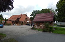
Warp
| coat of arms | Germany map | |
|---|---|---|

|
Coordinates: 52 ° 45 ' N , 9 ° 6' E |
|
| Basic data | ||
| State : | Lower Saxony | |
| County : | Nienburg / Weser | |
| Joint municipality : | County Hoya | |
| Height : | 32 m above sea level NHN | |
| Area : | 20.11 km 2 | |
| Residents: | 724 (Dec. 31, 2019) | |
| Population density : | 36 inhabitants per km 2 | |
| Postal code : | 27333 | |
| Area code : | 05022 | |
| License plate : | NI | |
| Community key : | 03 2 56 035 | |
| Community structure: | 4 districts | |
| Association administration address: | Schloßplatz 2 27318 Hoya |
|
| Website : | ||
| Mayor : | Heinz Wedekind | |
| Location of the municipality of Warpe in the Nienburg / Weser district | ||
Warpe is a municipality in the municipality of Grafschaft Hoya in the district of Nienburg / Weser in Lower Saxony .
geography
location
The municipality of Warpe is embedded in a landscape characterized by hills and valleys between 60 and 25 meters above sea level, and several watercourses arise and flow through the area, including the Bückener Mühlenbach . Dammed into small and large ponds, these brooks formed the basis for several, now disused, partly dilapidated and restored water mills.
Community structure
- Helzendorf
- Nordholz
- Warp
- Windhorst
history
From 1258 to 1555 the knight family von Warpe had their headquarters here. The Counts of Hoya also owned farms in Warpe. From 1665 to 1963 there was a school in Warpe.
Incorporations
Since the municipal reform, which came into force on March 1, 1974, Warpe has been an independent municipality with the districts (former municipalities) Helzendorf, Nordholz and Windhorst and part of the integrated municipality of Grafschaft Hoya .
Population development
| year | 1961 | 1970 | 1987 | 1992 | 1997 | 2002 | 2007 | 2008 | 2009 | 2010 | 2011 |
|---|---|---|---|---|---|---|---|---|---|---|---|
| Residents | 943 | 891 | 727 | 762 | 755 | 779 | 796 | 799 | 792 | 804 | 799 |
(1961: June 6th, 1970: May 27th, each with the current territorial status, from 1987 on each December 31st )

|
politics
Municipal council
The nine seats of the municipal council are distributed as follows:
- WG Warpe 9 seats
(Status: local election on September 11, 2016)
coat of arms
Blazon : "A silver watermill wheel in blue, accompanied on both sides by a golden ear of wheat, the stalks of which cross at the bottom, two crossed golden gable boards above the water wheel, which end in horse heads turned outwards."
Economy and Transport
The community is predominantly agricultural. In addition, tourism plays a smaller role.
Resident associations
- Harvest Club Warpe
- Warpe Volunteer Fire Brigade
- Choral society Nordholz-Helzendorf
- TSV Nordholz (sports club)
- Rifle Club Nordholz-Helzendorf
- Shooting club Warpe
- Windhorst shooting club
- Lucky bag e. V. (kindergarten)
(Source below)
Established businesses
- Mittelweser Tiefbau GmbH & Co. KG
- Hofkäserei Derboven GmbH & Co. KG
traffic
It is about 5 km to federal highway 6 . On school days there is a bus connection with the local bus line 26 of the transport company Landkreis Nienburg to Bücken and Hoya .
Personalities
- Pablo Hirndorf (* 1963), painter and object artist
- Bert Strebe (* 1958), writer, poet and journalist
Web links
Individual evidence
- ↑ State Office for Statistics Lower Saxony, LSN-Online regional database, Table 12411: Update of the population, as of December 31, 2019 ( help ).
- ↑ a b Federal Statistical Office (ed.): Historical municipality register for the Federal Republic of Germany. Name, border and key number changes in municipalities, counties and administrative districts from May 27, 1970 to December 31, 1982 . W. Kohlhammer GmbH, Stuttgart / Mainz 1983, ISBN 3-17-003263-1 , p. 191 .
- ↑ LSKN-Online
- ↑ https://wahlen.kdo.de/content.php?kunde=sg_grafschaft_hoya&wahlverz=sg_grafschaft_hoya/web/201609_K__Gemeinderatswahl_Warpe_11.09.2016&wahlname=Gemeinderatswahl_Warpe_11.09.2016&atei=160524135006727_0_1_t.html
- ↑ http://www.grafschaft-hoya.de
- ↑ https://www.mittelweser-tiefbau.de/home/
- ↑ https://rzbderboven.de/der-hof/


