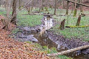
Wehrbachtal
|
Wehrbachtal
|
|
| location | North Rhine-Westphalia , Germany |
| surface | 13.08 hectares |
| Identifier | GT-028 |
| WDPA ID | 166196 |
| Geographical location | 51 ° 54 ' N , 8 ° 39' E |
| Setup date | 1990 |
| administration | Lower landscape authority of the Gütersloh district |
The Wehrbachtal is a nature reserve with a size of 13.08 hectares in Holte-Stukenbrock Castle in the Gütersloh district . It is listed under the number GT-028 and consists of two areas separated by a street.
The area was designated as a nature reserve in 1990. It is used to maintain a morphologically particularly pronounced Kastentals in the Senne with a natural course of military Bach (later in " Wapel called"), and to protect brook alder - ash -Wäldern, waste wood stocks, wet meadows and tall herb communities and their endangered animal and plant species ( e.g. kingfisher ), especially as a habitat for bat species .
It is also intended to secure or develop habitats in damp to wet locations and to promote the development of heather and silver grass fields in dry locations .
Individual evidence
- ^ "Wehrbachtal" nature reserve (GT-028) in the specialist information system of the State Office for Nature, Environment and Consumer Protection in North Rhine-Westphalia , accessed on March 7, 2017.
Web links
- "Wehrbachtal" nature reserve (GT-028) in the specialist information system of the State Office for Nature, Environment and Consumer Protection in North Rhine-Westphalia


