Rietberger Ems valley
|
Rietberger Ems valley
IUCN Category N / A - |
|
|
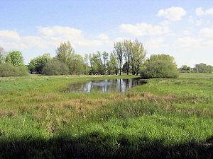
View over the Emsauen |
|
| location | North Rhine-Westphalia , Germany |
| surface | 4,313 km² |
| Identifier |
GT-001K1 PB-030K2 |
| Geographical location | 51 ° 48 ' N , 8 ° 26' E |
| Setup date | 1989 |
| administration | Lower landscape authorities of the Gütersloh and Paderborn districts |
The Rietberger Emsniederung is a cross-district wet meadow protection area with a size of 431.33 ha on the Ems , which is mainly (420.36 ha) in Rietberg in the Gütersloh district and a small part (10.96 ha) in Delbrück in the Paderborn district . It is carried with the numbers GT-001K1 and PB-030K2. After the Hörste wet meadows, it is the second largest nature reserve in the Gütersloh district and consists of two areas separated only by a road.
It was designated in 1989 for the preservation of communities and habitats of wild flora and fauna and because of the rarity, uniqueness and beauty of the area.
Together with the Steinhorster Basin , the Ems lowland forms a Natura 2000 - and thus a protected area with a size of 929 ha according to the FFH directive . This area is one of the most important breeding, resting, migration and wintering areas for birds in North Rhine-Westphalia and in connection with the Senne bird sanctuary , the Rietberger Fischteiche nature reserve in the south-west and the Emssee nature reserve , it is one of the ecologically most valuable landscape areas in the regional natural area.
In terms of natural space, the Rietberger Ems lowland belongs to the Ostmünsterland sands within the Ems sand plain in the Westphalian Bay .
Characteristic
The Rietberger Ems lowland is located in a depression , which is why the water level of the Ems is above the level of the surrounding land area. This situation repeatedly led to floods in the lowland area, which is why the area has quarry land and wet meadows in large areas . Since the agricultural use was only possible to a limited extent, a pond landscape was created as the core of today's nature reserve, which is the eastern boundary of the Rietberger Gartenschaupark.
In addition to the Ems, the lowland area is crossed by other flowing waters; these include the marrow ditch that tapers from the Schöning area and the Dortenbach emerging within the protected area .
literature
- Wilhelmine Herbort, Hans M. Bröskamp, Peter Rüther, Christel Schröder, Bernhard Walter: The Rietberger Emsniederung, a landscape through the ages . In: Publications from the Gütersloh district archive . tape 5 . Publishing house for regional history, 1999, ISBN 978-3-89534-271-4 .
Web links
- Nature reserve "Rietberger Emsniederung" (GT-001K1) in the specialist information system of the State Office for Nature, Environment and Consumer Protection in North Rhine-Westphalia
- Nature reserve “Rietberger Emsniederung” (PB-030K2) in the specialist information system of the State Office for Nature, Environment and Consumer Protection in North Rhine-Westphalia
Individual evidence
- ^ Detmold district government: Rietberger Emsniederung. Retrieved May 20, 2014 .
- ↑ Nature reserve "Rietberger Emsniederung" (GT-001K1) in the specialist information system of the State Office for Nature, Environment and Consumer Protection in North Rhine-Westphalia , accessed on March 7, 2017.
- ↑ Natura 2000: Bird sanctuary "Rietberger Emsniederung with Steinhorster Basin". Retrieved May 20, 2014 .


