Boom mountains
|
Boom mountains
IUCN Category N / A - |
|
|
In the Boomberge nature reserve |
|
| location | North Rhine-Westphalia , Germany |
| surface | 118 ha |
| WDPA ID | 344626 |
| Geographical location | 51 ° 57 ' N , 8 ° 14' E |
| Setup date | July 26, 2004 |
| administration | Lower landscape authority of the Gütersloh district |
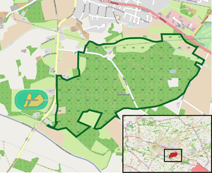
The Boomberge are an area characterized by inland dunes between the rivers Ems and Lutter south of Harsewinkel , Gütersloh district , North Rhine-Westphalia . Since July 26, 2004, the 118 hectare site has been designated as a nature reserve.
landscape
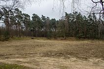
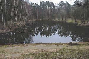
The boom mountains formed towards the end of the last ice age 10,000 years ago. When the ice melted, water-rich rivers formed that carried large amounts of sand with them. This sand settled on the banks and was blown into dunes. With the warming a heathland was created , which was used as pasture for sheep herds from the Middle Ages until the beginning of the 20th century . Later, the area was mainly reforested with pine trees . Oak , birch , mountain ash and buckthorn now also grow in the boom mountains . In the south of the area there is a sandy grassland , in the north-east there is an alder - quarry forest , in the east there is a vegetation-free sand area and an artificially created still water .
The highest point of the Harsewinkel urban area, which is part of the Münsterland landscape (administratively to East Westphalia-Lippe ) is located on the site . According to the website of the city of Harsewinkel, this point is 79.9 meters above sea level , according to the signs from the Lower Landscape Authority in the nature reserve 80.1 meters above sea level.
The boom mountains as a biotope
The boom mountains have been designated as a legally protected biotope because of the existence of some rare animal and plant species that are on the red list . In the boom mountains grow u. a. Sand sedge , mountain sand bells , bare-stemmed farm mustard and spring spark , the copper-brown tiger beetle can be seen on the surface , especially in strong sunlight, and dragonfly species such as the banded demoiselle and the blue-green mosaic damsel can be found in the waters .
The boom mountains as a water reservoir
The Harsewinkel waterworks operates eight vertical gravel fill wells for drinking water in the boom mountains . With submersible motor pumps , groundwater is pumped from a depth of around 20 meters and fed to the waterworks via pipes. The officially determined delivery rates per hour, day and year take into account the ecological conditions of the area.
The boom mountains as a local recreation area
The boom mountains are used as a recreational area by walkers, hikers, joggers, walkers, cyclists, mountain bike riders and horse riders alike. The popularity of excursionists in general and the misconduct of a few in particular makes it increasingly difficult to combine the goals of local recreation and nature conservation. In order to get the problem under control, the district of Gütersloh closed numerous trails through shrub cuttings and fences in 2004 and, in cooperation with local sports clubs, established special routes for joggers, cyclists and riders. In addition, a parking lot was built on the western edge of the area in order to curb "wild" parking in the nature reserve.
Web links
- "Boomberge" nature reserve (GT-037) in the specialist information system of the State Office for Nature, Environment and Consumer Protection in North Rhine-Westphalia


