
Cedar house
|
Cedar house
|
||
|---|---|---|
| coat of arms | Austria map | |
 |
|
|
| Basic data | ||
| Country: | Austria | |
| State : | Salzburg | |
| Political District : | Tamsweg | |
| License plate : | TA | |
| Surface: | 130.53 km² | |
| Coordinates : | 47 ° 9 ' N , 13 ° 31' E | |
| Height : | 1205 m above sea level A. | |
| Residents : | 1,171 (January 1, 2020) | |
| Population density : | 9 inhabitants per km² | |
| Postal code : | 5584 | |
| Area code : | 06478 | |
| Community code : | 5 05 15 | |
| NUTS region | AT321 | |
| Address of the municipal administration: |
Zederhaus 25 5584 Zederhaus |
|
| Website: | ||
| politics | ||
| Mayor : | Thomas Kößler ( ÖVP ) | |
|
Municipal Council : ( 2019 ) (13 members) |
||
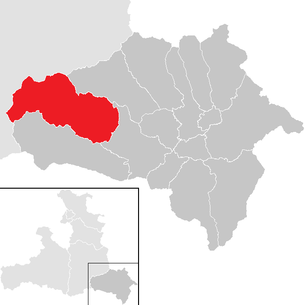
| Location of Zederhaus in the Tamsweg district | ||
  |
||
 The Zederhausen parish church with the rectory in the foreground |
||
| Source: Municipal data from Statistics Austria | ||

Zederhaus is one of the 15 communities in the district of Lungau , Salzburg in Austria with 1171 inhabitants (as of January 1, 2020). In terms of area, Zederhaus is the largest municipality in Lungau.
geography

The Zederhaus valley is located in the western part of the Lungau and runs parallel to the Murtal from north-west to south-east. Until the end of January 1962 the community belonged to the judicial district of Sankt Michael im Lungau , since February 1, 1962 it has been part of the judicial district of Tamsweg . The valley is bordered by the Weißenckkamm in the southwest (highest elevation: Weißeck , 2711 m ) and the Hochfeindkamm in the northeast (highest elevation: Hochfeind , 2687 m ) - two branches of the Radstädter Tauern .
The municipality of Zederhaus borders the municipalities of Flachau , Kleinarl and Hüttschlag in the north, Muhr in the west, Sankt Michael im Lungau in the south, and Tweng in the east. Road connections exist only to Sankt Michael and via the Tauern tunnel to Flachau.
Community structure
The municipality includes the following four localities (population in brackets as of January 1, 2020):
- Lamb (367)
- Rothenwand (227)
- Forest (1)
- Cedar House (576)
The community consists of the cadastral communities Lamm, Rothenwand, Wald and Zederhaus.
coat of arms
The coat of arms of the community is: “The shield on the left diagonally covered by the middle part of a Zederhauser prang bar , decorated with colorful ribbons and flowers; above the gold- nimbed St. John the Baptist , dressed in a brown, sleeveless, hairy robe , his right hand leaning on the golden cross staff , loosely wound in a spiral with a silver ribbon, with his left hand made from a golden bowl dispensing the water for baptism; below in green a slanting left silver eagle down feather. "
politics
The community council has a total of 13 members.
- With the municipal council and mayoral elections in Salzburg in 2004, the municipal council had the following distribution: 7 ÖVP, 4 SPÖ, and 2 FPÖ.
- With the municipal council and mayoral elections in Salzburg in 2009 , the municipal council had the following distribution: 7 ÖVP, 3 SPÖ, and 3 FPÖ.
- With the municipal council and mayoral elections in Salzburg in 2014 , the municipal council had the following distribution: 8 ÖVP, 4 FPÖ, and 1 SPÖ.
- With the municipal council and mayoral elections in Salzburg 2019 , the municipal council has the following distribution: 8 ÖVP, 4 FPÖ, and 1 SPÖ.
- mayor
- until 1920 Thomas Wieland, blacksmith
- 1920–1922 Matthäus Gruber, Gruberbauer
- 1922–1923 Franz Gfrerer, cooker maker
- 1923–1931 Bartl Gfrerer, house builder
- 1931–1938 Josef Moser, master tailor
- 1938–1940 Peter Gruber, master wagoner
- 1941–1942 Andrä Moser
- 1942–1945 Emanuel Rothenwänder
- 1945–1949 Johann Gfrerer, sexton maker (provisional)
- 1949–1969 Josef Bacher, farmer ( ÖVP )
- 1969–1979 Josef Gfrerer, Moosbauer (ÖVP)
- 1979–1998 Alfred Zanner (* 1932), master blacksmith (ÖVP)
- 1999–2019 Alfred Pfeifenberger (* 1958) (ÖVP)
- from 2019 Thomas Kößler (ÖVP)
Culture and sights

- Catholic parish church Zederhaus hl. John the Baptist
- Zederhauser prangstangen
- Mühlenweg Zederhaus
- The Maurergut memorial yard gives the visitor an insight into rural life in past centuries.
power plant
The Zederhaus power plant from the Schliereralm storage facility is part of the Lungau power plant group , collects 10 mountain streams in 2 side lines, went into operation in 1984 and delivers up to 10 MW of power.
traffic
- Road: The community of Zederhaus is located on the Tauern A10 motorway and is connected to and from Salzburg by a semi-junction . Furthermore, the municipality is accessed through the Zederhauser Landesstraße.
Personalities
- Anton Bayr (* 1927), politician and district school inspector
- Heimo Pfeifenberger (* 1966), soccer player and coach
- Michael Pfeifenberger (* 1965), director and screenwriter
- Valentin Pfeifenberger (1914–2004), clergyman
- Wolfgang Pfeifenberger (* 1967), politician
- Ernst Rothenwänder (* 1947), politician
- Josef Sampl (* 1948), politician and teacher
Web links
- Community website
- Zederhaus Tourist Association
- 50515 - cedar house. Community data, Statistics Austria .
- Entry on Zederhaus in the Austria Forum (in the AEIOU Austria Lexicon )
Individual evidence
- ↑ Statistics Austria: Population on January 1st, 2020 by locality (area status on January 1st, 2020) , ( CSV )
- ↑ Alfred Pfeifenberger . In: Salzburger Nachrichten : Salzburgwiki .
- ↑ Mühlenweg Zederhaus: From grain to bread
- ↑ Description of the Maurergut monument courtyard
- ↑ Riedingtal Nature Park

Göriach | Lessach | Mariapfarr | Mauterndorf | Muhr | Ramingstein | St. Andrä | St. Margarethen | St. Michael | Tamsweg | Thomatal | Tweng | Unterberg | Weißpriach | Cedar house