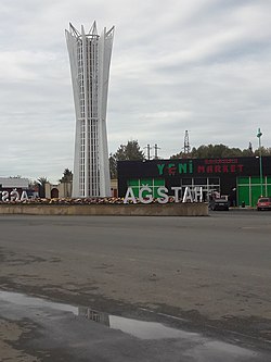
Ağstafa (city)
| Agstafa | ||

|
||
|
||
| State : |
|
|
| Coordinates : | 41 ° 7 ' N , 45 ° 27' E | |
| Height : | 340 m | |
| Residents : | 12,400 (2012) | |
| Time zone : | AZT ( UTC + 4 ) | |
| Telephone code : | (+994) 244 | |
| Community type: | City (şəhər) | |
|
|
||
Ağstafa (also Agstafa) is a city in Azerbaijan .
geography
Ağstafa is 454 km away from Baku in the valley of the Kura River and has 12,400 inhabitants (2012). There is a train station in the city and the Tbilisi -Baku highway runs through the city.
history
Historical reference books suggest that the city appeared around the railway line during construction in the second half of the 19th century. In the place where the city is now, a train station called Ağstafa was placed with the name of the nearby village. Soon the village and train station merged and were given city status. The city's status was granted in 1941.
Twin cities
Web links
Commons : Ağstafa - collection of images, videos and audio files

