
Böhmetal near Huckenrieth
|
Böhmetal near Huckenrieth
|
||
 Böhmetal near Huckenrieth |
||
| location | North of Soltau in Lower Saxony Heidekreis | |
| surface | 96.0 ha | |
| Identifier | NSG LÜ 021 | |
| WDPA ID | 81432 | |
| FFH area | 84.7 ha | |
| Geographical location | 53 ° 3 ' N , 9 ° 51' E | |
|
||
| Sea level | from 70 m to 85 m | |
| Setup date | December 16, 1972 | |
| administration | NLWKN | |

The Böhmetal near Huckenrieth is a nature reserve with the license plate number NSG LÜ 021 in the areas of the cities of Soltau and Schneverdingen in the Heidekreis district in Lower Saxony .
location
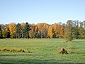
The 96 hectare Böhmetal near Huckenrieth lies between the Schneverdingen districts of Heber and Langeloh and the Soltau district of Wolterdingen . The eponymous Hucke Rieth is a belonging to Wolterdingen Weiler . The river Böhme flows through the nature reserve .
description
The nature reserve includes a section of the Bohemian lowlands, the valley slope and the dunes at the edge . The plant communities growing here, such as wet alder and birch forest , gagelstrauch , a nutrient-poor silting complex with peat moss , Schnabelried and moor lily and dry heather and pines , between which crowberries have spread on the dunes, are typical of the northwest German old moraine landscape , but very become rare.
history
With an ordinance of November 29, 1972, the Böhmetal near Huckenrieth was declared a nature reserve. The district of Heidekreis is responsible as the lower nature conservation authority.
Picture gallery

Bank in the Boehmetal
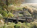
Bridge over the Bohemian
former Rieselwiesen


Web links
- Nature reserve "Böhmetal bei Huckenrieth" in the database of the Lower Saxony State Office for Water Management, Coastal and Nature Conservation (NLWKN)
- Topographic map of the nature reserve


Aller-Leinetal | Allern lowlands near Klein Häuslingen | All loops between Wohlendorf and Hülsen | Bansee | Birch Lake | Böhmetal near Huckenrieth | Brambosteler Moor | Ehbläcksmoor | Great moor near Becklingen | Groundless moor | Barrow heather near Langeloh | Lehrdetal | Lichtenmoor | Lönsgrab | Lührsbockeler Moor | Lüneburg Heath | Moor near Osterwede | Moor in the Schotenheide | Upper Wümmeniederung | Upper Fintautal | Ottinger Ochsenmoor | Riensheide with Stichter See and Sägenmoor | Black moor near Dannhorn | Seemoor and Schwarzes Moor near Zahrensen | Söhlbruch | Valley of the Little Örtze | Vehmsmoor | Wietzendorfer Moor | Wittenmoor