
Caraga
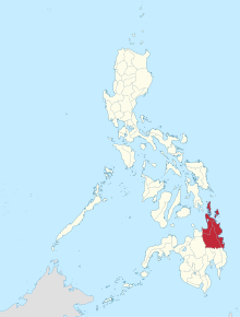
Caraga or Region XIII is a Philippine region in the northeast of Mindanao Island .
The Caraga region consists of the following five provinces: Agusan del Norte , Agusan del Sur , Dinagat Islands , Surigao del Norte and Surigao del Sur . The top five cities are Butuan City , Surigao City , Bislig City , Tandag City, and Cabadbaran City .
The administrative center is located in Butuan City .
geography
The Caraga region is located in northeast Mindanao . It is bounded in the north by the Mindanao Sea and in the south by the provinces Davao del Norte , Davao de Oro and Davao Oriental of Region XI . To the west are the provinces of Bukidnon and Misamis Oriental of Region X and to the east is the Philippine Sea , which is part of the Pacific Ocean .
The region has a total area of 21,478 km². This is 6.3% of the total land area of the Philippines and 22.7% of Mindanao Island. The largest province is Agusan del Sur , which alone occupies 47.6% of the region.
Most of Caraga is forested (71.22%). The region essentially consists of a low mountain range ( Diwata Mountains ) and extensive plains. The Diwataberge separate the Agusan- from the Surigao provinces and divide large portions of the lowlands along the Pacific coast. The largest agricultural areas are located along the basin of the Agusan River . The Agusan Marsh, a large and well-known wetland in the south of the Philippines, is located in the center of the Agusan del Sur province .
Of the lakes, Mainit Lake is the largest within this region. There are a total of eight municipalities on its banks: Alegria, Tubod, Mainit and Sison from the province of Surigao del Norte and Tubay, Santiago, Jabonga and Kitcharao from the province of Agusan del Norte .
Demographics and language
Based on the 2000 census, the region has a population of 2,095,367 people. The average growth rate over the last five years is 1.63%, one of the lowest in the entire island state. The population in 2015 is 2,429,224 people.
Of the four provinces, Agusan del Sur has the highest population with 559,294 and Surigao del Norte the lowest with 481,416 people. Butuan City is the largest city in the region with a population of 267,279.
In earlier times, many immigrants came from the central country of Asia. They were followed by Malays, Arabs, Chinese, Japanese, Spaniards and Americans. During the 20th century, immigrants from the Visayas and the areas of Luzon increased . Most of these immigrants used the Cebuano language and settled in the rural areas.
Cebuano is now spoken by 43.79% of the residents. Other dialects are Butuanon, which is used by 31.9% of the population, Surigaonon with a share of 25.21%, Kamayo with 7.06%, Boholanon with 5.87%, Manobo with 4.73% and Hiligaynon with 2 , 87%.
Surigaonon is mainly spoken in the province of Surigao del Norte and some parts of Agusan del Norte , especially in the localities on Lake Mainit . Surigaonon is related to the native languages Butuanon and the Tausug dialects.
The dominant religion is Roman Catholic , which includes 1,397,343 or 79% of the population of Caraga. The largest proportion of native ethnic and religious groups, with 294,284 or 43.55%, are the Manobos. Other common ethnic groups are the Kamayo, the Higa-onon, the Banwaon, the Umayamnon and the Mamanwa.
economy

Agriculture, fishing and the timber industry are Caraga's largest industries.
In agriculture, crops such as bananas , coconut , mangoes , calamansi , rubber , oil palms , wheat and rice are mainly grown. In addition, livestock and poultry farming are other agricultural factors in the region.
Along the long coastal areas of the Mindanao Sea in the north and northwest, and the Philippine Sea in the northeast, fishing is a main source of income for the residents. Here, as well as from the Agusan River , which flows through large parts of the region, and the Mainit Lake , shrimp , crabs , milk fish and seaweed are caught or harvested.
The main branches of the local industry are wood processing and mining. The region is rich in natural resources. It has large areas of productive and fertile land and is known for its timber industry, its abundant water resources and its rich mineral deposits such as iron , gold , silver , nickel , chromite , manganese and copper .
The wide stretches of coast, especially the province of Dinagat Islands , as well as the mountain ranges around the Hilong-Hilong mountain make the region interesting for tourism. Mountain hikes, mountain biking, diving, or tours on the Agusan River are among the tourist offers. In addition to the beaches, the coral reefs and the mountains, various caves, hot and cold springs, the evergreen forest areas, many historical sites and the pleasant weather in this region are also worth seeing.
Administrative division
Caraga is politically divided into 5 provinces and one province-free city, Butuan City . A total of 70 independently administered municipalities belong to the region. These are in turn divided into a total of 1,310 Baranggays (districts).
The region consists of a total of 7 congress districts.
| Province / City | Headquarters | Population ( 2010 ) |
Area ( km² ) |
Inhabitants (per km² ) |
|---|---|---|---|---|
| Agusan del Norte | Cabadbaran City |
332,487
|
1,773.2
|
187.51
|
| Agusan del Sur | Prosperidad |
656.418
|
8,966.0
|
73.21
|
| Dinagat Islands | San Jose |
126,803
|
802.1
|
158.09
|
| Surigao del Norte | Surigao City |
442,588
|
1,936.9
|
228.50
|
| Surigao del Sur | Tandag City |
561.219
|
4,552.2
|
123.29
|
| Butuan City |
-
|
309,709
|
817.3
|
378.94
|
Cities
| city | province | Population ( 2010 ) |
Area ( km² ) |
Inhabitants per km² |
|---|---|---|---|---|
| Bislig City | Surigao del Sur |
96,578
|
405.0
|
238.45
|
| Tandag City | Surigao del Sur |
52.114
|
316.2
|
164.81
|
| Surigao City | Surigao del Norte |
140,540
|
245.3
|
572.84
|
| Bayugan City | Agusan del Sur |
99,361
|
505.0
|
196.75
|
| Cabadbaran City | Agusan del Norte |
69,241
|
327.5
|
211.42
|
history
The history of Caraga can be traced back to the 4th century. When the researchers discovered the existence of the "Kalagans", an ethnic group of this area, they believed that they came from the Visayas . The word Caraga is therefore derived from the word Kalagan from the Cebuano language . The syllable kalag means something like soul or people and an means land . The Kalagans have a long history and are considered brave and fearless. That is why the region is also referred to by the first chroniclers as the "land of brave and fearless people".
In 1976, 600-year-old remains of the Balangay , large ocean-going boats , were found in Butuan City, Libertad . After further archaeological excavations in Butuan , the outlines of a pre-colonial port facility , skeletons and valuable funerary objects were discovered, which seem to confirm the assumption that Butuan is the oldest fortified settlement in the Philippines and can be traced back to the early Middle Ages .
The "Kalagans", called "Caragans" by the Spaniards, settled the present two provinces Surigao del Norte and Surigao del Sur , the northern part of Davao Oriental and the east of Misamis Oriental .
From 1597, Jesuit missionaries attempted to convert the people of Butuan (the area of today's Agusan provinces) and Caraga (today's Surigao provinces) to Christianity, but with little and only short-term success. They were followed in 1622 by the Augustinians , who established parishes in Tandag and in 1642 in Bislig. The order maintained its presence in the area until 1875, after which the Benedictine monks took over the Christian work in the district from 1893 to 1908.
The original district of Caraga was formed in 1609 and included the present-day provinces of Surigao del Norte , Surigao del Sur , the north of Davao Oriental and the east of Misamis Oriental , Agusan del Norte and Agusan del Sur .
In 1860 the Spanish colonial government established six military districts on Mindanao. Surigao and Agusan, including the areas between Butuan and the Bay of Caraga, were established together as the third district called the Eastern District and changed to the Distrito de Surigao by 1870 .
Towards the end of Spanish rule in 1898, the two present-day Agusan provinces were organized into a single politico-military command with the name Butuan and subordinated to the administrative jurisdiction of Surigao.
In 1901 this command office became a subdivided province of Surigao and in 1907 Agusan became an independent province.
At that time Butuan was only a village in Agusan Province. The boom in the timber industry ensured that trade and commerce found their way into the area in the 1950s. On August 2, 1950, Butuan was raised to the status of a notarized city with the effect of Republic Act No. 523 as the first place of today's Caraga district.
On June 19, 1960, Surigao was divided into a northern province, Surigao del Norte , and a southern province , Surigao del Sur , by Republic Act No. 2766 . In June 1967 the province of Agusan was divided into the new provinces of Agusan del Norte and Agusan del Sur .
As the last chapter in the history of Caraga, Dinagat Islands was split off from Surigao del Norte on December 2, 2006 and was granted the status of a new, independent province.
climate
The climate of the Caraga region is classified as climate type II and is not characterized by a distinct rainy or dry period. According to the weather records, the months of November to March are the rainiest of the year, with 18 to 25 rainy days per month.
The provinces of Surigao del Sur and Surigao del Norte are vulnerable to stronger winds and their weather is temporarily affected by the northwest monsoons.
The minimum and maximum temperatures are between 22.4 ° C and 32.4 ° C.
Colleges
- Bukidnon State University
- Philippine Normal University
- Surigao del Sur State University
- University of Southeastern Philippines
Attractions
- Butuan City Archaeological Dig Site
- the Britania archipelago
- The Mt. Hilong Hilong
- Mt. Mabaho in the Diwata Mountains
- The Mainit lake
- The Trinos Beach Resort
- The Magellan's Mark, the place where Magellan is said to have held his first mass in the Philippines on April 8, 1521.
- The Cabadbaran Museum
- The Anitapan Falls
- The Amontay Canyon
- The Gibong River
- The Binaba Falls near Prosperidad
- The Bega Falls near Prosperidad
- The Tugonan Falls near Prosperidad
- The Agusan Marshes (Agusan Marsh)
- Mt Magdiwata in San Francisco
- The Mt Diwata hot & cold springs
- The cathedral in Tandag
- The Church of San Agustin
- The Kaliguan Festival
- General Luna Beach
- The Magpupungko rock formation in Pilar, Siargao
- The Bababu Lake in Basilisa
- The Biyabid Falls in Sison
- Alingkakajaw Island
- The Mini Dam Park in San Jose
- The Cabadbaran-Santiago Watershed Forest Reserve
- The Siargao Islands Protected Landscape and Seascape
Web links
- Further historical information about Caraga from the Agusan – Surigao Historical Archive ( Memento from October 17, 2002 in the Internet Archive )
- Information on Caraga (.doc; 261 kB)
Individual evidence
- ↑ 2015 Population Counts Summary. In: psa.gov.ph. Retrieved June 4, 2016 .
Coordinates: 8 ° 55 ' N , 125 ° 30' E