
Col de la Madeleine
| Col de la Madeleine | |||
|---|---|---|---|
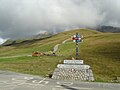
 North side of the Col de la Madeleine |
|||
| Compass direction | North | south | |
| Pass height | 1993 m | ||
| department | Savoie , France | ||
| Valley locations | La Léchère | La Chambre | |
| expansion | Pass road (D213) | ||
| Winter closure | November to early June | ||
| Mountains | french alps | ||
| profile | |||
| Mountain scoring | HC | HC | |
| Ø pitch | 5.4% (1465 m / 28.3 km) | 8.0% (1547 m / 19.3 km) | |
| Max. Incline | (at km 9) | (at km 10) | |
| map | |||
|
|||
| Coordinates | 45 ° 26 '7 " N , 6 ° 22' 32" E | ||

The Col de la Madeleine is a 1993 meter high alpine pass in France . It is located in the Savoie department , which belongs to the Auvergne-Rhône-Alpes region . It connects the place La Chambre on the river Arc in the Maurienne area with the places Aigueblanche and Feissons-sur-Isère in the Tarentaise . The south approach from La Chambre measures 19.3 kilometers with an average gradient of 8.0 percent, the north approach from Aigueblanche 28.3 kilometers with an average gradient of 5.4 percent. Winter closure is from November to early June. Both climbs are equipped with special milestones for cyclists at intervals of one kilometer .
The Col de la Madeleine has so far been part of the Tour de France program 26 times, the first time in the 1969 Tour , and the last time in 2018 during the 12th stage . The pass is always classified as a mountain rating in the Hors Catégorie .
In the Maurienne area there is another Col de la Madeleine (1746 m) on the D902 road. But this is not a mountain pass that connects two valleys. Rather, it is a small intermediate stage, which is due to the route of the road through the Arc Valley.
The exact height of the pass
On the old and new pass signs and in connection with the Tour de France , an altitude of 2000 meters is indicated (see picture gallery). The correct altitude of 1993 m can be found in both printed and online maps from Michelin and the Institut géographique national (IGN) .
Old passport sign (until 2013)

New passport plate (from 2014)

Route profile of the 19th stage of the Tour de France 2013


literature
- Road bike guide: Kristian Bauer: Roadbook Tour de France. Conquer 40 top climbs from the Alps to the Pyrenees on your own racing bike. (Plus highlights from the history of the tour). Bruckmann, Munich 2006, ISBN 3-7654-4477-4 .
- History: Peter Leissl : The legendary climbs of the Tour de France. Covadonga, Bielefeld 2004, ISBN 3-936973-09-1 .
Web links
Individual evidence
- ↑ Online map at Géoportail . Retrieved July 29, 2015.
- ↑ Topographic map issued by IGN number 3433 ET, scale 1:25,000.
- ↑ Map published by Michelin 333 Local Isère, Savoie, scale 1: 150,000.
- ↑ Online map at Géoportail . Retrieved July 28, 2015.
- ↑ ViaMichelin: Maps, route planning, traffic, weather, hotel reservations . Retrieved July 28, 2015.
Agnel • Allos • Andrion • Aravis • Bonette • Braus • Cayolle • Champs • Colle-Saint-Michel • Colombière • Croix de Fer • Croix-Fry • Cuillole • Galibier • Gets • Glandon • Granon • Iseran • Izoard • Jambaz • Joux Plane • Joux Verte • Larche • Lautaret • Lebraut • Lombarde • Madeleine • Saint Martin • Méraillet • Mollard • Mont Cenis • Montets • Montgenèvre • Morgins • Moutière • Ornon • Pré • Petit Saint-Bernard • Pontis • Ramaz • Roselend • Rousset • Saisies • Télégraphe • Tende • Turini • Valberg • Vars