
Col de la Cayolle
| Col de la Cayolle | |||
|---|---|---|---|
 Near the top of the pass |
|||
| Compass direction | North | south | |
| Pass height | 2326 m | ||
| Department | Alpes-de-Haute-Provence | Alpes-Maritimes | |
| Valley locations | Barcelonnette | Saint-Martin-d'Entraunes | |
| expansion | D 902 / D 2202 | ||
| Mountains | Maritime Alps | ||
| profile | |||
| Mountain scoring | 1 | 1 | |
| Ø pitch | 4.1% (1190 m / 29.2 km) | 6.3% (1291 m / 20.5 km) | |
| map | |||
|
|||
| Coordinates | 44 ° 15 '32 " N , 6 ° 44' 38" E | ||

The Col de la Cayolle is a mountain pass in the French Maritime Alps on the border of the Alpes-de-Haute-Provence and Alpes-Maritimes in the Provence-Alpes-Côte d'Azur region . The pass is at 2326 m . It connects Barcelonnette ( 1150 m ), in the Ubaye valley , with Saint-Martin-d'Entraunes ( 1050 m ).
geography
Like the parallel north-south connections Col d'Allos and Col de la Bonette , the Col de la Cayolle is located in the Mercantour National Park .
The river Var rises near the Cayolle and serves as the namesake of the department of the same name on the Côte d'Azur . In the further course of the pass road from Saint-Martin-d'Entraunes to the south, the Var has dug a remarkable deep canyon in red clay, the “ Gorges de Daluis ”.
The white water river Bachelard runs north .
Human use
The Col de la Cayolle, together with the Col des Champs and Col d'Allos, form a popular circuit for racing cyclists. The ascent from Barcelonnette is equipped with special signs for cyclists .
Cayolle pass crossing

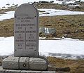
One of the mileage marks for cyclists


Web links
Individual evidence
- ↑ See for example Cayolle-Champs-Allos - Bikemap - Your bike routes online (in English) . bikemap.net. Retrieved July 18, 2015.
Agnel • Allos • Andrion • Aravis • Bonette • Braus • Cayolle • Champs • Colle-Saint-Michel • Colombière • Croix de Fer • Croix-Fry • Cuillole • Galibier • Gets • Glandon • Granon • Iseran • Izoard • Jambaz • Joux Plane • Joux Verte • Larche • Lautaret • Lebraut • Lombarde • Madeleine • Saint Martin • Méraillet • Mollard • Mont Cenis • Montets • Montgenèvre • Morgins • Moutière • Ornon • Pré • Petit Saint-Bernard • Pontis • Ramaz • Roselend • Rousset • Saisies • Télégraphe • Tende • Turini • Valberg • Vars