Col du Galibier
| Col du Galibier | |||
|---|---|---|---|
|
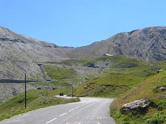
The last two kilometers from the north |
|||
| Compass direction | north | south | |
| Pass height | 2642 m | ||
| Department | Savoie , France | Hautes-Alpes | |
| Watershed | Valloirette , Arc | Romanche and Guisane | |
| Valley locations | Valloire | Col du Lautaret | |
| expansion | Pass road (D902) / summit tunnel | ||
| Built | 1876 | ||
| Winter closure | around October 15 - around June 1 | ||
| Mountains | french alps | ||
| profile | |||
| Mountain scoring | HC | HC | |
| Ø pitch | 7.7% (1226 m / 16 km) | 6.9% (587 m / 8.5 km) | |
| Max. Incline | 10% | 12% | |
|
Incline profile of the north side with the Col du Télégraphe |
|||
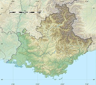
| Map (Hautes-Alpes) | |||
|
|
|||
| Coordinates | 45 ° 3 '50 " N , 6 ° 24' 29" E | ||
The Col du Galibier ( French for “Pass von Galibier”) is a mountain pass in the French part of the Alps . The pass road leading over the Col was built in 1876 and with a height of 2642 m (according to older information 2645 m ) is the fifth highest asphalt road pass in the Alps as of autumn 2007. The departmental road D 902 leading over the pass connects the two departments of Savoie in the north and Hautes-Alpes in the south, the border of which runs at the top of the pass. At the same time, the Galibier also separates the Auvergne-Rhône-Alpes region in the north from the Provence-Alpes-Côte d'Azur region in the south, as well as the (former) Franco-Provencal and Occitan areas .
history
Opening of the pass road in 1876
After widening the last bends of the old mule track over the Col du Galibier, the first pass road between the Maurienne and the Briançonnais or the Oisans was opened in 1876 . The pass road begins in the north in the winter sports resort Valloire , this place can only be reached via the Col du Télégraphe , which is upstream of the Galibier and connects Saint-Michel-de-Maurienne with Valloire. In the south, the road up to the Galibier begins on the 2057 m high Col du Lautaret , which connects Grenoble in the west with Briançon in the east. The culminating point of this first pass road over the Galibier was at an altitude of 2658 m and thus 16 meters higher than today's pass height. The entire pass road between Valloire and the Col du Lautaret is 24.5 kilometers long, 16 kilometers of which are on the north ramp and 8.5 kilometers on the south ramp. The road over the Galibier was initially designed as a dirt road and has only recently been paved.
Construction and commissioning of the summit tunnel in 1890/1891
Because the passage of the Galibier was very difficult even after the construction of the road - especially in the steep summit area - work began on building a 363-meter-long top tunnel in 1890, which was opened in 1891. The tube, which is only four meters wide, is single-lane and can therefore only be driven alternately in one direction. The new tunnel crosses the mountain range at a height of 2556 m , which means that the culmination point of the Galibier pass road is 102 meters less than the old pass height. The newly built tunnel also shortened the entire pass section by 1.5 to a length of 23 kilometers. Of this, 15 kilometers were accounted for by the north ramp, 7.5 kilometers for the south ramp and almost half a kilometer for the approximately horizontal vertex tunnel.
From 1911 to 1976 the summit tunnel was repeatedly used by the Tour de France cycling race .
Reactivation of the apex stretch in 1976
Because the summit tunnel, built in 1890/1891, became dilapidated over the years, the decision was made to bypass it and reactivated the summit stretch over the actual pass, which had already been used between 1876 and 1890. This route has been generously expanded and has been connecting the two portals of the Galibier tunnel above ground since 1976. The top of the pass was partially removed to create a plateau for a small parking lot. That is why the culmination point of the Galibier Pass Road has been at an altitude of 2642 m and thus 16 meters lower than the historic pass crossing and only 89 meters higher than the previously used tunnel. The old summit tunnel was shut down for safety reasons after the new route was completed. Since then, the pass road has been back to its original length of 24.5 kilometers.
The tunnel reopened in 2002
In 2002, the Galibier tunnel was surprisingly reopened after complete renovation, since then two alternative routes have been available to traffic over the Galibier in the summit area. However, since it was reopened, cycling through the tunnel has been banned, and pedestrians are not allowed to enter it either. The traffic light, which regulates the alternating one-way traffic through the tube and the confluence of the new and the old route on both sides of the Galibier tunnel, is the highest traffic light system in Europe with its location at an altitude of 2556 m . The entire pass section Valloire – Col du Lautaret is closed to vehicles that are heavier than 19 tons or higher than 4.10 meters. A maximum permissible total weight of 3.5 tons applies to the above-ground apex section, heavier vehicles must use the tunnel.
The mountains around the Col du Galibier
From the Col du Galibier or the small hill with an orientation stone not far from the pass, there is an overwhelming panorama. To the north, your gaze wanders to the highest mountain in the Alps , Mont Blanc . While Mont Blanc rises far away into the sky, in the south of the pass the highest and most famous mountain in the Dauphiné Alps are within reach: the Barre des Écrins and the Meije rise here in all their splendor from wild, torn glaciers and an unmistakable sea of peaks.
Cycling
The Col du Galibier and the Tour de France
The Col du Galibier, together with the neighboring L'Alpe d'Huez , the Mont Ventoux in Provence and the Col du Tourmalet in the Pyrenees, is considered to be one of the most famous climbs of the Tour de France .
The high-alpine Galibier was included in the program for the first time in the Tour de France in 1911 and thus already in the ninth edition of the famous cycling race. That year, the fifth stage led over 366 kilometers from Chamonix to Grenoble . The first on the Col du Galibier was the French Émile Georget , who later also won this stage. The Galibier was the first alpine pass in the history of the famous cycling tour, before 1911 major climbs were only possible in the Vosges ( Ballon d'Alsace , first used in the Tour de France 1905 ) and in the Pyrenees ( Col du Tourmalet , first used in the Tour de France 1910 ).
The Galibier has been a very frequent feature of the Tour of France program since the Tour de France in 1911 , most recently on the 17th stage in 2017 . As a rule, the Col du Galibier is also the highest point of the course. As part of the mountain classification in the Tour de France, the Galibier is always classified as a Pass Hors Catégorie , regardless of which side it is driven on.
At the 2011 Tour de France , the Galibier was conquered twice to mark the centenary, with a mountain finish on the 18th stage .
This tradition made the Galibier very well known in cycling circles and every year attracts thousands of leisure cyclists to ride the pass themselves. To support this form of tourism, both climbs are equipped with special signs for cyclists at intervals of one kilometer . In the ascent from Col du Lautaret , however, these signs are missing in the final ascent (July 2015). In the ascent of Valloire there are garbage containers with an extra wide slot and pictograms by cyclists right next to the road at intervals of a few kilometers. These should make it possible to cycle without stopping to dispose of the packaging of your power snacks .
Giro d'Italia
In 2013 , for the first time in the history of the Giro d'Italia, the Galibier was on the program of the Tour of Italy. The 15th stage ended on the Galibier. Due to bad weather, the destination had to be moved from the pass road to the monument to Marco Pantani at Les Granges du Galibier at an altitude of 2301 meters. The Italian Giovanni Visconti won the stage, which was shortened by 4.2 kilometers . The Galibier was driven from the north and classified as a climb of the 1st category in the mountain rating of the Giros.
The monument in honor of Henri Desgrange
At the south portal of the vertex tunnel , a memorial stone in the form of a stone stele was erected for Henri Desgrange (1865–1940), the founder of the Tour de France . In his honor, the Henri Desgrange souvenir is held once at every Tour de France in addition to the normal mountain classification . In this special ranking, the rider who first reaches the highest point of the Tour de France will receive a special bonus of € 5000. As a rule, the Col du Galibier itself is the highest point of the tour and therefore the venue for this special ranking. If the course leads over one of the three even higher passes Col de la Bonette , Col Agnel or Col de l'Iseran in one year , the souvenir Henri Desgrange will be extended accordingly on one of these passes.
See also
literature
- Road bike guide: Kristian Bauer: Roadbook Tour de France. Conquer 40 top climbs from the Alps to the Pyrenees on your own racing bike. (Plus highlights from the history of the tour). Bruckmann, Munich 2006, ISBN 3-7654-4477-4 .
- History: Peter Leissl : The legendary climbs of the Tour de France. Covadonga, Bielefeld 2004, ISBN 3-936973-09-1 .
- Photo book: Philippe Bouvet, Philippe Brunel, Serge Laget, Philippe Le Men, Christian Naitslimane: Cols mythiques du Tour de France. L'Equipe, Issy-Les-Moulineaux 2005, ISBN 2-915535-09-4 .
Web links
- Information for motorcyclists on 4biker.eu
- Information for cyclists on quaeldich.de
- Photos and information on bastianwehler.de
Individual evidence


